Beautiful, Breezy, & Cool Across Central Alabama As We Approach Midday
A BRIEF CHECK ON OUR WEATHER AT 10:45 AM
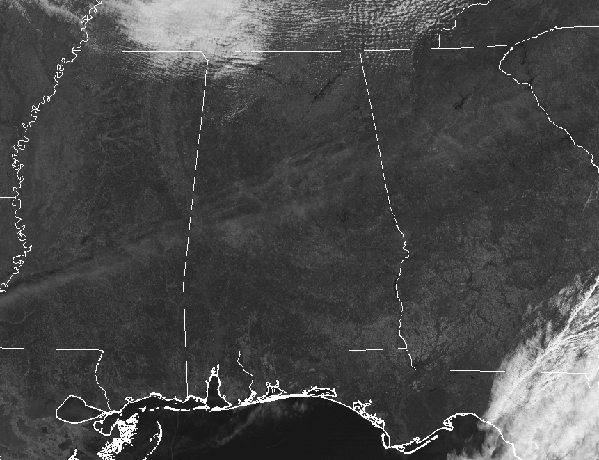
With the exception of a few very thin clouds over the central portions of Central Alabama at the moment, skies are bright and sunny. Temperatures across the area are still rather cool at this point, but have warmed nicely since daybreak. We are ranging in the mid-40s in the northwestern parts of the area to the upper 50s down in the southeast. Birmingham was at 50 degrees, while Eufaula was the warm spot at 58 degrees. The cool spot was Haleyville at 46 degrees.
RECORD DAILY MAXIMUM RAINFALL SET AT MONTGOMERY ON MONDAY
Due to training of thunderstorm cells in yesterday’s squall line, record-breaking rainfall occurred in the state capital. A total of 2.83 inches fell in Montgomery, breaking the previous daily maximum record of 2.62 inches that was set way back in 1896.
OTHER RAINFALL TOTALS FROM AROUND THE AREA
Along the I-85 corridor seemed to be the magic spot for the higher rain totals, while the rest of the area only received enough to knock the dust down a little. Here are the official reports from NWS Birmingham…
Birmingham International Airport … 0.17 in
Tuscaloosa … 0.27 in
Anniston … 0.10 in
Calera … 0.28 in
Auburn … 1.45 in
Troy … 0.01 in
WEATHER FOR THE REST OF YOUR TUESDAY
We’ll continue to enjoy this beautiful weather that we have been blessed with for today, with a few clouds possibly sneaking into the extreme northern parts of the area before sunset. Afternoon highs will be in the lower 50s to the lower 60s from north to south, but be sure to grab a light jacket due to the west-northwesterly winds averaging around 10-15 MPH. Those winds will begin to settle down as we head into the evening and overnight hours, and skies will stay relatively clear throughout. Lows will drop down into the lower to mid-30s, with a few of the colder pockets hitting the 20s.
WONDERFUL WEDNESDAY WEATHER
This trend of clear and sunny skies will continue into the “Hump Day,” and so will these seasonal temperatures. Winds will be very light mainly out of the north, and highs will range from the lower 50s in the north to the upper 50s in the south. Skies will continue to be clear throughout the evening and overnight hours, and the lows will be in the mid-20s to the lower 30s.
ON THIS DAY IN WEATHER HISTORY
2012 – A strong cold front approached the region and interacted with a very moist and unstable environment already in place. Numerous showers and thunderstorms developed along and out ahead of the front across Arkansas and Mississippi and pushed eastward across Central Alabama late on the 22nd and into the morning of the 23rd. There were several supercell thunderstorms that produced multiple tornadoes as they tracked across the forecast area. Numerous reports of straight-line wind damage and several reports of large hail and flash flooding were also received during the event. Eleven tornadoes touched down in Central Alabama that day, injuring 76 and killing two. Out of those eleven tornadoes, one was rated an EF3 with estimated winds of 150 MPH, and four were EF2 with wind speeds estimated at 120-130 MPH.
THE ALABAMAWX BEACH FORECAST CENTER
Click here to see the AlabamaWx Beach Forecast Center page.
E-FORECAST
Get the AlabamaWx Weather Blog’s Seven-Day Forecast delivered directly to your inbox by email twice daily. It is the most detailed weather forecast available in Central Alabama. Subscribe here… It’s free!
ADVERTISE WITH US
Don’t miss out! We can customize a creative, flexible and affordable package that will suit your organization’s needs. Contact Bill Murray at (205) 687-0782.
Category: Alabama's Weather, ALL POSTS
About the Author (Author Profile)
Scott Martin is an operational meteorologist, professional graphic artist, musician, husband, and father. Not only is Scott a member of the National Weather Association, but he is also the Central Alabama Chapter of the NWA president. Scott is also the co-founder of Racecast Weather, which provides forecasts for many racing series across the USA. He also supplies forecasts for the BassMaster Elite Series events including the BassMaster Classic.Subscribe
If you enjoyed this article, subscribe to receive more just like it.


