A Quick Check On Our Weather Situation At 9:30 AM
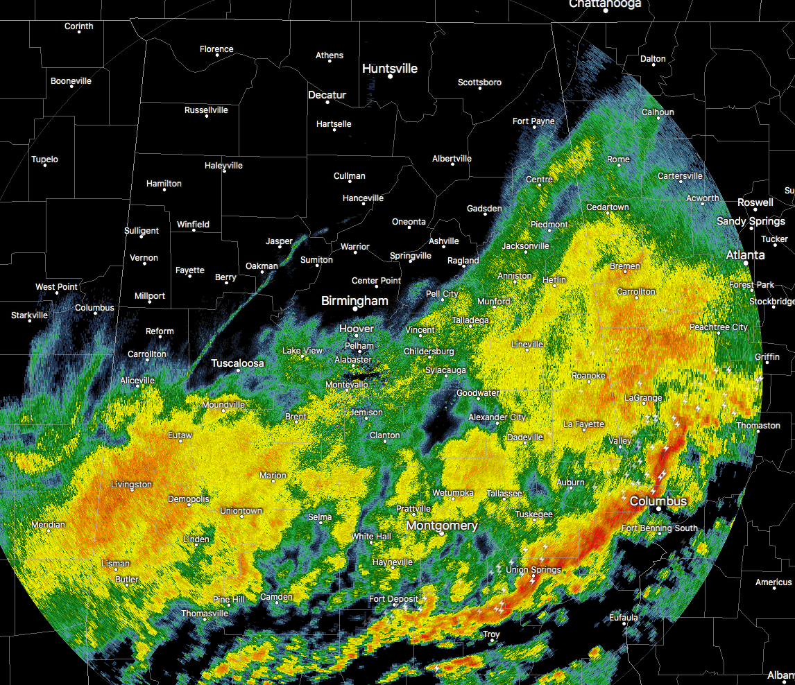
Radar check at 9:30 shows that for the north and the northwestern parts of Central Alabama, the rainfall has now come to an end. Nearly all of the rain and thunderstorm activity has now pushed east of I-59 and I-20/59.
The main energy focus with this system has now pushed into the south and southeastern parts of the area, mainly stretching from Smiths to Union Springs to Greenville. A Severe Thunderstorm Warning is that was in effect for northeastern Lee County until 9:45 AM has just been canceled.
We’ll need to continue to watch this part of the area for any more severe storm development through the rest of the morning hours until the main part of the line pushes off into Georgia. The main threat will be from damaging thunderstorm wind gusts up to 60 MPH, but we cannot rule out an isolated brief tornado. There is still plenty of lightning with this line as well, so go indoors immediately if you hear thunder. If you can hear thunder, you are close enough to the storm to be struck by lightning.
Behind that main band of storms, light to moderate rainfall continues for everyone south of a line from Aliceville to Tuscaloosa to Homewood to Gadsden to Fort Payne. This rain activity will continue to move eastward and a good bit of the northern half of Central Alabama should dry out for the remainder of the day. South of I-20 and I-20/59 through the southern half of the area will continue to have scattered to numerous showers until about the 10PM-12AM time frame tonight.
Category: Alabama's Weather, ALL POSTS
About the Author (Author Profile)
Scott Martin is an operational meteorologist, professional graphic artist, musician, husband, and father. Not only is Scott a member of the National Weather Association, but he is also the Central Alabama Chapter of the NWA president. Scott is also the co-founder of Racecast Weather, which provides forecasts for many racing series across the USA. He also supplies forecasts for the BassMaster Elite Series events including the BassMaster Classic.Subscribe
If you enjoyed this article, subscribe to receive more just like it.


