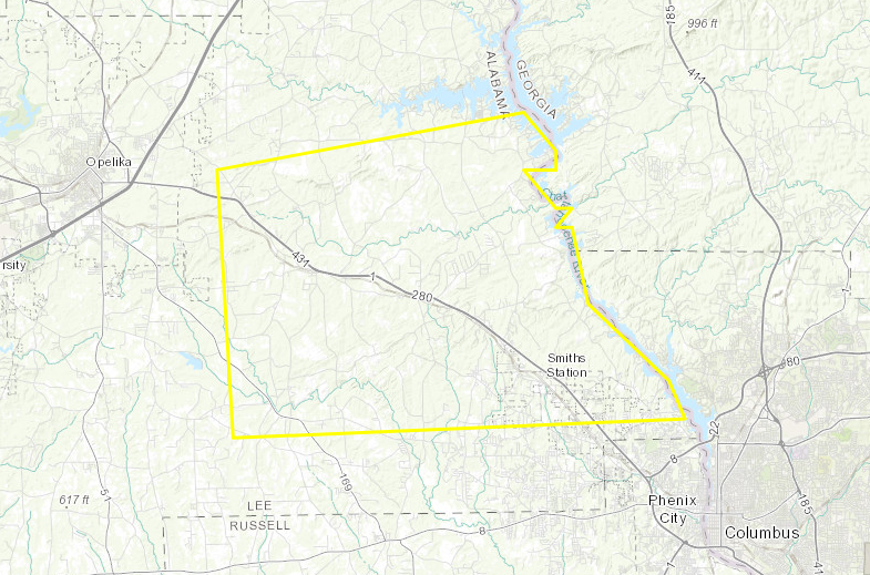
Severe Thunderstorm Warning for Northeastern Lee County Until 9:45 AM
BULLETIN – IMMEDIATE BROADCAST REQUESTED
Severe Thunderstorm Warning
National Weather Service Birmingham AL
908 AM CST WED FEB 7 2018
The National Weather Service in Birmingham has issued a
* Severe Thunderstorm Warning for…
Northeastern Lee County in east central Alabama…
* Until 945 AM CST
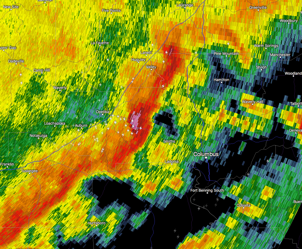
* At 908 AM CST, a severe thunderstorm was located near Bleecker, or
9 miles southeast of Opelika, moving east at 55 mph.
HAZARD…60 mph wind gusts and nickel size hail.
SOURCE…Radar indicated.
IMPACT…Expect damage to roofs, siding, and trees.
* Locations impacted include…
Smiths, Smiths Station, Bleecker, Griffen Mill, Goat Rock Lake and
Bartletts Ferry Dam.
PRECAUTIONARY/PREPAREDNESS ACTIONS…
For your protection move to an interior room on the lowest floor of a
building.
Category: Archived Warnings
About the Author (Author Profile)
Scott Martin is an operational meteorologist, professional graphic artist, musician, husband, and father. Not only is Scott a member of the National Weather Association, but he is also the Central Alabama Chapter of the NWA president. Scott is also the co-founder of Racecast Weather, which provides forecasts for many racing series across the USA. He also supplies forecasts for the BassMaster Elite Series events including the BassMaster Classic.Subscribe
If you enjoyed this article, subscribe to receive more just like it.


