Nice For Most At Midday, Showers Beginning To Creep In
CONDITIONS ACROSS CENTRAL ALABAMA AT 1:10 PM
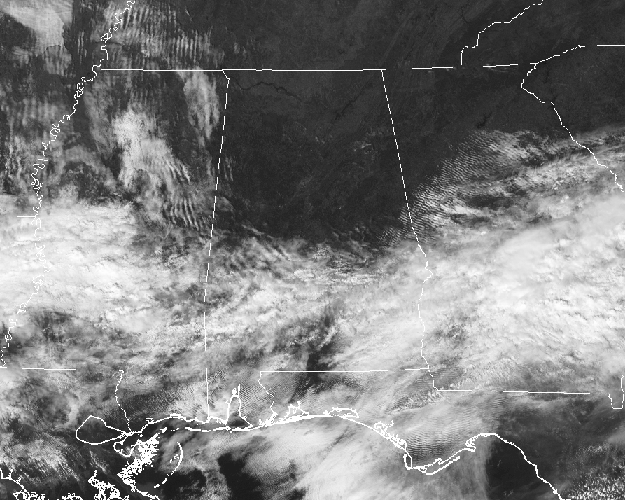
Skies across much of Central Alabama are mainly clear… but in the southern parts of the area, we have clouds encroaching from the south and southwest.
A few showers are moving into the southwestern parts of the area, especially in parts of Dallas and Marengo counties. Temperatures are ranging from the mid-50s under the cloud cover in the southeast, to the mid and upper 60s in the northern and central parts of the area.
RAIN WILL BEGIN TO MOVE IN LATER TODAY
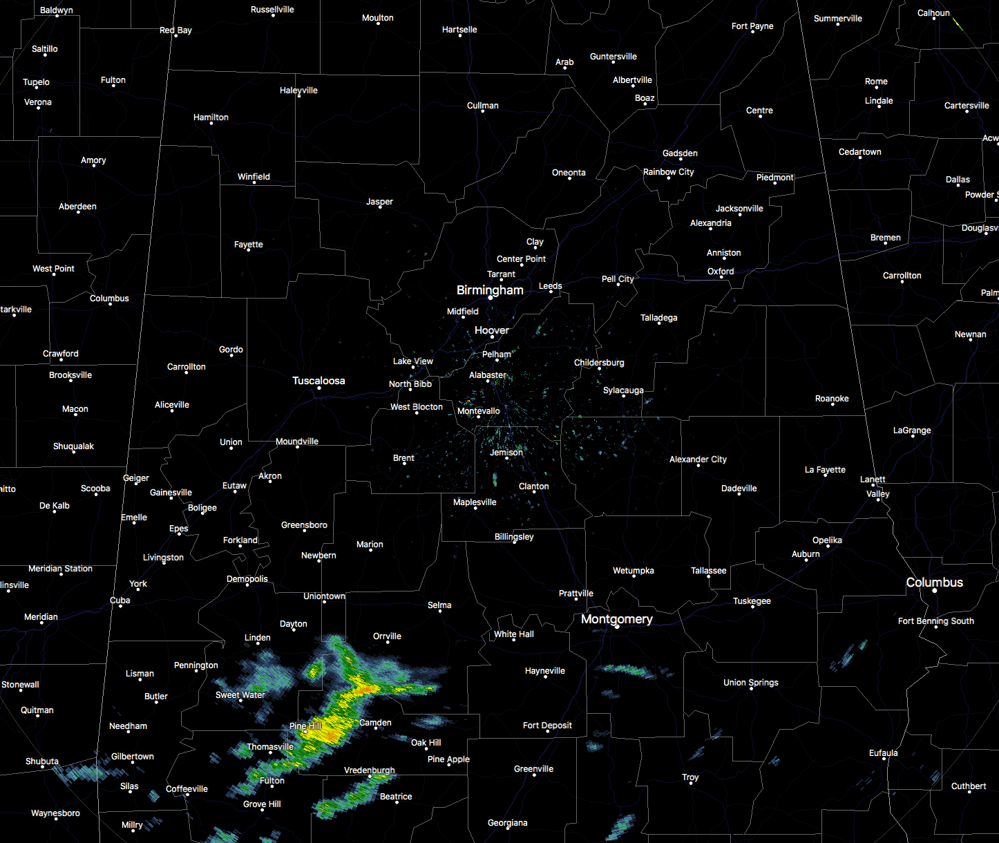
Shower activity to our south and southwest will continue to build and move into the area later this afternoon and through the evening, but there will be breaks before more showers move in from the west during the overnight hours. Afternoon highs will top out in the upper 50s to the mid-60s. There will be no surface instability with tonight’s activity, so no severe weather expected and very few claps of thunder.
PERIODS OF RAIN FOR THE CENTRAL ALABAMA WEEKEND
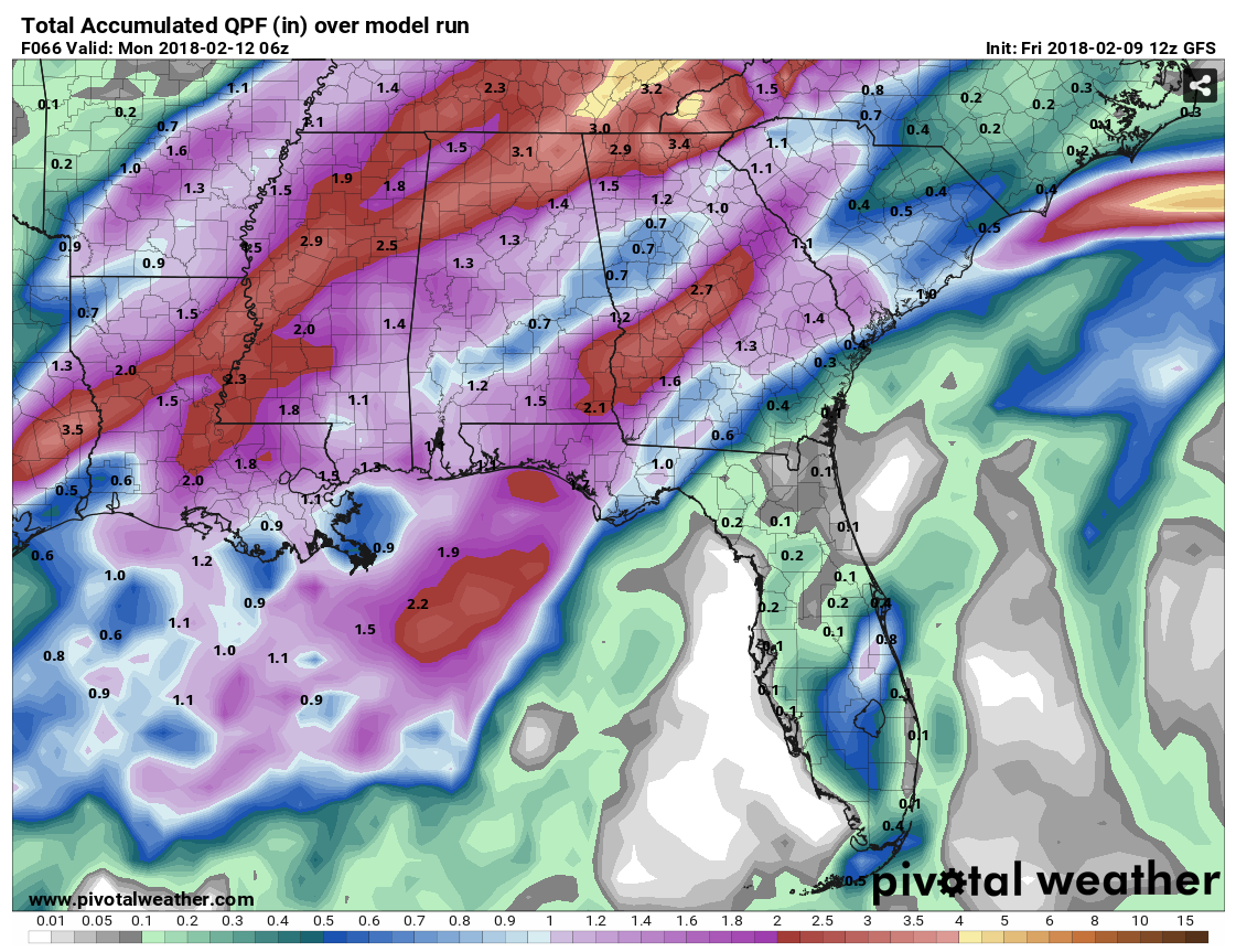
GFS estimated rainfall totals through 12 AM Monday.
A very moist airmass will settle over Central Alabama for the weekend, and there will be occasional showers and thunderstorms moving through. At this point, there is no risk for severe storms in Central Alabama on Saturday, but I wouldn’t be surprised if a marginal risk is introduced for Sunday. Highs on both days will be in the mid-60s to the mid-70s. Rainfall amounts will range from 3/4-inch to 2.5 inches, with some localized amounts even higher. The higher amounts will fall over the northern parts of the area.
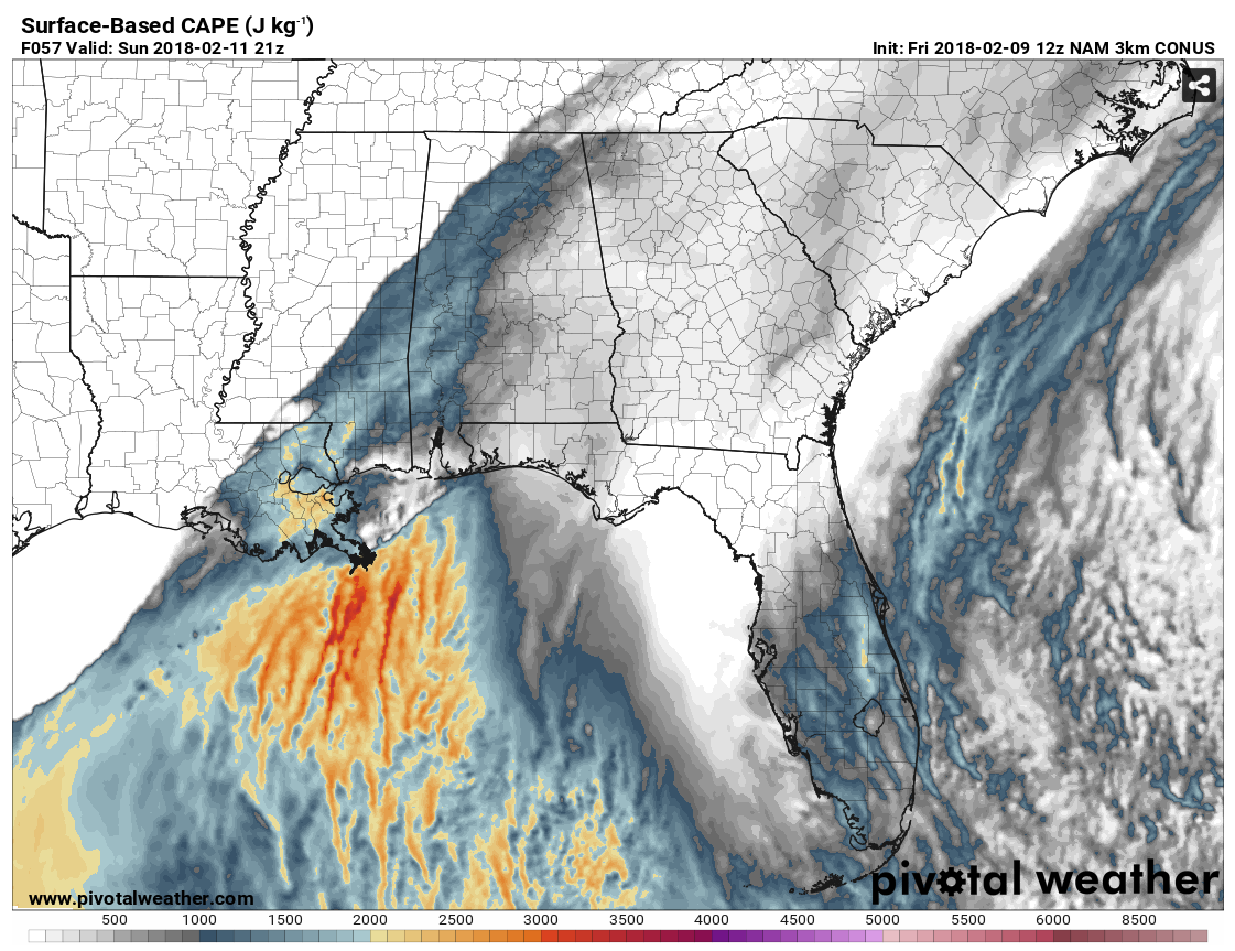
NAM Surface-Based CAPE values valid at 3PM Sunday.
Instability values will be in the 1500-2000 J/kg range on Sunday afternoon just ahead of a squall line, along with stronger wind fields. Dewpoints will be in the lower to mid-60s ahead of the squall line as well. We’ll have to watch for the possibility of damaging straight-line thunderstorm wind gusts, and the possibility of a brief spin-up tornado. Significant Tornado Parameter is topping out around 1.3 in some parts of the area.
ON THIS DAY IN WEATHER HISTORY
1990 – Thunderstorms developing ahead of a cold front erupted over eastern Texas late in the morning, and produced severe weather as they swept across the southeastern states. Early evening thunderstorms spawned a tornado which injured one person at Nat TX, and produced tennis balls size hail which caused more than half a million dollars damage around Shreveport LA.
THE ALABAMAWX BEACH FORECAST CENTER
Click here to see the AlabamaWx Beach Forecast Center page.
WEATHERBRAINS
Check out the show at www.WeatherBrains.com. You can also subscribe on iTunes. You can watch the show live at live.bigbrainsmedia.com. You will be able to see the show on the James Spann 24×7 weather channel on cable or directly over the air on the dot 2 feed.
E-FORECAST
Get the AlabamaWx Weather Blog’s Seven-Day Forecast delivered directly to your inbox by email twice daily. It is the most detailed weather forecast available in Central Alabama. Subscribe here… It’s free!
ADVERTISE WITH US
Don’t miss out! We can customize a creative, flexible and affordable package that will suit your organization’s needs. Contact Bill Murray at (205) 687-0782.
Category: Alabama's Weather, ALL POSTS
About the Author (Author Profile)
Scott Martin is an operational meteorologist, professional graphic artist, musician, husband, and father. Not only is Scott a member of the National Weather Association, but he is also the Central Alabama Chapter of the NWA president. Scott is also the co-founder of Racecast Weather, which provides forecasts for many racing series across the USA. He also supplies forecasts for the BassMaster Elite Series events including the BassMaster Classic.Subscribe
If you enjoyed this article, subscribe to receive more just like it.


