Just A Brief Mid-Afternoon Check Of Our Weather
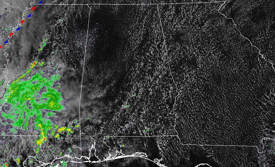
As we approach the 2:00 PM hour in Central Alabama, skies are partly cloudy throughout the area, and there are a few isolated showers showing on radar in the southern parts in Lowndes County and up into Montgomery and Elmore counties. Temperatures were in the mid-70s to the lower 80s throughout the area.
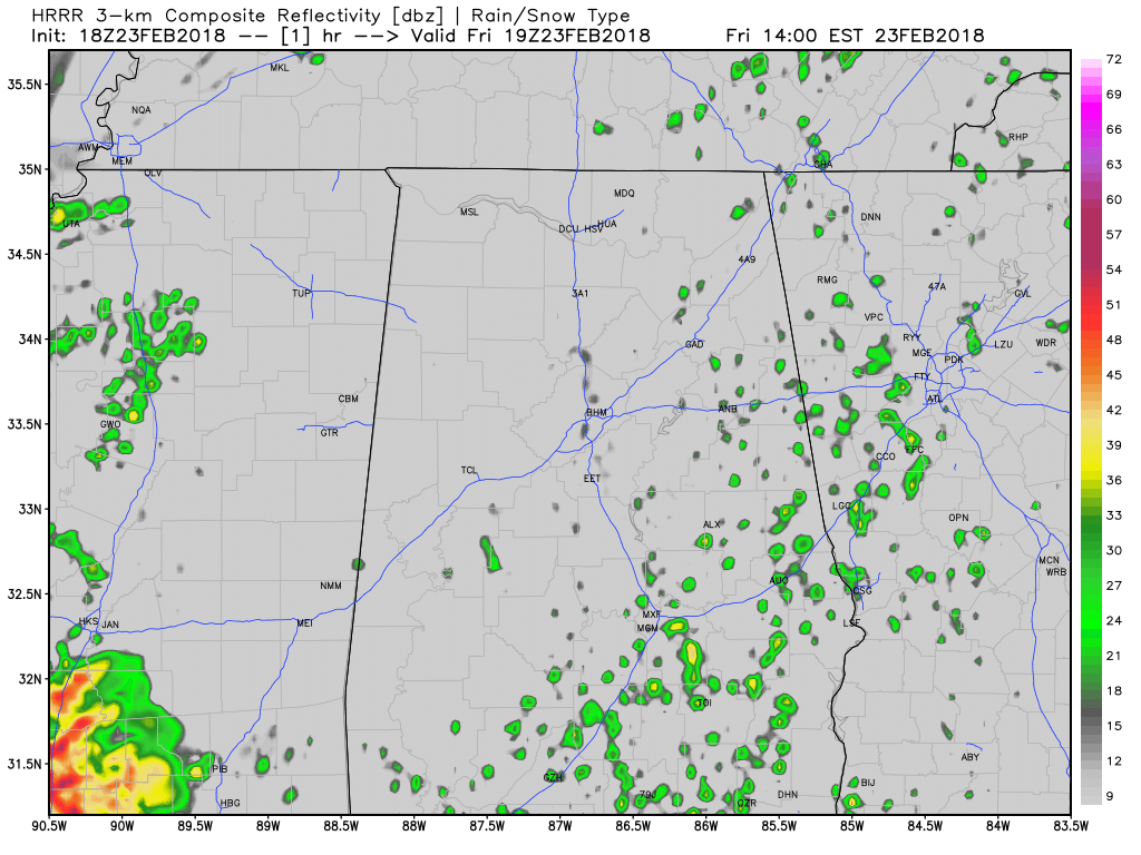
Latest HRRR Simulated Radar solution valid through 6:00 AM Saturday.
For the rest of the day, we’ll have partly cloudy skies throughout Central Alabama with a very small chance of a few isolated to scattered showers and thunderstorms south of a line from Tuscaloosa to Clanton to Auburn. North of that line, we’ll continue to be warm and dry. Afternoon highs will top out in the upper 70s to the lower 80s. For tonight, we’ll have a chance of scattered showers and thunderstorms mainly over the western half of the area north of I-20/59, while a few isolated showers are possible throughout the rest of Central Alabama. Overnight lows will be in the lower to mid-60s.
Saturday’s weather doesn’t look all that bad at this point, with only a very small chance of a few scattered showers over the western half of the area. Afternoon highs will be in the lower to mid-80s. Latest NAM run is keeping all of the activity with the frontal boundary back to our west until around midnight or just after. The main window for any strong to severe storms will be from 12:00 AM to 6:00 AM Sunday for the areas along and west of I-59 and I-20/59. The main threat will be from damaging straight line thunderstorm wind gusts of 60 MPH or greater, and the possibility of a few isolated tornadoes.
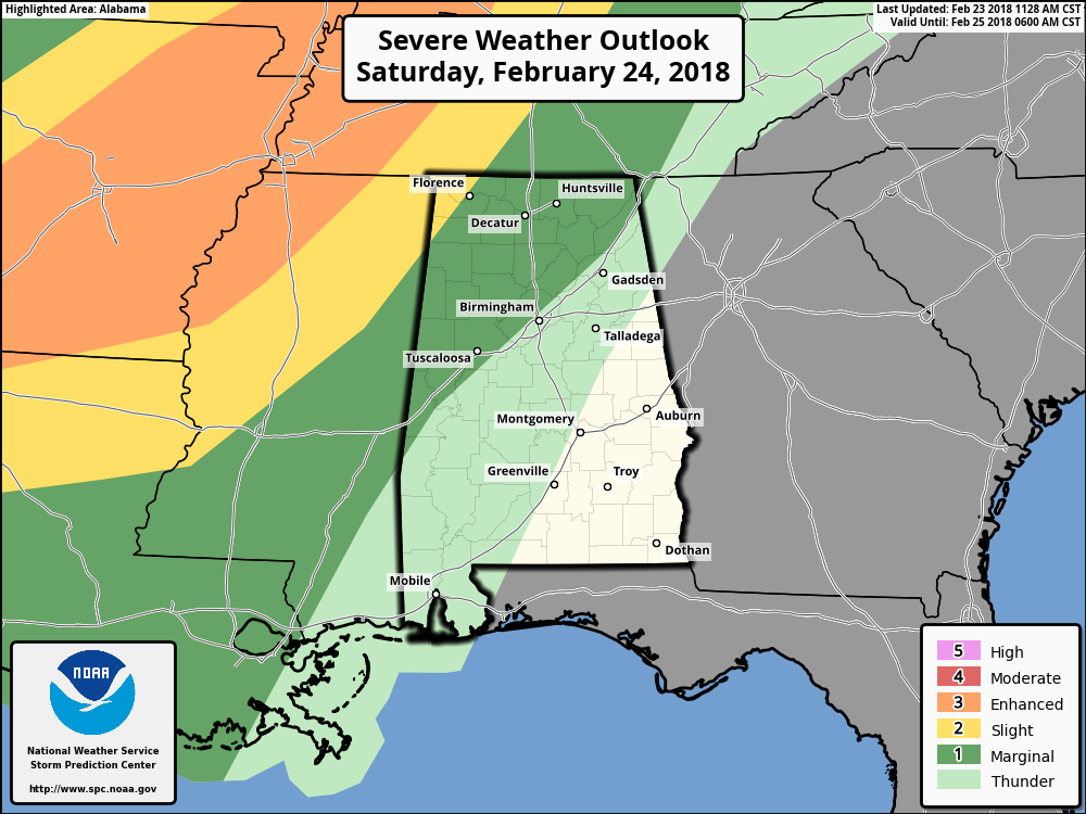
The good news is that the SPC is seeing with the latest model runs that most of the severe weather will be to our west and northwest. Parts of Central Alabama that are in the Marginal Risk will be along and west of I-59 and I-20/59, and only the northwestern corner of the state is in the standard Slight Risk. Once again, this will all be occurring during the overnight and pre-dawn hours on Sunday. Now is the time to brush up on those severe weather awareness tips that I have been posting all week, and put them to use if needed.
Category: Alabama's Weather, ALL POSTS
About the Author (Author Profile)
Scott Martin is an operational meteorologist, professional graphic artist, musician, husband, and father. Not only is Scott a member of the National Weather Association, but he is also the Central Alabama Chapter of the NWA president. Scott is also the co-founder of Racecast Weather, which provides forecasts for many racing series across the USA. He also supplies forecasts for the BassMaster Elite Series events including the BassMaster Classic.Subscribe
If you enjoyed this article, subscribe to receive more just like it.


