Storms Have Now Entered Northwestern Parts of Central Alabama
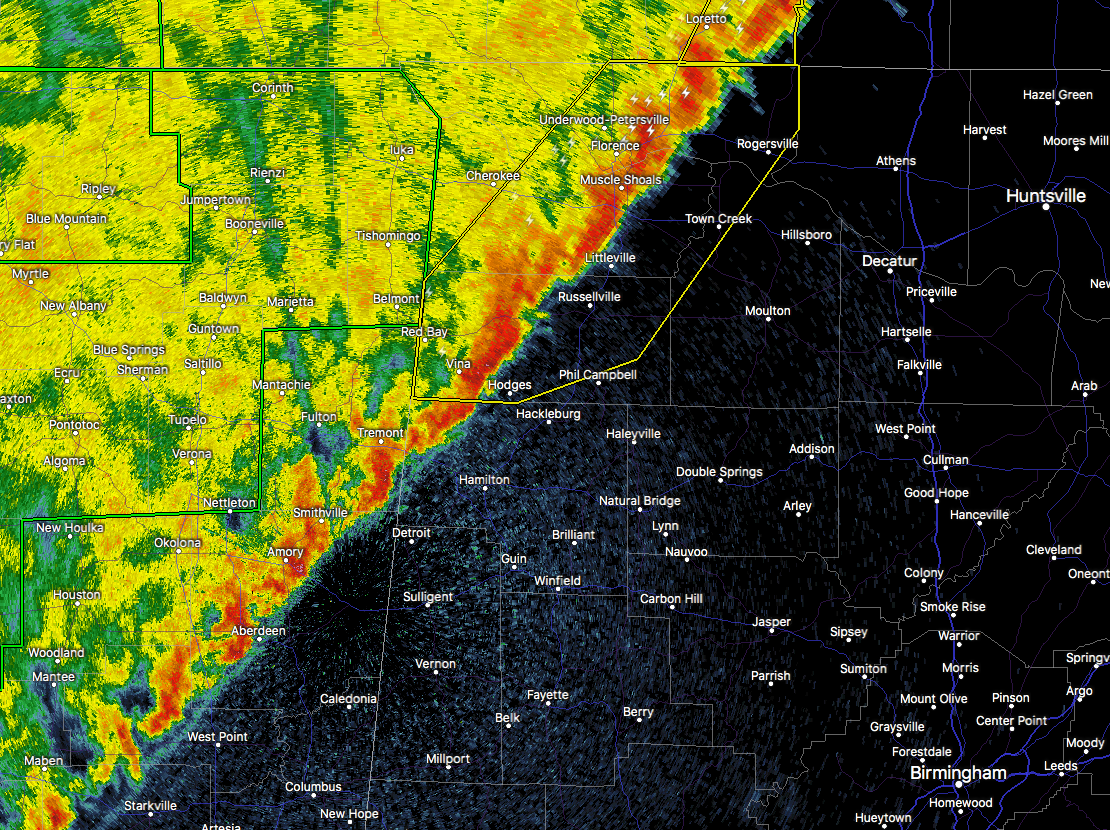
As of 12:15 AM, the line of showers and thunderstorms have now pushed into the northwestern corner of Central Alabama, as the line is slowly encroaching towards Hamilton and Bexar in Marion County. At this point, there are no watches or warnings in effect for any part of Central Alabama.
Up to the north in the northwestern corner of the state, NWS Huntsville continues a Severe Thunderstorm Warning for parts of Colbert, Franklin, Lauderdale, and Lawrence counties until 12:30 AM, for the main threat of damaging wind gusts up to 60 MPH. The next few locations in the path of this part of the line are Anderson, Rogersville, Leighton, Town Creek, Littleville, Russellville and Hodges. We’ll have to see if they decide to continue the warning on to the east, and if they do, it will most likely be for the southern part of that segment in Franklin County.
It looks like the higher chances for strong to marginally severe storms will be over the northwestern parts of the state during the next few hours. A few strong to marginally severe storms are possible over the areas west of I-59 and I-20/59 through 5:00 AM, but the line is expected to continue to weaken as it moves through the area.
For later this morning and into the afternoon hours, showers and thunderstorms will continue throughout the area as the line will eventually stall out over Central Alabama. The good news is that the SPC has dropped any risk for severe storms for Sunday afternoon, but a few storms could become strong with gusty winds.
Category: Alabama's Weather, ALL POSTS
About the Author (Author Profile)
Scott Martin is an operational meteorologist, professional graphic artist, musician, husband, and father. Not only is Scott a member of the National Weather Association, but he is also the Central Alabama Chapter of the NWA president. Scott is also the co-founder of Racecast Weather, which provides forecasts for many racing series across the USA. He also supplies forecasts for the BassMaster Elite Series events including the BassMaster Classic.Subscribe
If you enjoyed this article, subscribe to receive more just like it.


