A Quick Check On Our Weather Situation At 11:55 PM
RADAR CHECK AT 11:40 PM
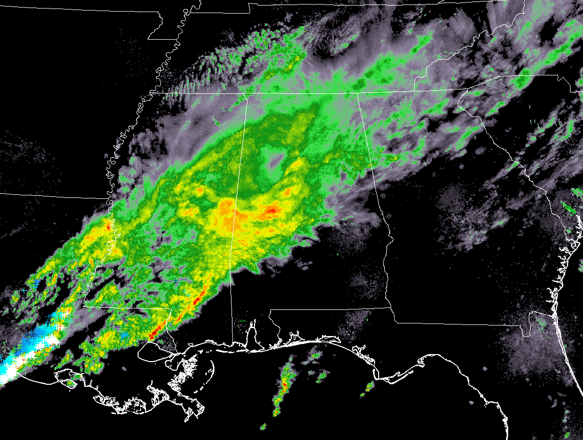
As you can see by the latest radar image for the southeastern United States, there is still plenty of showers and storms that will eventually push through Central Alabama during the overnight and into the early morning hours on Monday. The heaviest rainfall in Central Alabama at this point is located in the southwestern parts of the area, mainly over locations such as York, Livingston, Demopolis, Greensboro, Moundville, and Eutaw. All of the activity is slowly pushing to the east.
WHAT TO EXPECT FOR THE REMAINDER OF THE NIGHT
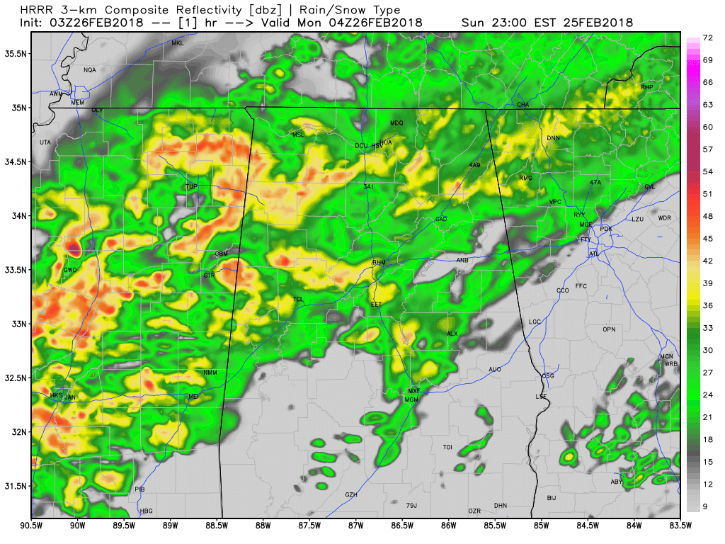
HRRR Simulated Radar valid through 3:00 PM Monday.
Rain and a few embedded thunderstorms will continue over much of the area for the remainder of Sunday night and well through much of the morning on Monday. The good news is that the rain will be over for the Birmingham metropolitan area by 6AM-7AM time frame, and out of Montgomery by the 8AM-9AM time frame. All of Central Alabama should be rain free by 10AM-11AM, as the back side of the main rain activity will have pushed off into Georgia.
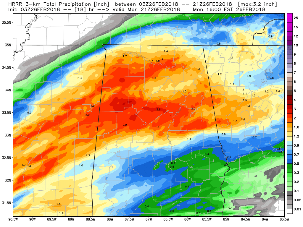
HRRR Total Rainfall Amounts valid at 3PM Monday.
Unfortunately, we’ll have some heavy rainfall amounts expected throughout much on the north and central parts of the area that could lead to some localized flooding. The latest HRRR solution is painting anywhere from 1.5 inches to nearly 3.0 inches over the northern half of the area and into parts of North Alabama, while the southern parts of Central Alabama will be limited to 0.5 to 1.0 inches.
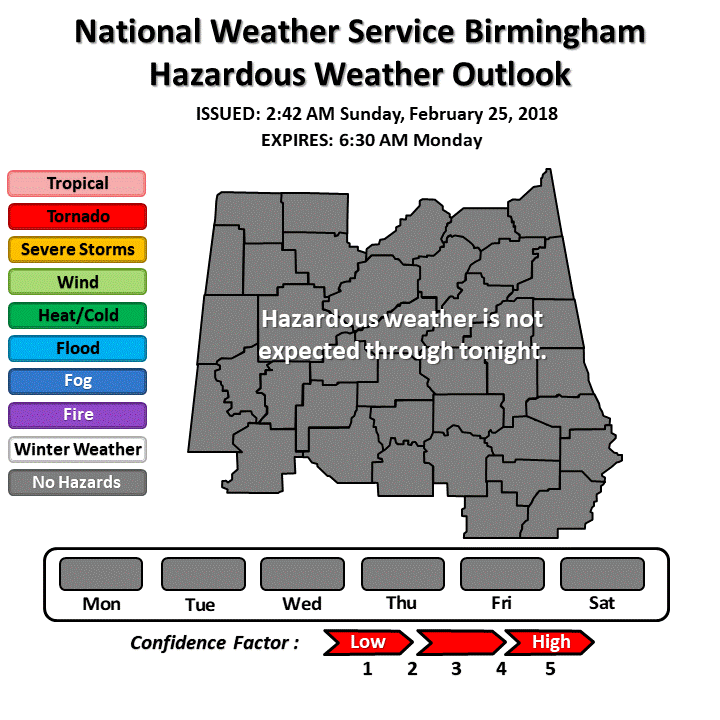
The good news is that the NWS Birmingham Weather Forecast Office is not expecting any severe weather for the remainder of the night through 6:30 AM Monday morning. While you may here some heavy downpours and a few loud claps and rumbles of thunder, no storms are expected to become severe. Looking at the latest model trend, there is virtually no surface-based instability. Any stronger storms should remain south of the area, but we’ll keep an eye out if anything materializes.
Category: Alabama's Weather, ALL POSTS
About the Author (Author Profile)
Scott Martin is an operational meteorologist, professional graphic artist, musician, husband, and father. Not only is Scott a member of the National Weather Association, but he is also the Central Alabama Chapter of the NWA president. Scott is also the co-founder of Racecast Weather, which provides forecasts for many racing series across the USA. He also supplies forecasts for the BassMaster Elite Series events including the BassMaster Classic.Subscribe
If you enjoyed this article, subscribe to receive more just like it.


