Tornado Warning Expired For Parts Of Etowah County
…THE TORNADO WARNING FOR NORTHEASTERN ETOWAH COUNTY WILL EXPIRE AT
830 PM CDT…
The storm which prompted the warning has moved out of the area.
Therefore the warning will be allowed to expire.
A tornado watch remains in effect until 1100 PM CDT for northeastern
Alabama.
LAT…LON 3412 8616 3419 8614 3419 8611 3420 8610
3420 8584 3411 8584 3413 8580 3412 8579
3410 8580 3405 8577 3410 8606
TIME…MOT…LOC 0121Z 278DEG 35KT 3413 8568
Tornado Warning Continues For Parts Of Etowah County
Mar 19th @ 7:31 pm

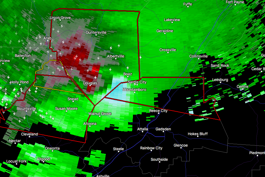
…A TORNADO WARNING REMAINS IN EFFECT UNTIL 830 PM CDT FOR NORTHEASTERN ETOWAH COUNTY… At 755 PM CDT, a severe thunderstorm capable of producing a tornado was located near Tabor Road, or 10 miles north of Gadsden, moving east at 40 mph.
HAZARD…Tornado and golf ball size hail.
SOURCE…Radar indicated rotation.
IMPACT…Flying debris will be dangerous to those caught without shelter. Mobile homes will be damaged or destroyed. Damage to roofs, windows, and vehicles will occur. Tree damage is likely. Locations impacted include… Boaz, Sardis City, Reece City, Tabor Road, Black Creek, Wilsonia, Crudup, Mountainboro and Keener.
Tornado Warning Continues For Parts Of Etowah County Until 815 PM
Mar 19th @ 7:31 pm

…A TORNADO WARNING REMAINS IN EFFECT UNTIL 830 PM CDT FOR NORTHERN ETOWAH COUNTY… At 740 PM CDT, a severe thunderstorm capable of producing a tornado was located over Sardis City, or over Boaz, moving east at 40 mph.
HAZARD…Tornado and golf ball size hail.
SOURCE…Radar indicated rotation.
IMPACT…Flying debris will be dangerous to those caught without shelter. Mobile homes will be damaged or destroyed. Damage to roofs, windows, and vehicles will occur. Tree damage is likely. Locations impacted include… Sardis City, Reece City, Tabor Road, Black Creek, Wilsonia, Crudup, Mountainboro and Keener.
Tornado Warning Issued For Parts Of Etowah County Until 8:30PM
Mar 19th @ 7:31 pm

The National Weather Service in Birmingham has issued a
* Tornado Warning for…
Northern Etowah County in northeastern Alabama…
* Until 830 PM CDT
* At 728 PM CDT, a severe thunderstorm capable of producing a tornado was located near Albertville, moving east at 40 mph.
HAZARD…Tornado and golf ball size hail.
SOURCE…Radar indicated rotation.
IMPACT…Flying debris will be dangerous to those caught without shelter. Mobile homes will be damaged or destroyed.
Damage to roofs, windows, and vehicles will occur. Tree damage is likely.
* Locations impacted include…
Sardis City, Reece City, Tabor Road, Black Creek, Wilsonia, Crudup, Mountainboro and Keener.
Category: ALL POSTS
About the Author (Author Profile)
Subscribe
If you enjoyed this article, subscribe to receive more just like it.


