

Cool Northwest, A Cool Wedge to the East, Warm in the Middle at Midday
The GOES-16 satellite visible imagery tells the weather story across North and Central Alabama.
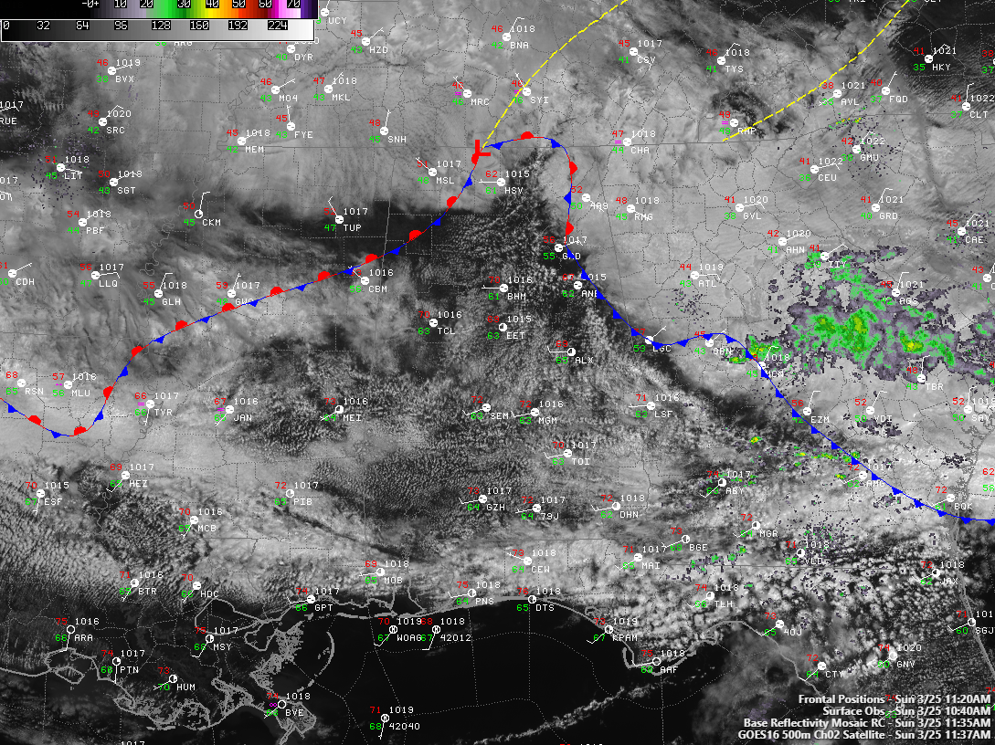
A stationary front lies over Northwest Alabama. Clouds are thick over the western Tennessee Valley counties, and temperatures are in the lower 50s.
Skies have cleared to a large extent over North Central Alabama, allowing temperatures to soar through the 60s and into the 70s.
The dreaded easterly wedge is sliding in from Georgia, and you can see the boundary in the enhanced cloud development approaching Gadsden and Anniston.
Temperatures over North Georgia are in the 40s with heavy cloudiness.
North and Central Alabama are mainly dry. There could be a few light showers this afternoon. A round of showers will move into and through the area tonight from the northwest. Rainfall amounts will be mainly light.
Still looking at heavy rain, especially over North Alabama for late Wednesday night into Thursday. Flooding may become a concern, but severe weather does not look like it will be a significant issue.
Category: Alabama's Weather, ALL POSTS
About the Author (Author Profile)
Bill Murray is the President of The Weather Factory. He is the site's official weather historian and a weekend forecaster. He also anchors the site's severe weather coverage. Bill Murray is the proud holder of National Weather Association Digital Seal #0001 @wxhistorianSubscribe
If you enjoyed this article, subscribe to receive more just like it.


