

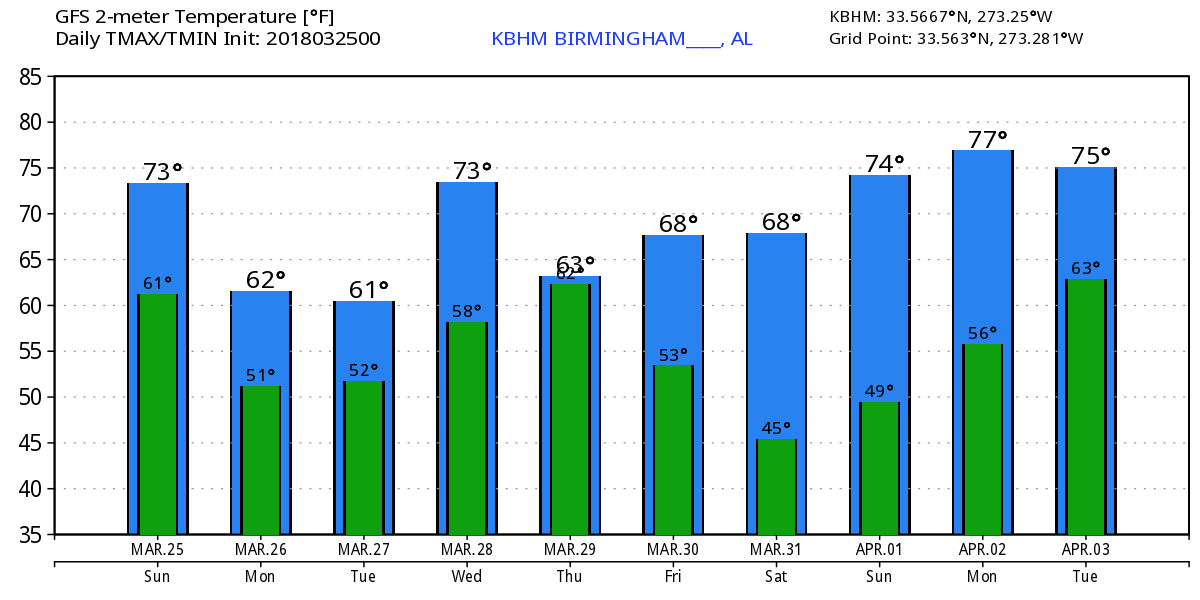
Warm Sunday, Cool Monday with a Wedge
We’re starting the day out much like yesterday with a fairly good supply of clouds across the Southeast US, but it is also not a complete blanket, so as we saw yesterday, there will be breaks in the clouds to allow sunshine through from time to time. Cannot rule out the possibility of a passing shower today, but any severe weather should be mainly confined to Texas. Look for the highs today to again reach the lower and middle 70s.
Monday the upper air pattern remains that of a ridge, however, it is the surface weather pattern that will likely impact us the most. A 1038 millibar high moves across New England setting up conditions for a back door cold front or the wedge. Patchy light rain and clouds should be in place as the wedge makes itself known across the northern half of Alabama. This should keep our temperatures down considerably from this weekend with highs mainly in the upper half of the 50s.
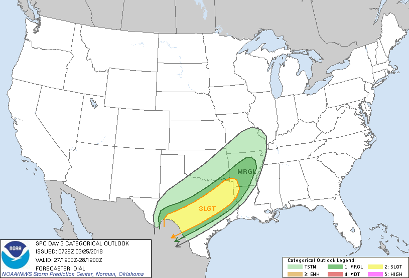
The wedge holds onto the pattern into Tuesday, but the surface flow comes around more to the south. This should mean our temperatures will warm back up into the 60s with the potential for only an isolated shower or two. While we are dealing with the wedge on Monday and Tuesday, the likelihood of severe weather remains well to our west across parts of Texas and Oklahoma (see Day 3 outlook graphic below).
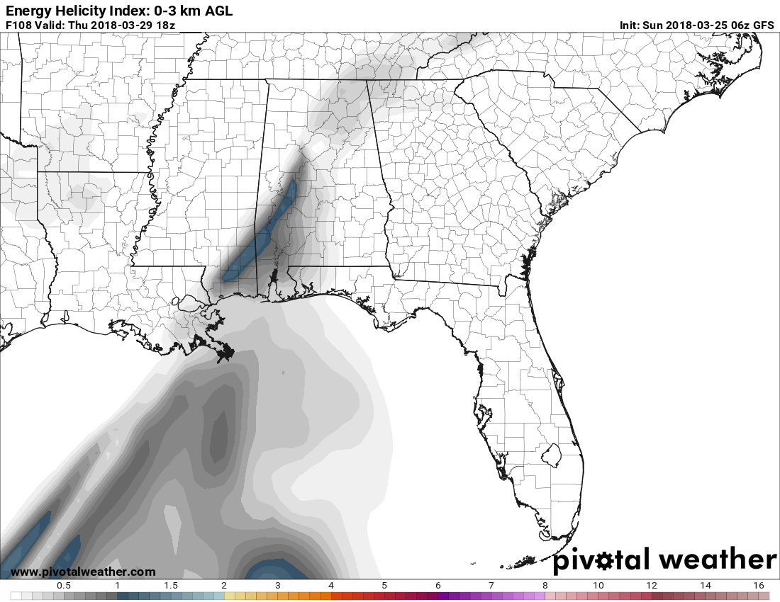
The big trough over the Southwest US moves out across West Texas on Wednesday reaching the Lower Mississippi River Valley Thursday. From late Wednesday into Thursday appears to be our best chances for rain and thunderstorms. While the system appears likely to produce the threat of severe weather to our west from Monday into Wednesday, the system seems to be losing its punch as it arrives in our vicinity as seen on the Energy Helicity Index (EHI). As I noted yesterday, this is still a ways out, so we’ll have to maintain a close eye on future model runs for any changes that might impact this forecast.
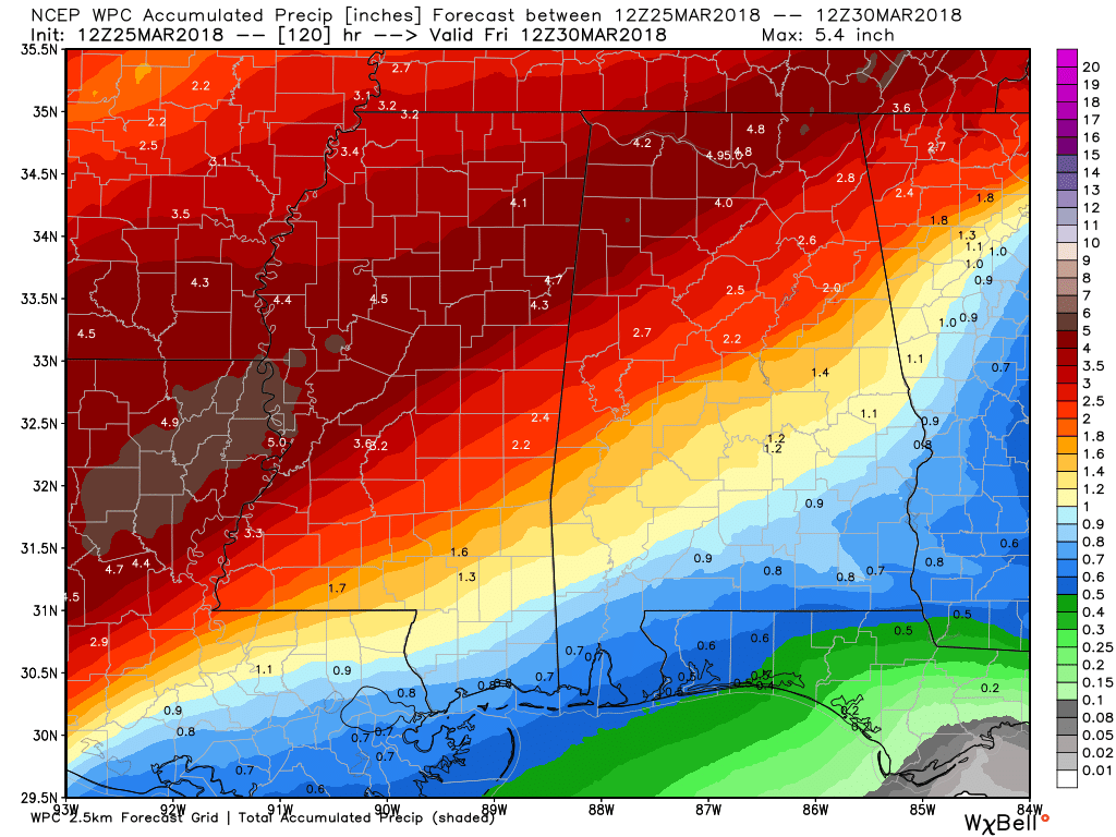
Rainfall amounts are still forecast to vary quite widely across Alabama as the gradient in amounts from Southeast Alabama to Northwest Alabama remains as we saw yesterday. Amounts have come up a good deal, however, since the graphic now goes through Friday morning. Amounts will range from near three-quarters of an inch in Southeast Alabama to over 4 inches in the northwest corner.
The upper trough passes by on Friday and the upper flow across much of the US goes zonal for Saturday and Sunday. After a dry Friday with highs in the 60s, we should see a very nice weekend with highs returning into the 70s along with dry weather.
A rather strong upper trough is seen at the start of voodoo country plunging into New England by April 4th. Much of the upper air action will stay west and north of us with ridging the main feature seen around the 6th of April. But a strong is forecast around the 8th of April moving across the Middle Mississippi River Valley, so we’ll have to pay attention to that feature which could bring a round of severe weather. April 8th will also be the 20th anniversary of the EF5 tornado that affected western Jefferson County in 1998 with 32 fatalities.
Beach Forecast: Click here to see the AlabamaWx Beach Forecast Center page.
WeatherBrains: Don’t forget you can listen to our weekly 90 minute netcast anytime on the web, or on iTunes. This is the show all about weather featuring many familiar voices, including our meteorologists here at ABC 33/40.
James Spann will be up next with the Weather Xtreme Video on Monday morning. I hope that you enjoy the day. Godspeed.
-Brian-
Category: Alabama's Weather, ALL POSTS, Weather Xtreme Videos
About the Author (Author Profile)
Brian Peters is one of the television meteorologists at ABC3340 in Birmingham and a retired NWS Warning Coordination Meteorologist. He handles the weekend Weather Xtreme Videos and forecast discussion and is the Webmaster for the popular WeatherBrains podcast.Subscribe
If you enjoyed this article, subscribe to receive more just like it.


