Turning Out To Be A Nice Wednesday, Just A Little On The Cool & Breezy Side
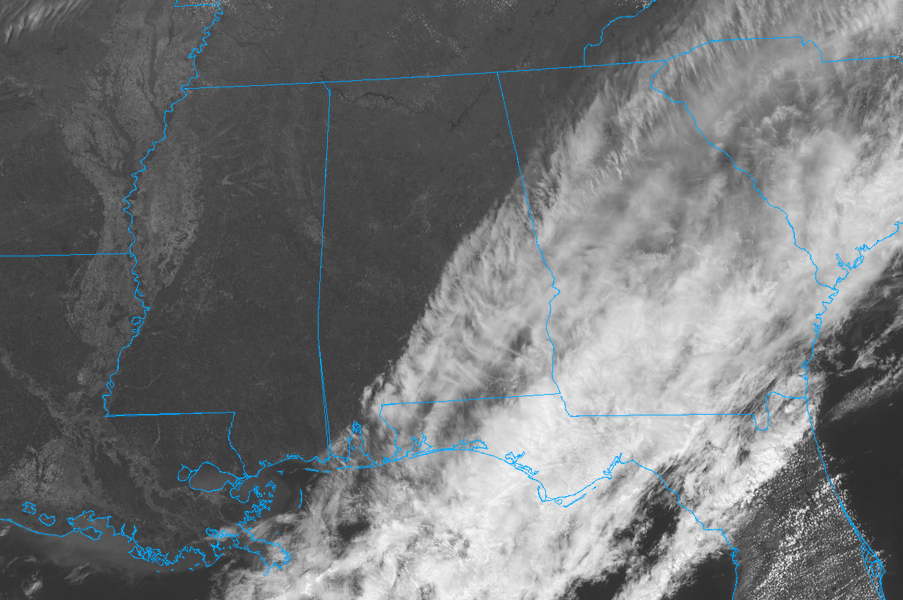
At 1:20 PM across North/Central Alabama, skies are continuing to clear from the northwest to the southeast, with a good bit of the area enjoying bright sunshine. The only drawback at this time is the breezy conditions, with winds averaging 15 MPH out of the north making it feel a little cooler than what it actually is. Temperatures range from the lower 50s in the north to the lower 60s in the south. The only exception to that is the 66 degree reading in Eufaula, making it the warm spot in North/Central Alabama.
For the rest of today, winds will gradually start to subside and will eventually become calm during the middle of the evening. Skies will continue to clear out and clouds should be out of the area by sunset. Afternoon highs will top out in the lower 50s to the mid-60s from north to south.
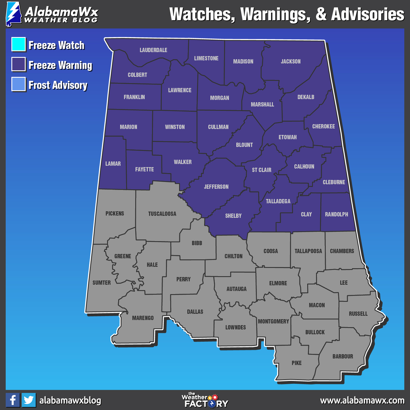
For tonight, temperatures will really cool off and turn very cold for this time of the year. Overnight lows will bottom out in the upper 20s in the north to the upper 30s in the south. A Freeze Warning goes into effect at 1:00 AM Thursday for all of the North Alabama counties and 4:00 AM Thursday for the counties in the northern half of Central Alabama, where temperatures are expected to reach and drop below the freezing point. The warning has an expire time at 9:00 AM Thursday.
Thursday’s weather will be warmer, but still not up to the normal temperatures for early April in North/Central Alabama. Skies will be mostly sunny throughout the day and highs will reach the lower 60s in the north to the lower 70s in the extreme southern parts of Central Alabama. For Thursday night, temperatures will not be as cold as tonight’s, and clouds will begin to move in from the northwest during the evening. Skies will be mostly cloudy and we may have a few scattered showers over the northern parts of the area starting after midnight. Lows will be in the mid to upper 40s from north to south.
BEACH FORECAST: Don’t you wish you were there, already? Soaking up the rays and wiggling your toes in the sand? Get the latest weather and rip current forecasts for the beaches from Fort Morgan to Panama City on our Beach Forecast Center page. There, you can select the forecast of the region that you are interested in.
WEATHERBRAINS: Don’t forget you can listen to our weekly 90 minute netcast anytime on the web at WeatherBrains.com or on iTunes. This is the show all about weather featuring many familiar voices, including the meteorologists at ABC 33/40.
E-FORECAST: Get the AlabamaWx Weather Blog’s Seven-Day Forecast delivered directly to your inbox by email twice daily. It is the most detailed weather forecast available in Central Alabama. Subscribe here… It’s free!
ADVERTISE WITH ALABAMAWX: Don’t miss out! We have enjoyed more than 6.5 MILLION page views on AlabamaWx.com since the start of 2018. We can customize a creative, flexible and affordable package that will suit your organization’s needs. Contact Bill Murray at (205) 687-0782.
Category: Alabama's Weather, ALL POSTS
About the Author (Author Profile)
Scott Martin is an operational meteorologist, professional graphic artist, musician, husband, and father. Not only is Scott a member of the National Weather Association, but he is also the Central Alabama Chapter of the NWA president. Scott is also the co-founder of Racecast Weather, which provides forecasts for many racing series across the USA. He also supplies forecasts for the BassMaster Elite Series events including the BassMaster Classic.Subscribe
If you enjoyed this article, subscribe to receive more just like it.


