Drying Out and Much Cooler
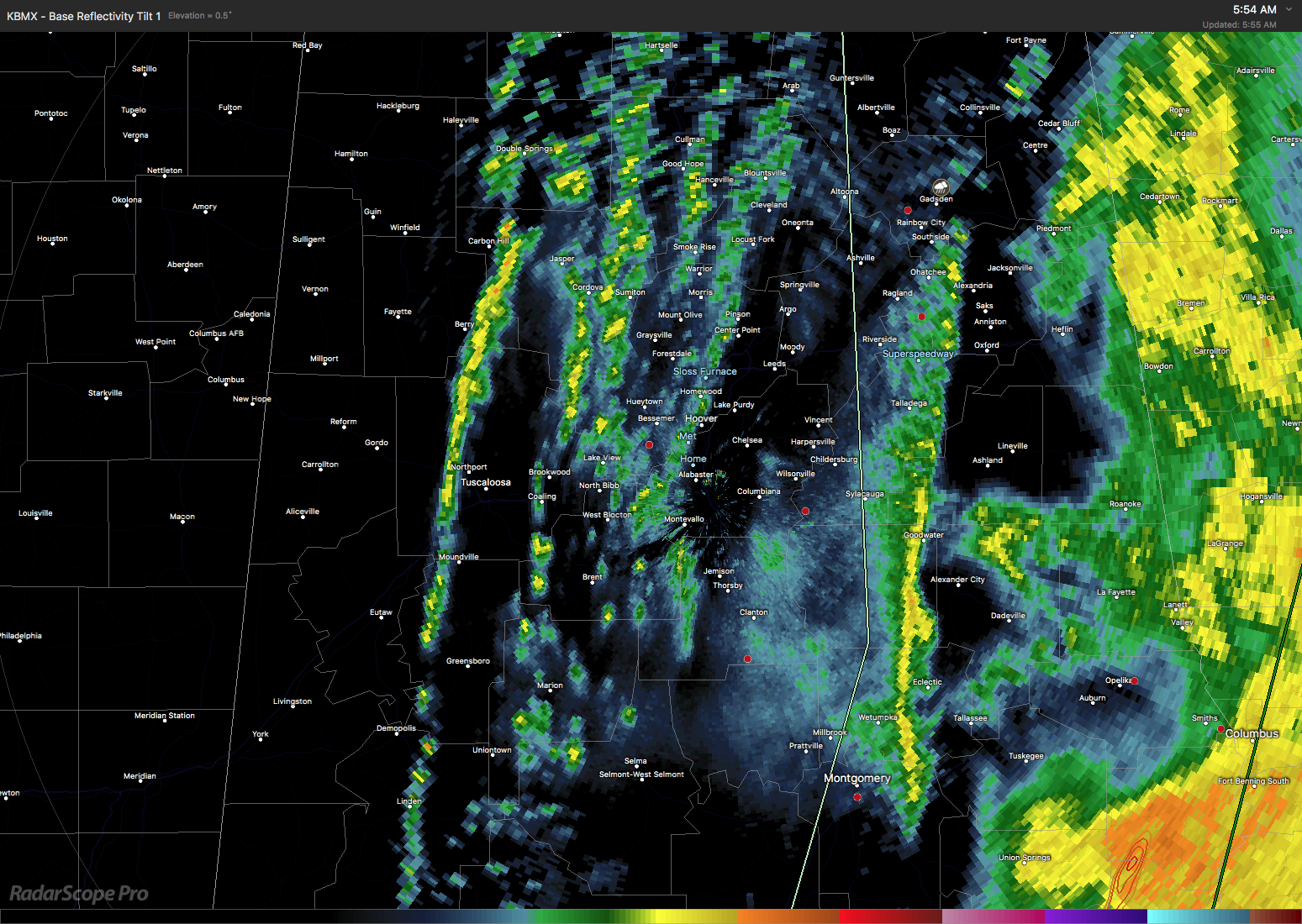
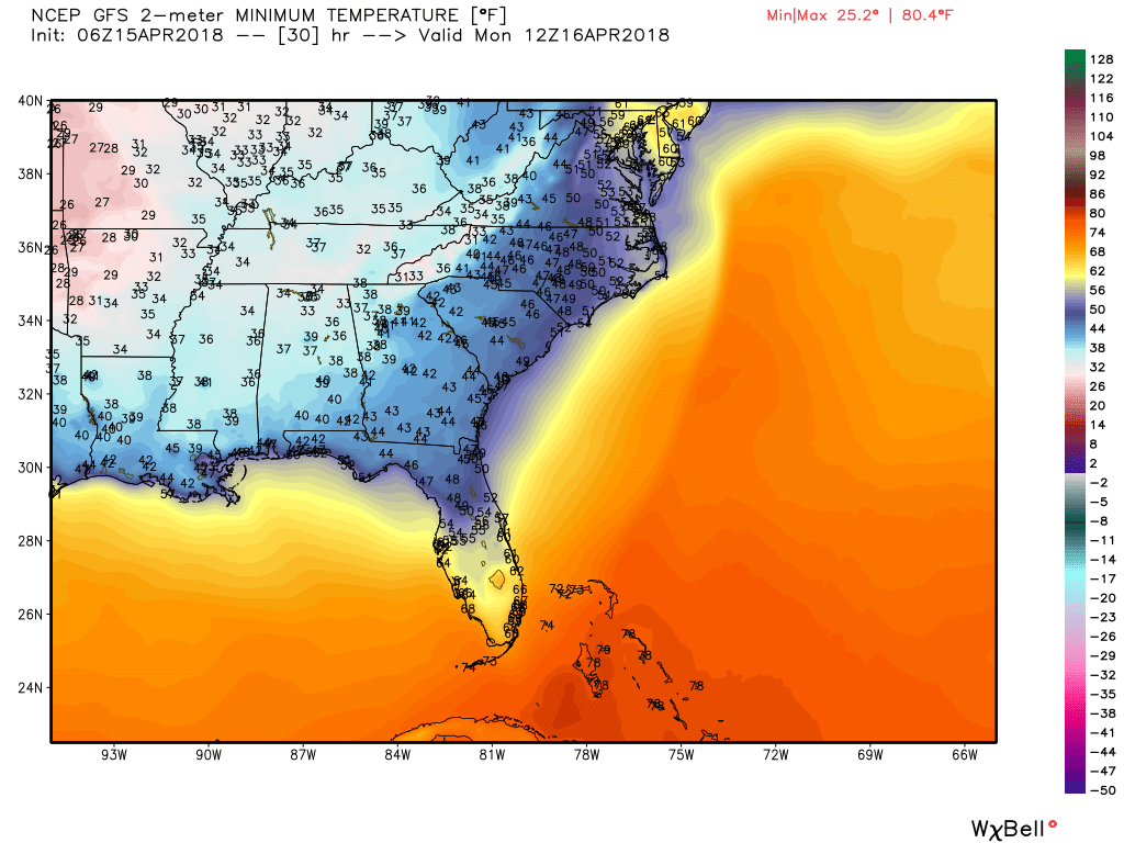
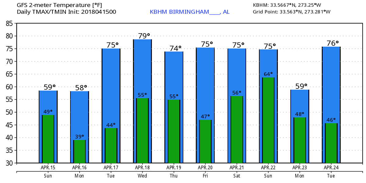
Clouds covered all of Alabama near sunrise, but some clearing is expected to occur across the western counties of Alabama. However, low clouds were visible across Arkansas, so probably the best forecast description for today will be a mix of sun and clouds. The heavy rain which occurred across the state last night had almost cleared the state this morning with the exception being across the southeast corner of Alabama. The storm total for the event at my weather station in Helena was 3.75″ as of 6:00 am. Showers will continue this morning as the precipitation gradually comes to an end for all of us. Looks like the afternoon should be primarily dry with quite a range of temperatures with readings in the 40s an 50s.
After today, the pattern looks pretty dry until next weekend. The upper trough moving by today will clear the weather replacing the upper flow with a strong northwesterly flow into Monday and Tuesday behind that large upper low. This will keep Monday pretty chilly with morning lows dipping into the upper 30s once again – this certainly seems like the winter that just won’t quit. I don’t think frost will be a major issue, so I do not expect to see any kind of frost advisory. But those normally colder sheltered valleys may well see patchy frost once again. With the wind expected to stay up, the idea of widespread frost seems unlikely.
An upper ridge moves in on Tuesday allowing us to warm up a bit. The morning low will still be somewhat chilly dipping into the lower 40s, but the likelihood for frost seems less with the possible exception of Northeast Alabama.
The upper flow remains quite busy as yet another upper low is forecast to zip across the Great Lakes region on Wednesday. A surface low will be just west of Chicago with a cold front trailing southwestward along the Mississippi River by midday Wednesday. The GFS 06z run this morning showed slightly better precipitable water values, so the idea of an isolated shower or two is possible. But not many rain gauges will see measurable amounts as most of us remain dry.
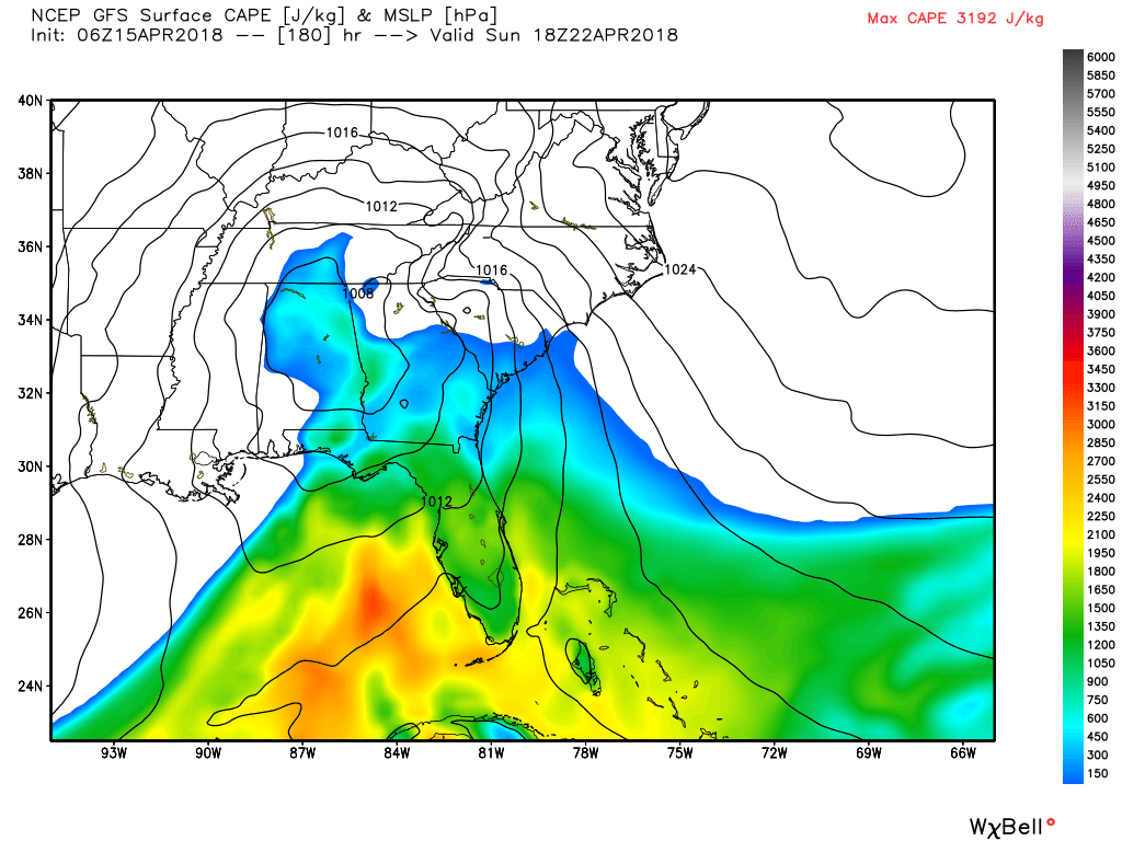
An upper ridge becomes the primary feature in out weather for Thursday and Friday. But by Saturday yet another upper closed low will be moving out of Oklahoma across the Lower Mississippi River Valley. This should generate a surface low over eastern Oklahoma that will move eastward into eastern Alabama by midday on Sunday. While the timing may change in future runs, the current run suggests the best threat for rain and embedded thunderstorms will come from Friday evening through mid-morning on Sunday. Instability values suggest the potential for some thunder, but the forecast EHI values are well below severe weather thresholds. The afternoon highs for the last couple of days of the week and into the weekend are expected to be in the 70s.
Looking out into voodoo country, the upper pattern remains fairly active. There is another strong closed low moving through the Central US around the 26th of April reaching the Mid Atlantic States by the 28th. But that one is followed closely by yet another system which seems to shear out well north of Alabama as the upper ridge remains fairly strong for the Southeast US.
IT’S THAT TIME AGAIN!!! The Honda Indy Grand Prix of Alabama will be April 20-22 at the beautiful Barber Motorsports Park! Make plans for the event that has been voted “Best Annual Event” & “Best Sporting Event” in Birmingham. Kids 15 & under are admitted free with a ticketed adult, and three-day general admission tickets are $69. Single day tickets are $15. Pack a picnic/cooler and bring the family out for a weekend full of activities and racing! GET YOUR TICKETS HERE!!! Weather looks great for Friday and Saturday at the track with mostly sunny skies and highs in the 70s. Sunday morning could be stormy, but it dries out in time for the afternoon and the main event.
Beach Forecast: Click here to see the AlabamaWx Beach Forecast Center page.
WeatherBrains: Don’t forget you can listen to our weekly 90 minute netcast anytime on the web, or on iTunes. This is the show all about weather featuring many familiar voices, including our meteorologists here at ABC 33/40.
Quite a day yesterday across Alabama with a very slow moving line of storms that produced rainfall amounts that reached into the 3 to 4 inch range, but fortunately, the amount of severe weather seemed to be held to a bare minimum. James Spann will have the next edition of the Weather Xtreme Video here before 7 on Monday morning. You can check back here often for updates on Alabama weather. Have a great day and Godspeed.
-Brian-
Category: Alabama's Weather, ALL POSTS, Weather Xtreme Videos
About the Author (Author Profile)
Brian Peters is one of the television meteorologists at ABC3340 in Birmingham and a retired NWS Warning Coordination Meteorologist. He handles the weekend Weather Xtreme Videos and forecast discussion and is the Webmaster for the popular WeatherBrains podcast.Subscribe
If you enjoyed this article, subscribe to receive more just like it.


