

Another Bright, Sunny, & Warm Midday Across Central Alabama
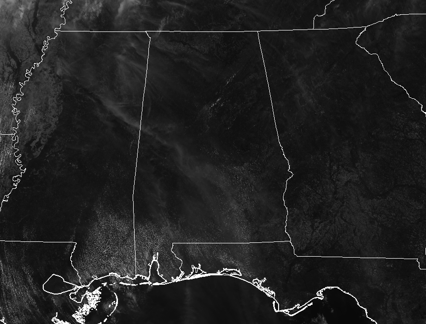
At the 12:00 PM hour across Central Alabama, our big story is the combination of bright sunshine and warm temperatures which is making this Thursday simply outstanding. We do have a few cumulus clouds out there along with a few wispy clouds that are moving overhead from the big storms out to our west. These may only filter out a minute amount of sunshine at times, but we’ll see bright sunshine throughout the afternoon. Temperatures are currently running in the upper 70s to the lower 80s throughout the area, with Birmingham tied with a few other locations at the warm spot at 81 degrees.
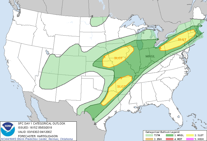
The larger story in the weather enterprise today is a large part of the eastern-half of the United States has been placed under a risk for severe weather today, a swath that stretches from the southwestern parts of Texas all of the way up to the New England states and into southern Maine. The good news is that the risks are much less than what filled the Day 1 Outlook map yesterday, but severe thunderstorms are still expected to impact the lower Missouri and middle Mississippi Valley region late this afternoon and evening, with additional severe thunderstorms possible in a corridor across parts of the lower Great Lakes region into southern New England. Damaging winds, large hail, and a few tornadoes are possible in the risk areas.
Focusing back on Central Alabama… We’ll continue to have mostly clear skies with plenty of bright sunshine throughout the remainder of the afternoon and into the early evening hours. Afternoon highs will be unseasonable warm once again, reaching the mid to upper 80s throughout the area. Those mainly clear skies will continue throughout the late night and overnight hours, with lows staying rather mild in the upper 50s to the mid-60s.
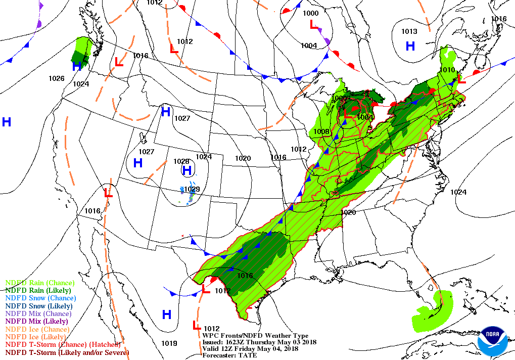
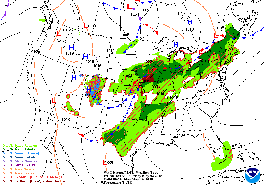
It looks like Friday’s weather for Central Alabama will be fantastic and warm once again. The cold front causing all of the big storms to our west and north will continue to lag back for one more day, draping over the Plains States up to the Great Lakes. Skies will once again be mostly sunny with afternoon highs in the mid-80s to just touching 90 degrees from north to south. Rain chances will finally start to increase late on Friday night and into early Saturday morning, but those chances will remain relatively low and be confined to the northwestern corner of Central Alabama. For the rest of the area, skies will be mostly clear throughout the overnight and pre-dawn hours. Lows will dip down into the lower to mid-60s.
On This Day In Weather History
1999 – On May 3, 1999, an unusual confluence of atmospheric conditions in Oklahoma spawned dozens of tornadoes that swept across the state in an hours-long parade of destruction. Thousands of homes were damaged or destroyed, and 19 counties became disaster areas. The worst toll was in human lives: 44 dead, including three children. Hundreds more were injured.
Beach Forecast Center
Don’t you wish you were there, already? Soaking up the rays and wiggling your toes in the sand? Get the latest weather and rip current forecasts for the beaches from Fort Morgan to Panama City on our Beach Forecast Center page. There, you can select the forecast of the region that you are interested in.
WeatherBrains
Don’t forget you can listen to our weekly 90 minute netcast anytime on the web at WeatherBrains.com or on iTunes. This is the show all about weather featuring many familiar voices, including the meteorologists at ABC 33/40.
E-Forecast
Get the AlabamaWx Weather Blog’s Seven-Day Forecast delivered directly to your inbox by email twice daily. It is the most detailed weather forecast available in Central Alabama. Subscribe here… It’s free!
Advertise With Us
Don’t miss out! We have enjoyed more than 8.2 MILLION page views on AlabamaWx.com since the start of 2018. We can customize a creative, flexible and affordable package that will suit your organization’s needs. Contact Bill Murray at (205) 687-0782.
Category: Alabama's Weather, ALL POSTS
About the Author (Author Profile)
Scott Martin is an operational meteorologist, professional graphic artist, musician, husband, and father. Not only is Scott a member of the National Weather Association, but he is also the Central Alabama Chapter of the NWA president. Scott is also the co-founder of Racecast Weather, which provides forecasts for many racing series across the USA. He also supplies forecasts for the BassMaster Elite Series events including the BassMaster Classic.Subscribe
If you enjoyed this article, subscribe to receive more just like it.


