Storms Moving Faster; Will Reach Tuscaloosa By 1:30 p.m.
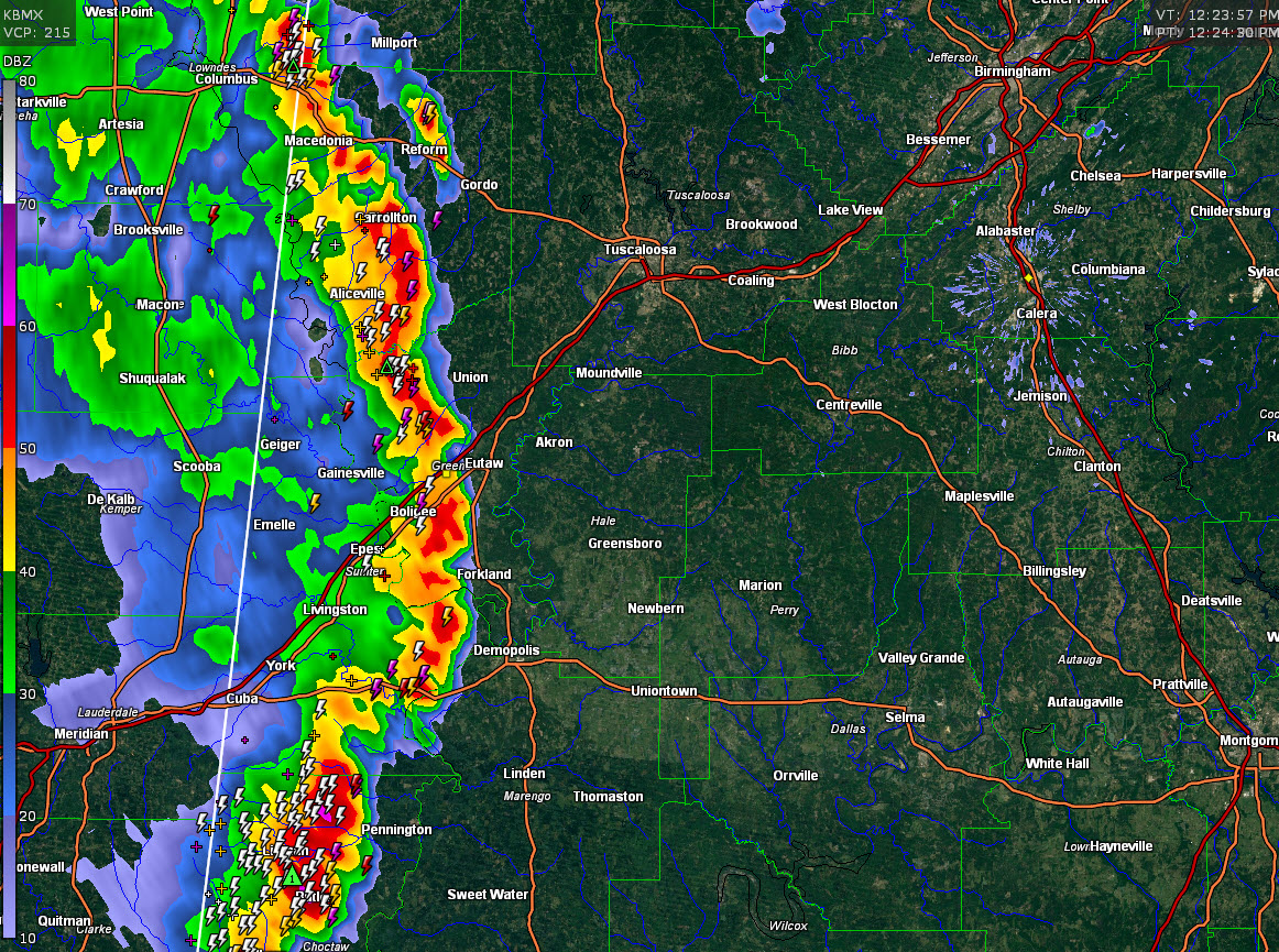
The line of storms moving through West Alabama is moving a little faster, to the east and east northeast at nearly 30 mph.
The curved line extends from just west of Reform in Pickens County to west of Eutaw in Greene County to west of Pennington in Choctaw County.
The northern and southern ends of the segment are stronger that the middle, but all of the storms are producing heavy rain, lightning and gusty winds.
None of them are severe at this time, but we are monitoring them just in case since they are pushing into unstable air as we approach peak heating.
The storms should reach the Birmingham Metro around 3 p.m. or so, if they hold together.
Category: Alabama's Weather, ALL POSTS
About the Author (Author Profile)
Bill Murray is the President of The Weather Factory. He is the site's official weather historian and a weekend forecaster. He also anchors the site's severe weather coverage. Bill Murray is the proud holder of National Weather Association Digital Seal #0001 @wxhistorianSubscribe
If you enjoyed this article, subscribe to receive more just like it.


