Weekend Storms, Drier Next Week
I always find it interesting to see how the temperature changes as a shower or storm moves close by but does not produce significant rain. I recorded 1 hundredth of an inch, barely enough to dampen the street, but the impact on my temperature was pretty good.
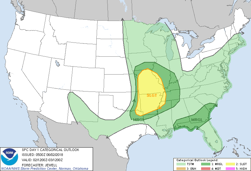
This morning there are a few showers occurring over South Alabama in association with a trough axis that extended from western North Carolina into South Alabama. Outside of the showers there was a mixture of clear skies and clouds with temperatures in Central Alabama mainly in the lower 70s. It is going to be another day with scattered showers driven by afternoon heating as highs climb to around 90 degrees. There is a marginal risk for damaging wind across South Alabama and the Florida Panhandle along the trough axis while the standard slight risk for severe storms was located over Arkansas and Missouri for today where large hail and damaging wind are possible especially with the mesoscale convective system (MCS) over eastern Kansas and Northwest Missouri.
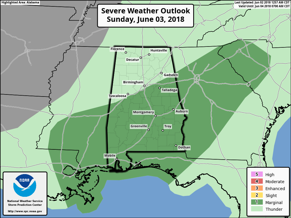
The upper trough over the Dakotas today moves into the Central Great Lakes Region pushing the trough axis over the Southeast US out into the Atlantic as we begin to see a trough become established generally along the East Coast. The surface cold front will move through Alabama on Sunday when we’ll see a marginal risk for severe storms over the southern half of Alabama and parts of Mississippi and Georgia. Severe weather should be limited to isolated storms driven with the help of afternoon heating with damaging wind the main prospect.
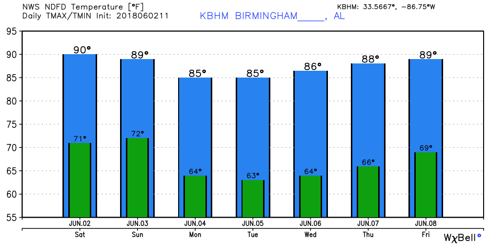
The surface front exits into the Gulf early Monday as a trough becomes established along the East Coast. This puts Alabama and the Southeast US under northwesterly flow aloft and bring in some much drier air for much of the week ahead. This will mean lower dew points that are likely to drop into the 50s especially on Tuesday. That should feel very nice with some locations seeing lows in the 50s. But even for those of us that don’t drop quite that cool, the lower half of the 60s with drier air will feel good. And those afternoon highs in the 80s with less humidity will also seem pretty good.
The trough along the East Coast stays with us, so we stay in a northwesterly flow pattern with a nice ridge over West Texas. We’ll have to be alert to the potential for the development of large clusters of thunderstorms developing over the Central US and traveling into the Southeast US on that flow. In fact the GFS shows a fairly potent short wave over West Tennessee on Friday that might produce such an event. By the end of the week temperatures should be again approaching the 90s.
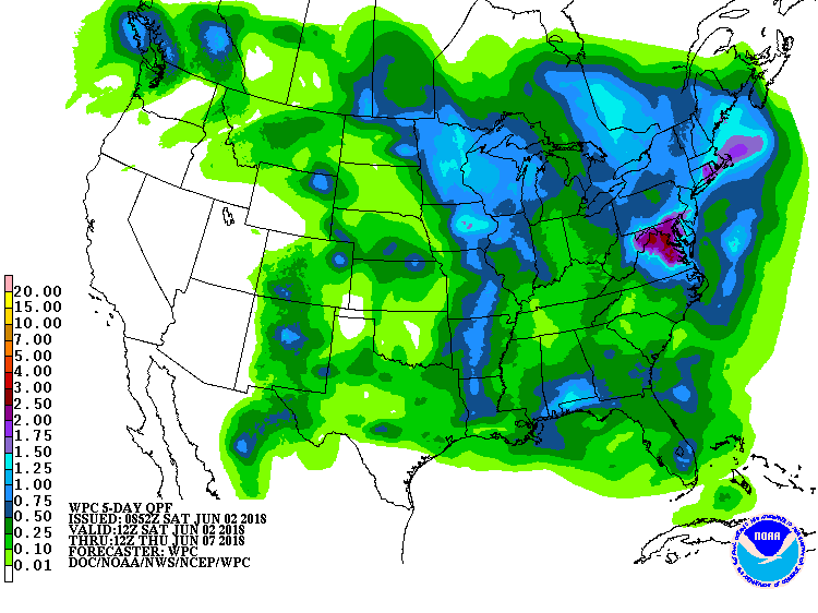
Rainfall for the next five days will occur primarily with showers over the next two days. Amounts will be spotty with some places seeing less than a quarter of an inch while others are luckier and see one half to three quarters of an inch.
Looking out into voodoo country, the GFS 500 millibar forecast charts keep a slight troughiness over the Southeast US for much of week 2. This is good to see since it keeps us out of any excessive heat. But by June 16th ridging appears to be on the increase with the potential for higher heat, more humidity, and a return to daily showers and storms.
BEACH FORECAST: Click here to see the AlabamaWx Beach Forecast Center page.
WEATHER BRAINS: Don’t forget you can listen to our weekly 90 minute netcast anytime on the web, or on iTunes. This is the show all about weather featuring many familiar voices, including our meteorologists here at ABC 33/40.
I will be filling in for Charles Daniel this weekend, so you can catch the latest forecast at 6 and 10 pm today. I expect to post the next Weather Xtreme Video here by 7 am or so on Sunday. Enjoy the day and Godspeed.
-Brian-
Category: Alabama's Weather, ALL POSTS, Weather Xtreme Videos
About the Author (Author Profile)
Brian Peters is one of the television meteorologists at ABC3340 in Birmingham and a retired NWS Warning Coordination Meteorologist. He handles the weekend Weather Xtreme Videos and forecast discussion and is the Webmaster for the popular WeatherBrains podcast.Subscribe
If you enjoyed this article, subscribe to receive more just like it.


