Wet Weather into Saturday
* * * Happy Summer ! The summer solstice occurred at 5:07 am, so today will see the longest amount of daylight for the northern hemisphere. * * *
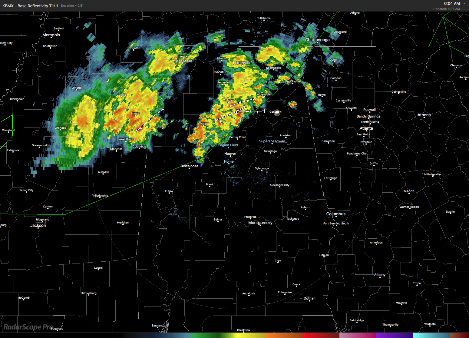
The sky over Alabama was mostly cloudy this morning thanks to a couple of waves of showers and thunderstorms moving through North Alabama and northern Mississippi. The surface pattern featured a frontal boundary that has moved closer to North Alabama this morning. Aloft, the closed low and associated trough was poised to move across the Middle Mississippi River early Friday. Morning temperatures were in the lower and middle 70s – lower 70s where rain was occurring. Looks like there could be several waves of showers and storms today ahead of the trough with highs expected to reach the 80s.
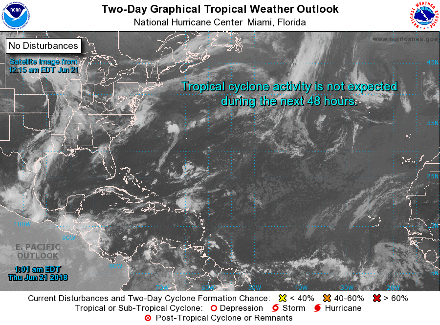
The Atlantic Basin is quiet this morning while there is one area of disturbed weather in the Eastern Pacific under surveillance that is not expected to develop much over the next couple of days, but further development is possible in the 3 to 5 day range.
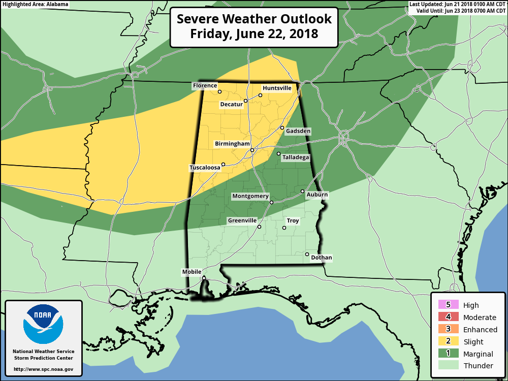
The upper trough will move slowly across to our northwest today and to our north on Friday bringing the best chances for rain and thunderstorms. SPC has Northwest Alabama in a marginal risk for Day 1 while they outline a slight risk from northern Alabama westward into northern Louisiana and southern Arkansas on Day 2 (Friday). CAPE values are forecast to range from about 1200 over North Alabama to 3500 over South Alabama. While the primary threat is expected to be damaging wind, an isolated tornado is possible with storm relative helicity values 150 to 200 over the northern two-thirds of Alabama.
The upper trough moves into the eastern Great Lakes area on Saturday but with the surface front in our area, rain chances will remain pretty good as the threat of severe weather diminishes with the primary dynamics back in the Central US. By Sunday and into the first couple of days of next week,
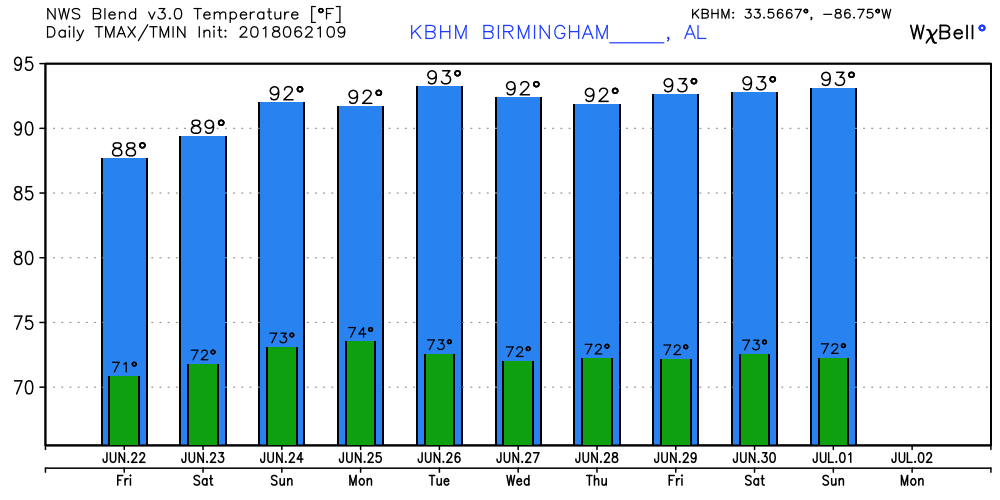
we see some weak ridging over the eastern portion of the US and the Southeast. Another strong trough in the westerlies moves across the Great Lakes on Wednesday and dampens down that weak ridging. With precipitable water values remaining fairly high, the forecast will need to maintain some chance for showers and thunderstorms each day. Highs Sunday through Thursday will likely remain stuck in the lower 90s – generally 90 to 93.
Looking out into voodoo country and we see the GFS becoming very bullish on the development and establishment of a ridge over the eastern US as the Bermuda high pushes into the area from the east. This seems likely to bring some hot weather to the eastern half of the country as we head into July.
BEACH FORECAST: No affects from the Gulf system or Bud on the beautfiul beaches of Alabama and Northwest Florida. Click here to see the AlabamaWx Beach Forecast Center page.
WEATHERBRAINS: Don’t forget you can listen to our weekly 90 minute netcast anytime on the web, or on iTunes. This is the show all about weather featuring many familiar voices, including our meteorologists here at ABC 33/40.
I’m heading to the Alabaster-Pelham Rotary Club at noon for a presentation. They gave me the choice of topics, so I’m going to step back nearly 15 years to 2004 and talk about my encounter with Hurricane Ivan, both on the ground and in the air. The next Weather Xtreme Video should be posted here by 7 am or so on Friday. Have a great day and Godspeed.
-Brian-
.
Category: Alabama's Weather, ALL POSTS, Weather Xtreme Videos
About the Author (Author Profile)
Brian Peters is one of the television meteorologists at ABC3340 in Birmingham and a retired NWS Warning Coordination Meteorologist. He handles the weekend Weather Xtreme Videos and forecast discussion and is the Webmaster for the popular WeatherBrains podcast.Subscribe
If you enjoyed this article, subscribe to receive more just like it.


