Action to the West
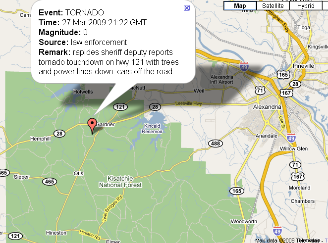
A tornado has just been reported to the west southwest of Alexandria in Central Louisiana near Gardner.

3/27 16:43:36
3/27 16:38:31
This is a complex of thunderstorms that developed over extreme eastern Texas earlier. It is riding along that snaky frontal boundary and feasting on 2500-4000 j/kg air. It will push into Mississippithis evening. Even though the airmass there is not as unstable, it will likely hold together, especially if that secondary low associated with it can continue to intensify. A new tornado watch has been issued until 9 p.m. for a small part of Northeast Louisiana and Southwest Mississippi.
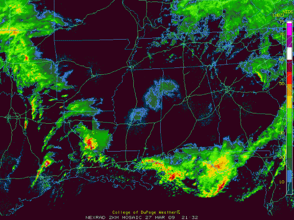
Here is the regional radar mosaic.

Look at the cell back over extreme Southeast Texas.
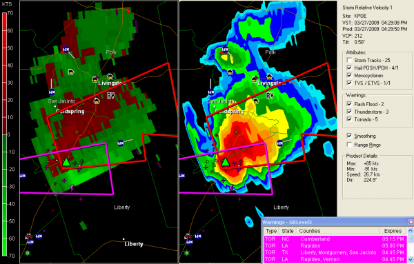
Here is a closeup. That’s a nasty storm.

Some damage was reported in Cleveland with this cell. It still has a serious velocity couplet associated with it. It even had a debris ball a short time ago and has produced baseball sized hail.
That’s some juicy air down there. 75F/71F at Houston last hour.
This cell is developing as expected ahead of the main cold front. Activity should continue to fire in the unstable airmass over eastern Texas and Louisiana. A new tornado watch was just posted for Southwest Louisiana and Southeast Texas. A moderate risk of severe weather continues through the early morning hours as far east as Columbus and Meridian in Mississippi with a slight risk into West Alabama.
Our main threat will come after midnight as the main low, which is now east of Dallas lumbers eastward.
Category: Uncategorized


