SPC Mesoscale Discussion: Tornado Watch 208 Continues

SUMMARY…A few of the stronger storms, particularly in northern portions of WW 208, will continue to pose a tornado threat for the next hour or two.
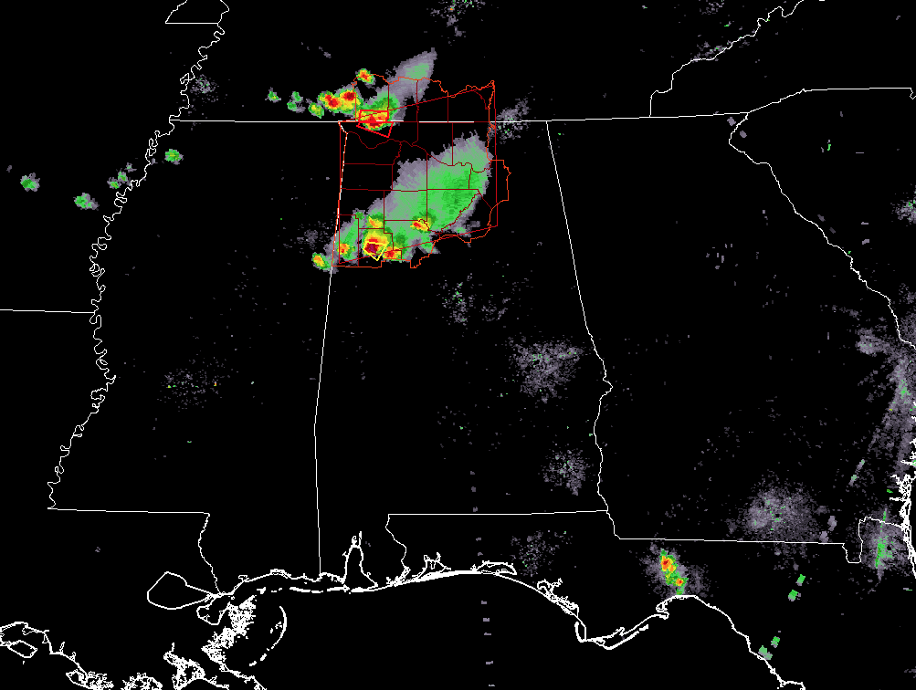
DISCUSSION…Two clusters of storms have persisted in WW 208 — one in south-central Tennessee and another in northern/central Alabama. With effective deep-layer shear values from 25-35 kts, storms have been able to maintain marginal supercellular structure. VWP data shows favorable low-level hodograph curvature and 20-25 kts of 0-1 km shear for KHTX. 0-1 km shear decreases with southward extend per KGWX VWP showing around 10 kts. The area of greatest tornado threat for the next few hours appears to be southern Middle Tennessee and parts of northwestern Alabama. A storm along Wayne County, TN and Lauderdale County, AL has shown stronger mid-level rotation and exhibited rightward deviant storm over the last half hour. Furthermore, deep-layer shear should remain stronger in this area, due to proximity to a weak mid-level wave, as well as better low level shear. Storms moving south into central Alabama should become more disorganized with time as shear decreases to the south. The overall threat should diminish as continued boundary layer cooling will increase convective inhibition.
Category: ALL POSTS, MescoScale Discussions
About the Author (Author Profile)
Subscribe
If you enjoyed this article, subscribe to receive more just like it.


