July Begins Somewhat Unsettled
Birmingham ends the month of June with 5.67 inches of rain, 1.39 inches above the 30-year average. My rainfall in Helena was a little less with 3.65 inches, about a half inch below the 30-year average.
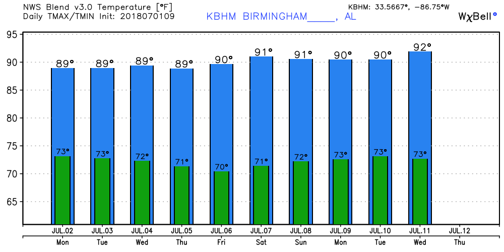
The Alabama sky featured a mix of clouds and clear sky along with a good deal of fog across the southern half of the state. The clouds and fog thanks to the numerous showers and storms that formed yesterday in response to the diurnal heating along with the weak low pressure area both at the surface and aloft. That low pressure area was located over the Florida Panhandle this morning as it trekked westward. The weakness aloft along with diurnal heating should once again set off numerous showers and storms across Mississippi, Alabama, Georgia and the Florida Panhandle today and again Monday. Highs will generally be around the 90-degree mark ranging from 88 to 93. Thanks to clouds and numerous showers Central Alabama should remain below the critical heat index value of 105.
SPC maintains a slight risk for severe storms from the Upper Peninsula of Michigan southward into Central Illinois for Day 1.

The weak upper low will westward along the Gulf Coast to a location near Lake Charles, LA, on Tuesday. Monday should see numerous showers again while Tuesday we should see less showers and storms. Highs Tuesday will again be in the range from 88 to 93.
Wednesday another weak upper level area of low pressure approaches the Southeast US coast coming out of the Southwest Atlantic. That weak low is forecast to move into the Southeast US Friday and continue moving slowly westward into the weekend. Like we are seeing with the current one, this weak upper low together with the daily heating by the sun will keep the weather unsettled from Wednesday through the weekend. Clouds and showers will keep temperatures in check with our highs in the 88 to 93 range.
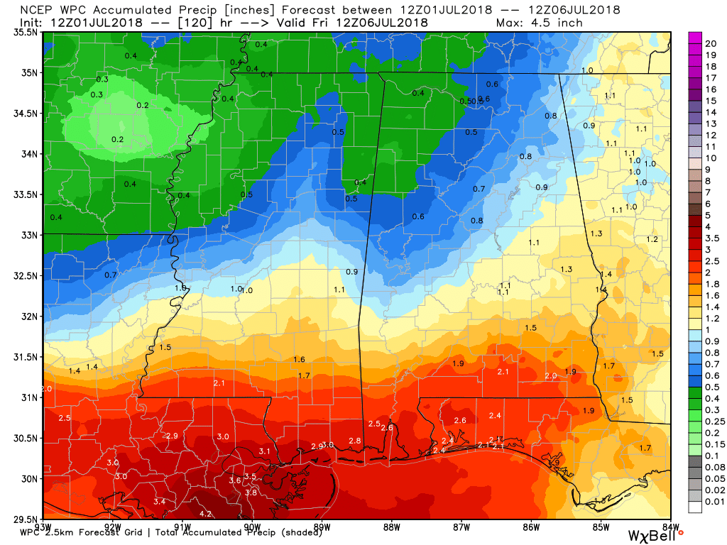
Rainfall for the next five days through Friday morning will be around an inch in Central Alabama but vary from near half an inch in Northwest Alabama to 2.5 inches along the Alabama and Northwest Florida coast. Not everyone gets this amount of rain, but these are amounts you can expect to see IF you get showers and storms.
Looking out into voodoo, the big message coming out of the GFS 06Z run this morning is gradual establishment of an upper ridge from the Southeast US coast to near the coast of California. The westerlies are pushed well north as traveling systems move across the southern tier of Canada. Our air mass remains humid, so it looks like the heat will go up as we keep scattered showers in the forecast just about every day.
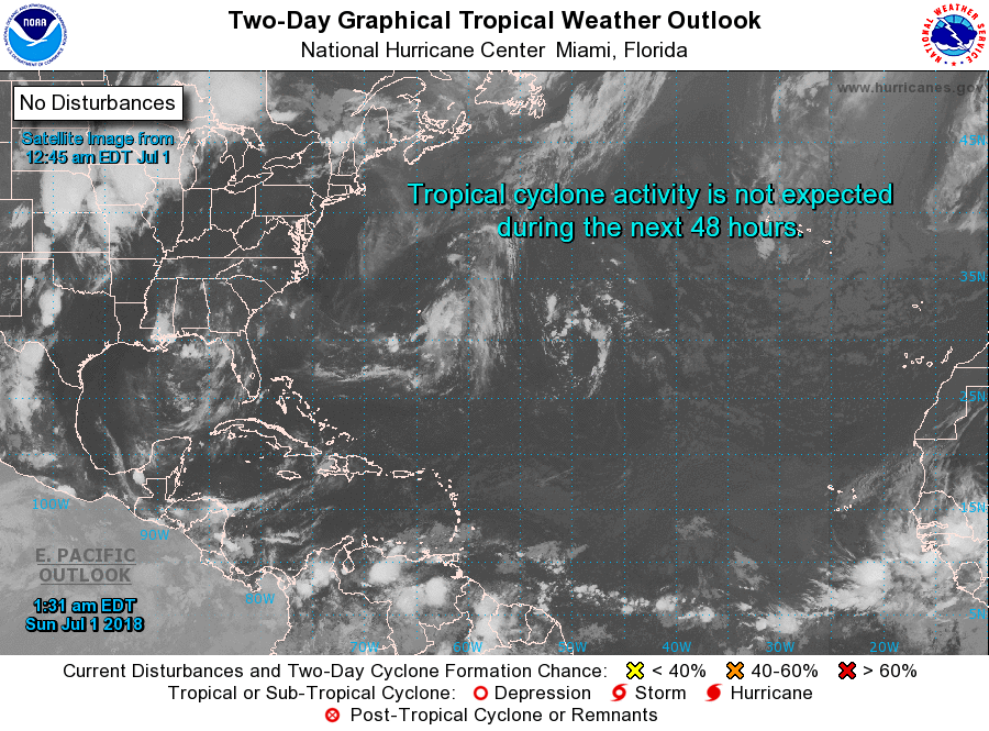
Tropics: All remains quiet across the Atlantic basin with lots of dry air and cooler than average water temperatures across the South Atlantic. No tropical issues are expected through next week. The Eastern Pacific is busier with a dying Emilia and a strengthening Fabio.
Beach Forecast: Click here to see the AlabamaWx Beach Forecast Center page.
WeatherBrains: Don’t forget you can listen to our weekly 90 minute netcast anytime on the web, or on iTunes. This is the show all about weather featuring many familiar voices, including our meteorologists here at ABC 33/40.
You can expect to find the next Weather Xtreme Video here tomorrow morning with James Spann. Be sure to stay weather aware with the scattered thunderstorms and respect any storm with lightning. Have a great day and Godspeed.
-Brian-
Category: Alabama's Weather, ALL POSTS, Weather Xtreme Videos
About the Author (Author Profile)
Brian Peters is one of the television meteorologists at ABC3340 in Birmingham and a retired NWS Warning Coordination Meteorologist. He handles the weekend Weather Xtreme Videos and forecast discussion and is the Webmaster for the popular WeatherBrains podcast.Subscribe
If you enjoyed this article, subscribe to receive more just like it.


