Unsettle Weather for Several Days
The weather pattern will continue to be unsettled for the weekend and into the start of next week with a weak and dissipating front that should be the focus for numerous showers and storms. While this could spell some extended durations for rain as in 2 to 3 hours, it won’t mean an all day washout. As we saw yesterday, some flash flooding is possible when the relatively slow moving storms set up and train for a couple of hours in one spot. A sun/cloud mix starts the day, so the extra clouds should be effective in keeping our high temperatures in the upper 80s. And I’ll take whatever cooling impact we can get to break out of the 90s for a few days.
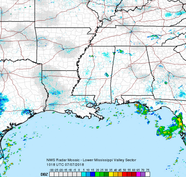
The front is difficult to identify with a wind shift across South Alabama but no sign of really dry air until you reach Kentucky. The front will flounder in our area through Monday, so this feature along with a weak area of lower pressure aloft with combine to maintain the unsettled weather with numerous showers each afternoon and evening Sunday and Monday. Clouds and numerous storms will hold highs in the middle and upper 80s.
The upper ridge pulls further westward on Tuesday maintaining troughiness along the East Coast and keeping the Southeast US unsettled once again on Tuesday with potential for numerous showers and storms. Look for our highs to be in the upper 80s.
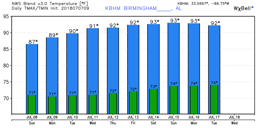
From Wednesday through Saturday, the GFS maintains the ridge to our west with the troughiness along the East Coast. This maintains a north to northwest flow aloft for us in Alabama, so this will keep any excessive heat at bay with highs around the 90-degree mark. This will also keep a slightly less humid air mass for much of Alabama so showers and storms should be much reduced with only about a isolated to scattered storms during the afternoon heat. Highs will move up a little with most places seeing values 90 to 93.
Looking out into voodoo country, the GFS is somewhat bullish on returning the upper ridge to the eastern half of the US by July 18th. From then through the end of the forecast period, the 594 contour covers the southern tier of the US from coast to coast. So highs should move into the middle 90s but scattered storms driven by daytime heating will stick with us.
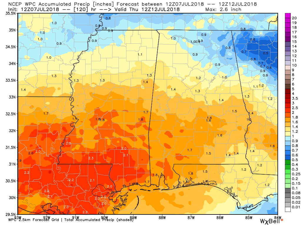
Rainfall amounts over the next 5 days will continue to be varied due to the nature of showers, but most people will likely see 1 to 1.5 inches of rain. Variations will continue much like we saw yesterday with some spots getting excessive rain while some locations see reasonable amount.
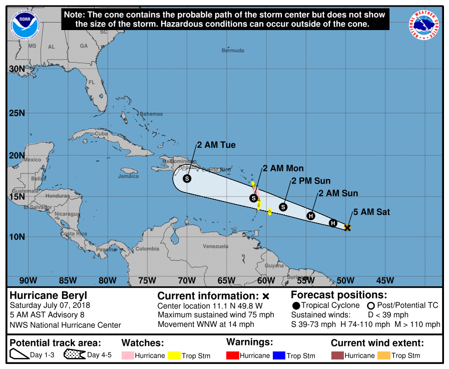
The tropical Atlantic has become active. Hurricane Beryl is moving steadily westward across the South Atlantic with watches and warnings posted for the Lesser Antilles. The storm has been defying forecasters, but it does appear likely to degenerate at least to tropical storm strength as it approaches the Lesser Antilles on Sunday.
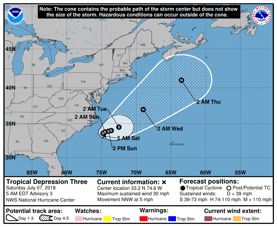
And Tropical Depression Three was located about 145 miles south-southeast of Cape Hatteras, NC. It is expected to meander just offshore into early next week before finally heading northeastward out to sea. It could become a tropical storm later today or early Sunday and would be named Chris.
Beach Forecast: Click here to see the AlabamaWx Beach Forecast Center page.
WeatherBrains: Don’t forget you can listen to our weekly 90 minute netcast anytime on the web, or on iTunes. This is the show all about weather featuring many familiar voices, including our meteorologists here at ABC 33/40.
Unfortunately there have now been 12 lightning fatalities across the US in 2018. Lightning is frightening, so give it all the respect it deserves and move inside when storms are in your area. I plan to have the next Weather Xtreme Video posted here by 7 am or so on Sunday morning. Have a great day and Godspeed.
-Brian-
.
Category: Alabama's Weather, ALL POSTS, Weather Xtreme Videos
About the Author (Author Profile)
Brian Peters is one of the television meteorologists at ABC3340 in Birmingham and a retired NWS Warning Coordination Meteorologist. He handles the weekend Weather Xtreme Videos and forecast discussion and is the Webmaster for the popular WeatherBrains podcast.Subscribe
If you enjoyed this article, subscribe to receive more just like it.


