Numerous Showers Once Again
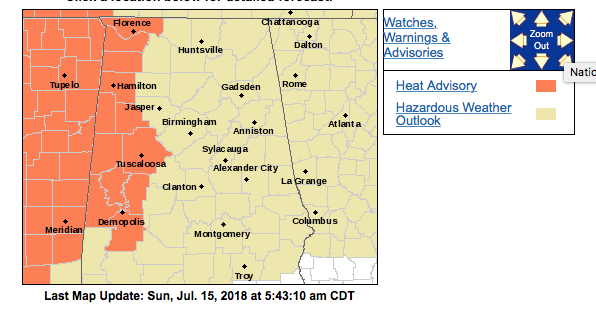
Very little change in the overall pattern affecting the Southeast US, so I expect to see numerous storms develop once again in the heat of the afternoon as highs climb into the lower 90s. Heat advisory is in effect through this evening for the western counties of Alabama from Demopolis to Florence. Precipitable water values remain high, so with little movement to most of the storms, localized flash flooding could once again be an issue. And be sure to respect the lightning threat with these storms, too.
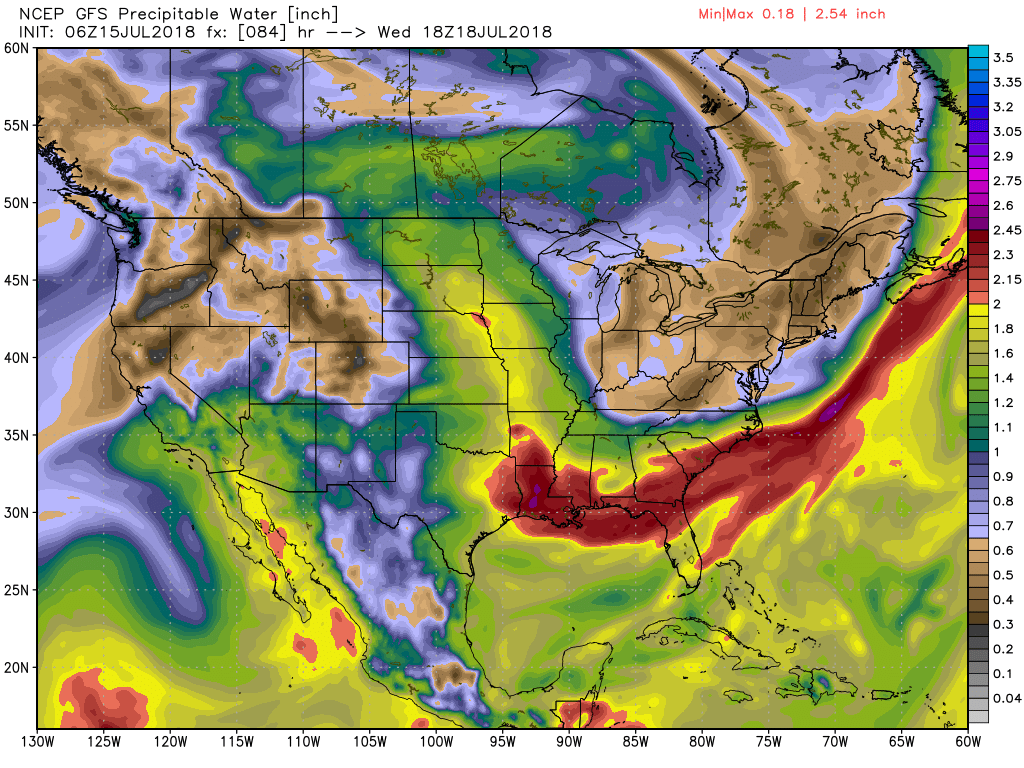
As was noted yesterday, we could see a bit of a change for the northern half of the state of Alabama as the upper ridge slides westward to become situated over the southern Rockies by Wednesday. This will turn our upper flow to more northwesterly as a broad trough develops over the eastern half of the country. Storms will remain numerous Monday and Tuesday, but with some drier air as depicted by the precipitable water chart flows into North Alabama, we should see a significant drop off in storm coverage. Highs will remain in the lower 90s, but Wednesday some spots may only see highs in the upper 80s.
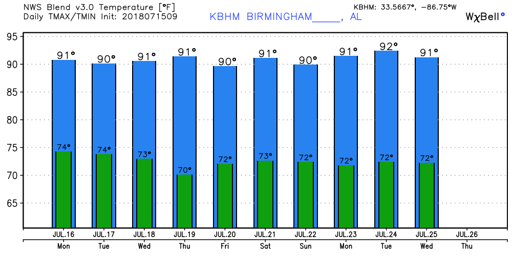
A fairly strong upper trough will slide across the Great Lakes Thursday through Saturday which is expected to drag a weak cold front into the Southeast US Friday and Saturday. This will once again bring the chances for storms up somewhat after a couple of days of lowered chances. Highs stick pretty close to climatological averages with values from 89 to 92.
Looking out into voodoo country, the GFS remains convinced that there will not be any extreme heat across the eastern half of the country as the upper air pattern remains with a weak trough while the upper ridge remains in the vicinity of the Four Corners area. This means highs 90 to 92 with the likelihood of daily chances for scattered showers.
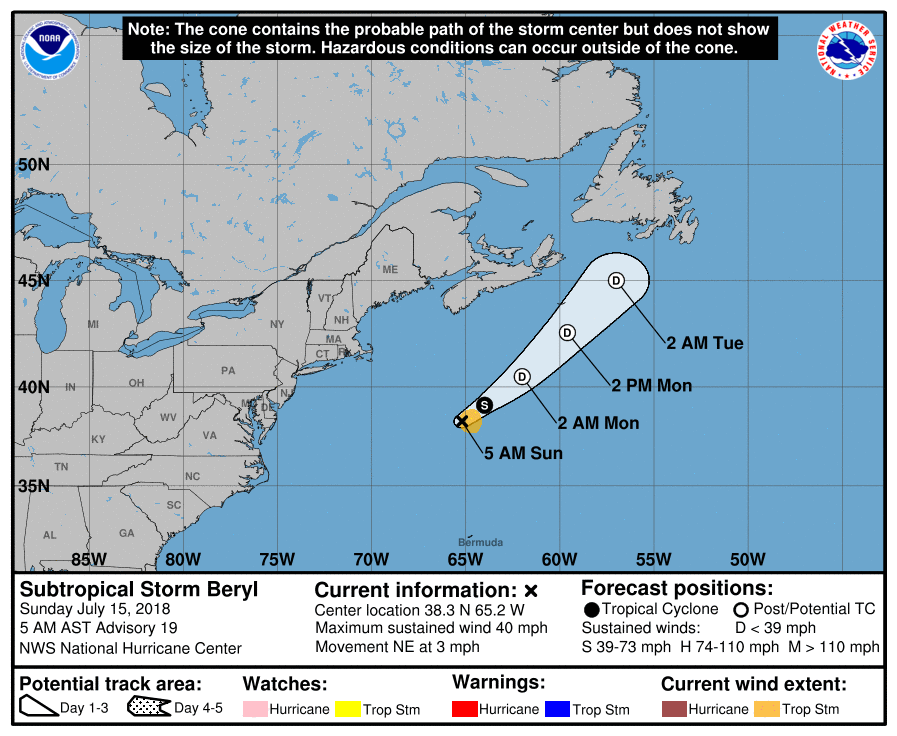
The Atlantic Basin is fairly quiet with the exception of the remnants of Beryl which is likely to weaken to a depression by Monday.
Beach Forecast: Click here to see the AlabamaWx Beach Forecast Center page.
WeatherBrains: Don’t forget you can listen to our weekly 90 minute netcast anytime on the web, or on iTunes. This is the show all about weather featuring many familiar voices, including our meteorologists here at ABC 33/40.
James Spann is back with the next edition of the Weather Xtreme Video on Monday morning. You can catch the latest forecast on ABC 3340 Good Morning Alabama as I fill in for Meaghan Thomas on Monday morning. Have a great day and Godspeed.
-Brian-
Category: Alabama's Weather, ALL POSTS, Weather Xtreme Videos
About the Author (Author Profile)
Brian Peters is one of the television meteorologists at ABC3340 in Birmingham and a retired NWS Warning Coordination Meteorologist. He handles the weekend Weather Xtreme Videos and forecast discussion and is the Webmaster for the popular WeatherBrains podcast.Subscribe
If you enjoyed this article, subscribe to receive more just like it.


