A Few Evening Notes On Tropical Storm Gordon

The latest data in from the NOAA Orion Hurricane Hunter aircraft mission shows that the center of Tropical Storm Gordon was located around 95 miles west of Fort Meyers, Florida with a minimum pressure of 1003 MB. Maximum sustained winds are now at 60 MPH, just 14 MPH away from becoming a category 1 hurricane.
A Hurricane Warning is in effect the mouth of the Pearl River to the Alabama/Florida border.
A Tropical Storm Warning is in effect for locations west of the mouth of the Pearl River to east of Morgan City, including Lake Pontchartrain and Lake Maurepas), and from the Alabama/Florida border to the Okaloosa/Walton county line.
The Tropical Storm Warning for the southwest coast of Florida has been discontinued.
A Storm Surge Warning is in effect from Shell Beach to Dauphin Island from now until late Tuesday or Tuesday night. A Storm Surge Watch is in effect from west of Shell Beach to the mouth of the Mississippi River and east of Dauphin Island to Navarre.
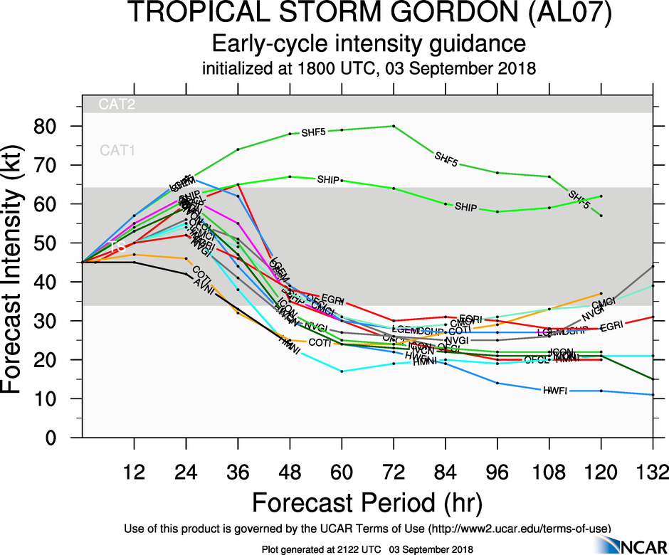
While most of the ensembles keep the intensity of Gordon in the tropical storm category, a few do have it strengthening into a category 1 hurricane within the next 24 hours. Conditions continue to be conducive for gradual strengthening over the next 24-36 hours, and the NHC has Gordon reaching category 1 hurricane strength by landfall on Wednesday.
Gordon is expected to bring hurricane conditions along with life-threatening storm surge to parts of the central Gulf Coast where the Storm Surge Warning is currently in effect. Tropical storm conditions are expected to arrive in the warning areas by Tuesday afternoon or early evening.
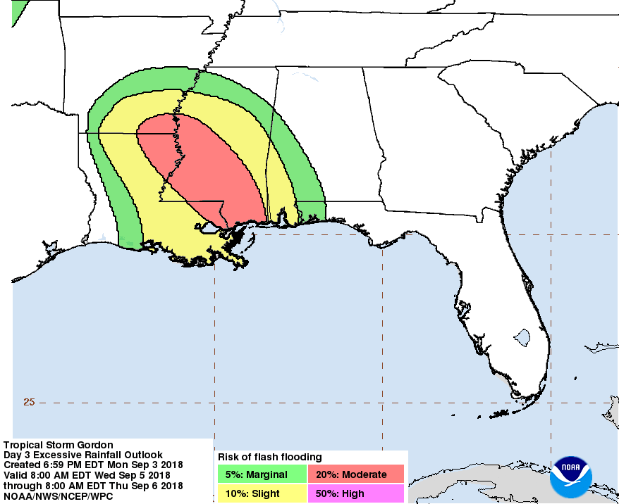
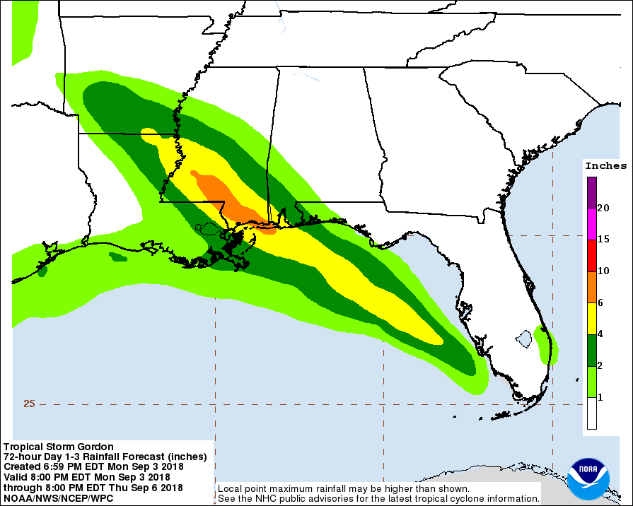
Heavy rainfall will affect the southern parts of Alabama and Mississippi, along with much of Louisiana, where totals could reach as high as 6-8 inches. This amount of rain in a short amount of time could cause flash flooding issues.
An isolated tornado or two will be possible throughout the rest of this evening and through the overnight hours across the southern and west-central parts of the Florida Peninsula.
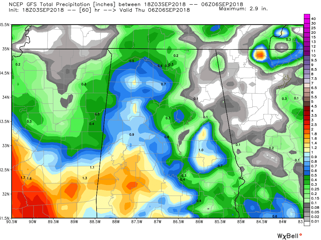
While Central Alabama will get some rain throughout the next 2 days from Gordon, much of that will be located over the southwestern parts of the area, but only totaling 1-2 inches. The rest of the area will see the standard chance of isolated to scattered afternoon and evening showers and thunderstorms. Flooding rainfall is not expected for anywhere in Central Alabama from Gordon, and wind gusts will only pick up to around 10-15 MPH at times. The tornado threat for the southern parts of the area is very low, but with tropical systems, expect the unexpected.
We’ll keep you posted with updates on Tropical Storm Gordon throughout the next couple of days on AlabamaWx.com. Have a great evening.
Category: Alabama's Weather, ALL POSTS
About the Author (Author Profile)
Scott Martin is an operational meteorologist, professional graphic artist, musician, husband, and father. Not only is Scott a member of the National Weather Association, but he is also the Central Alabama Chapter of the NWA president. Scott is also the co-founder of Racecast Weather, which provides forecasts for many racing series across the USA. He also supplies forecasts for the BassMaster Elite Series events including the BassMaster Classic.Subscribe
If you enjoyed this article, subscribe to receive more just like it.


