Gordon Continues Approach To The Gulf Coast: It’s The Midday Nowcast For Central Alabama
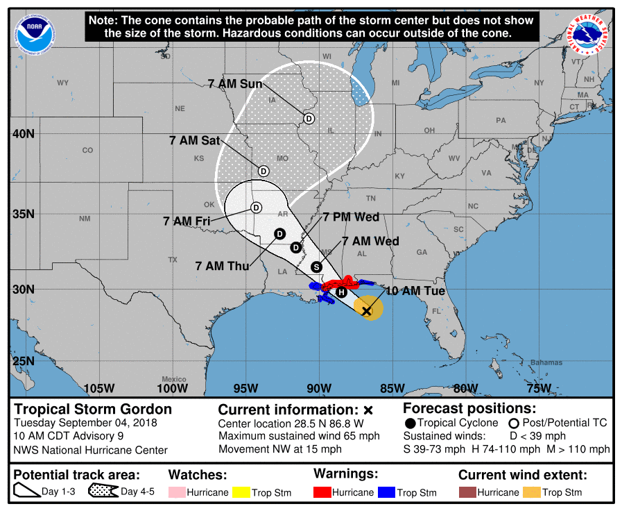
Of course the big weather story of the day is Tropical Storm Gordon, which is expected to strengthen into a category 1 hurricane before making landfall later this evening. The outer rain bands are already affecting the Florida Panhandle, bringing squalls to the coastline from Apalachicola to just west of Destin. Current forecast track has the center of the cone of uncertainty making landfall just west of Gulfport near Bay St. Louis right at or just before midnight tonight. The cone itself stretches to as far west as Eden Isle, Louisiana, and as far east as Bayou La Batre, Alabama. The good news, as I stated in an earlier post, that we will see very little in difference to our typical late summertime forecast for Central Alabama.
There are no counties in Central Alabama that is under any watches or warning at this point, and it is almost guaranteed that will remain the case throughout the remainder of the day and into the morning hours on Wednesday.
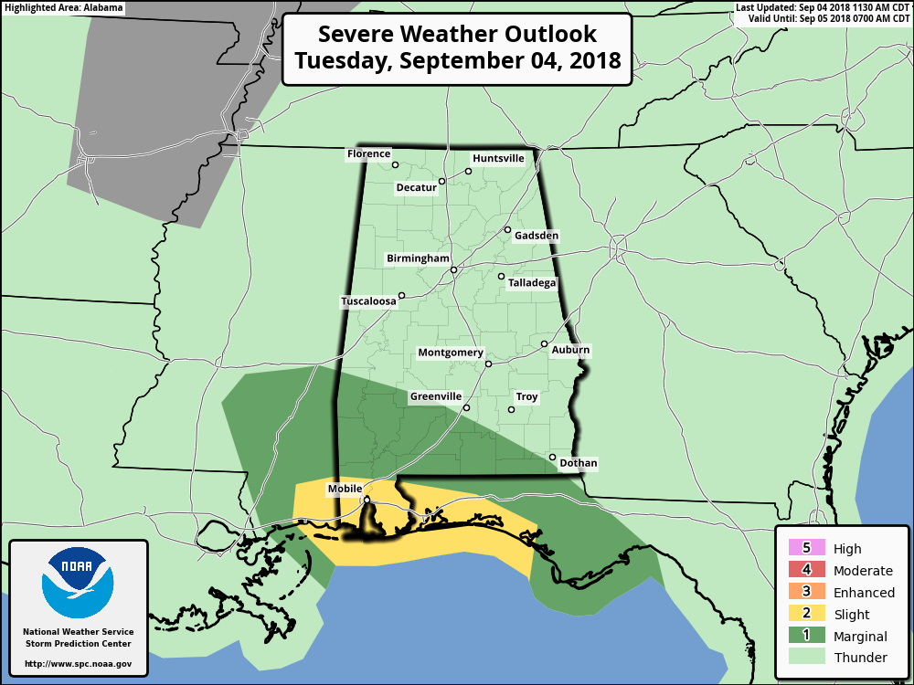
SPC has a good portion of South Alabama in severe weather risks for today through the early morning hours on Wednesday. We do note that the southern part of Marengo County is included in the Marginal Risk for severe weather as there may be an isolated damaging wind gust possible along with an even smaller threat of a spin-up tornado possible. No other part of Central Alabama is in a defined risk of severe weather.
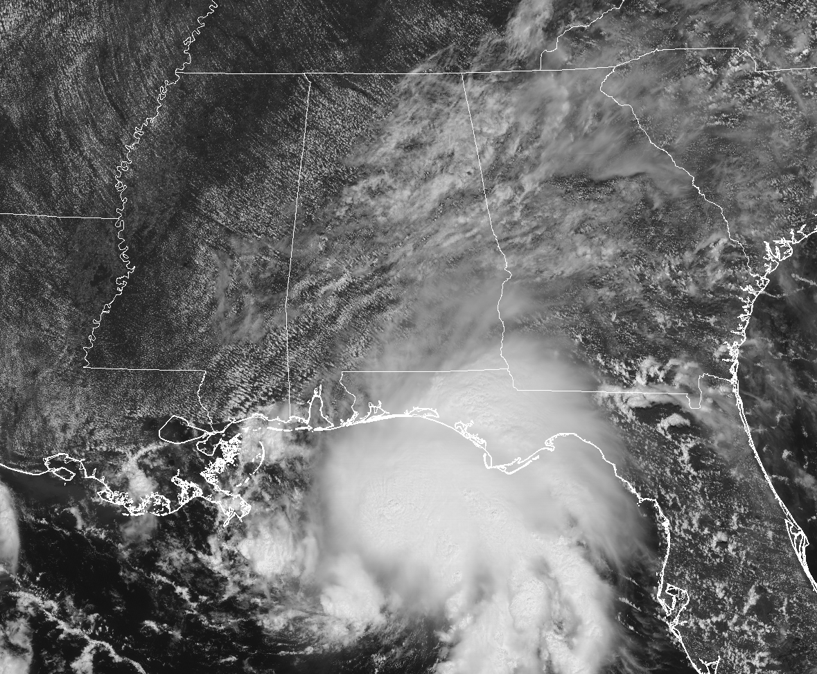
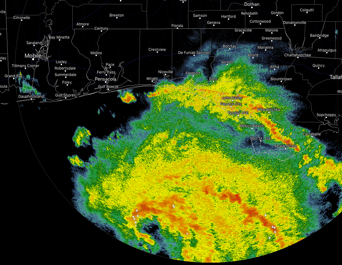
As you can see by the latest visible satellite image above, clouds from Gordon have moved well into the eastern half of the state. Only a few isolated light showers are showing up across the area at this point, and they are moving off to the northwest at a decent pace.
For the rest of today, much of the northern half of the area will remain dry with only a small chance of few passing isolated showers, while rain chances increase as you move into the southern half of the area. Chances in the southern half will be 30-60% for scattered to numerous showers and storms. Afternoon highs will be in the mid-80s to the lower 90s. While much of the activity dissipates for much of the area, the extreme west and southwestern parts of the area will continue to have an increased risk of showers and storms from Gordon as it makes landfall along the Gulf Coast and begins its northwestward trek across southern Mississippi. Lows will be in the lower to mid-70s. Rain chances south of I-22 and east of I-65 will range from 20% to 60% as you move southwestward.
Wednesday’s weather may be a little breezy with wind gusts possibly hitting 20 MPH at times. We’ll also continue to have a higher risk of showers and storms over the western and southwestern parts of the area due to Gordon. For the rest of the area, we’ll have the standard risk of a few isolated to scattered showers and storms. Afternoon highs will range through the 80s.
We’ll continue to have updates throughout the day on AlabamaWx.com. Keep checking back often.
Category: Alabama's Weather, ALL POSTS
About the Author (Author Profile)
Scott Martin is an operational meteorologist, professional graphic artist, musician, husband, and father. Not only is Scott a member of the National Weather Association, but he is also the Central Alabama Chapter of the NWA president. Scott is also the co-founder of Racecast Weather, which provides forecasts for many racing series across the USA. He also supplies forecasts for the BassMaster Elite Series events including the BassMaster Classic.Subscribe
If you enjoyed this article, subscribe to receive more just like it.


