Quick Update On The Rest Of The Tropical Disturbances
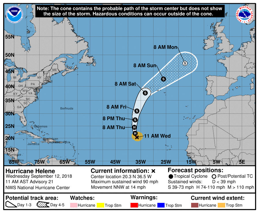
Hurricane Helene has already made the curve to the north and will be moving over the cooler waters of the North Atlantic Ocean by Saturday. She will make a close approach to the Azores on Saturday as a tropical storm, but will continue to curve to the northeast and will become subtropical by Monday morning. As of 10:00 am CT, she was packing winds at 90 MPH and with a minimum central pressure at 977 MB (28.85 inches).
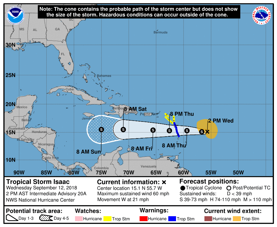
Tropical Storm Isaac is battling with increased wind shear today and it is possible that this would cause the storm to weaken to a tropical wave within the next two days. If there is any of the system left, wind shear could decrease over the east-central Caribbean Sea and conditions could become more conducive for reorganization. At this point, the confidence in that happening is low. Isaac should remain a tropical storm when it moves across the Lesser Antilles on Thursday. Tropical storm watches remain in effect for Montserrat, St. Kitts and Nevis, Antigua, and Saba and St. Eustatius, while a tropical storm warning remains in effect for Martinique, Dominica, and Guadeloupe. As of 1:00 pm CT, Issac was packing winds at 60 MPH and was moving to the west at 21 MPH.
We should have a depression or a storm within the Gulf of Mexico within the next day or two as conditions will become conducive for organization and strengthening of an area of low pressure. Right now, the treat of heavy tropical rains and gusty winds will start affecting the Gulf Coast of northern Mexico, Texas, and western Louisiana late this week. No threat to Alabama as of now, but we’ll keep an eye on it.
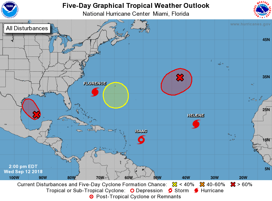
An area of low pressure a few hundred miles to the west-southwest of the Azores has become better organized and it appears that we may have a torpical/subtropical storm forming. It is forecast to strengthen somewhat while moving to the southwest for the next couple of days and then turn to the northeast just behind Helene. Could this be Joyce in the making?
Another hotspot has been spotted by the NHC near Bermuda as an area of low pressure is expected to develop by the end of the weekend or at the start of next week. At this point, it is expected to slowly drift to the west and some gradual development can be expect. It is only given a 20% chance of development within the next 5 days, but it is real early in the game on this one.
Category: Alabama's Weather, ALL POSTS
About the Author (Author Profile)
Scott Martin is an operational meteorologist, professional graphic artist, musician, husband, and father. Not only is Scott a member of the National Weather Association, but he is also the Central Alabama Chapter of the NWA president. Scott is also the co-founder of Racecast Weather, which provides forecasts for many racing series across the USA. He also supplies forecasts for the BassMaster Elite Series events including the BassMaster Classic.Subscribe
If you enjoyed this article, subscribe to receive more just like it.


