Warm, Dry for the Weekend
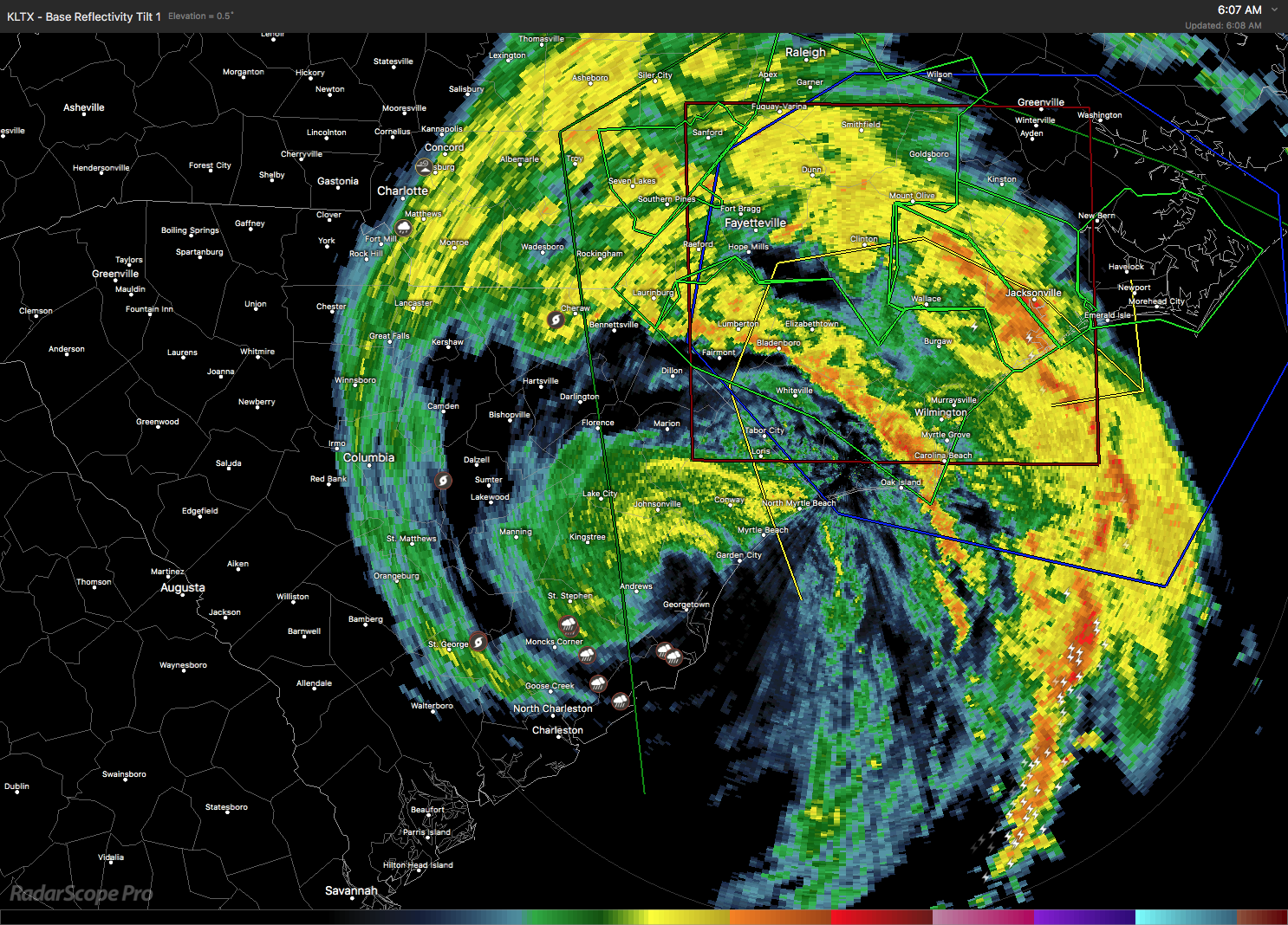
Florence remained a tropical storm this morning as it drifts through South Carolina continuing to produce storm surge on coastal areas of the Carolinas and maintaining heavy rain over portions of North and South Carolina.
Alabamians waking up to a clear sky across the state this morning with temperatures in the lower half of the 70s. Looks like a sunny day in store for the state with highs again pushing into the lower 90s. Seems summer-like temperatures just keep holding on.
Football Weather: Auburn hosts LSU this afternoon (2:30 pm CDT kickoff) at Jordan-Hare Stadium. The sky will be mostly sunny with a kickoff temperature near 90 degrees falling into the upper 80s by the fourth quarter. Alabama travels to Oxford, MS, to take on Ole Miss this evening. The 6:00 pm CDT kickoff will be mostly clear. The temperature will fall from near 88 at kickoff into the low 80s by the final whistle. And UAB hosts Tulane today at Legion Field with a 12:00 noon CDT kickoff. The sky will be mostly sunny with temperatures rising from 87 at kickoff to near 90 by the fourth quarter.
Tropics: Florence, now a tropical storm, continued to produce severe storm surge and freshwater flooding across parts of the Carolinas; it sure looks like rain totals could be in excess of 3 feet in spots by Sunday. The system will drift through South Carolina today and Sunday, still producing heavy rain while the wind field weakens.

Florence will have no impact on Alabama’s weather besides than keeping us dry.
Tropical storms Joyce and Helene in the eastern Atlantic are moving north to northeast and are no threat to North America. Isaac dissipated over the eastern Caribbean early this morning. And a tropical wave moved into South Texas bringing potential for heavy rain there.
High pressure will help to keep our weather sunny and dry through much of the week ahead. An upper ridge will be the primary feature in our weather pattern through the end of next week. The remnants of Florence slowly move northwest and north before becoming an open wave and accelerating into the Atlantic by Tuesday. A strong trough in the westerlies moves into the Great Lakes region by the end of the week trailing a cold front into the Mid South region. This together with increased moisture will bring isolated showers back into the forecast for Thursday and Friday and into next weekend. Temperatures all week should be in the range of 89 to 92 as summer holds tough. There is some promise to slightly lower temperatures with added moisture and clouds Friday and Saturday.

Looking out into voodoo, we get to follow the movements of a large ridge as it migrates westward becoming centered over Texas from the 23rd through the 27th. But the GFS promises a big change with a fairly strong and deep trough setting up over the eastern US by the 30th of September.
Beach Forecast: Click here to see the AlabamaWx Beach Forecast Center page.
WeatherBrains: Don’t forget you can listen to our weekly 90 minute netcast anytime on the web, or on iTunes. This is the show all about weather featuring many familiar voices, including our meteorologists here at ABC 33/40.
Thanks for tuning in. I expect to have the next Weather Xtreme Video posted here by 7 am or so on Sunday. You can catch the latest forecasts on ABC 3340 at 6 and 10 pm this evening as I fill in for Charles Daniel. Have a great weekend and Godspeed.
-Brian-

Category: Alabama's Weather, ALL POSTS, Weather Xtreme Videos
About the Author (Author Profile)
Brian Peters is one of the television meteorologists at ABC3340 in Birmingham and a retired NWS Warning Coordination Meteorologist. He handles the weekend Weather Xtreme Videos and forecast discussion and is the Webmaster for the popular WeatherBrains podcast.Subscribe
If you enjoyed this article, subscribe to receive more just like it.


