Generally Wet Weather Continues Through Thursday
BENEFICIAL RAIN: Rain totals today from the ABC 33/40 Skywatcher team…
Rainbow City 2.54”
Weaver 2.25”
Jacksonville 1.81”
Bibbville 1.30”
Locust Fork 1.25”
Heflin 1.02”
Mountain Brook 0.87”
Hueytown 0.83”
Coker 0.09”
Arley 0.04”
Cottondale 0.01”
As you can see, the heavier rain totals were over Central and East Alabama with big downpours the developed yesterday afternoon and early last night. We have more showers forming on radar early this morning, and we will maintain a good chance of occasional showers and thunderstorms statewide today. The sky will be mostly cloudy, and the high will be in the mid 80s for most communities. The average high for September 25 at Birmingham is 82.
MID-WEEK: A deep upper trough will dig down into the Central U.S. over the next few days, pushing a cold front in our direction. This will keep our weather wet through tomorrow and Wednesday with periods of rain and a few thunderstorms. Additional rain amounts of 2-3″ are likely over the northern half of the state. Like yesterday, a few strong storms are possible, but organized severe weather is not expected.
The front will stall out just north of Birmingham Thursday; drier and cooler air will ease into the northwest corner of the state, but wet weather continues along and south of the front.
FRIDAY AND THE WEEKEND: Last week the European and American global models showed the upper trough setting up over the eastern third of the nation Friday, pulling down cooler and drier air. Now the models have backed off on the idea; instead they lift the trough out rather quickly, meaning the front most likely won’t get past Birmingham. So, rather humid weather will continue Friday through the weekend with a mix of sun and clouds, and scattered showers and thunderstorms on a daily basis. Chance of any one community seeing rain each day will be in the 40/50 percent range, and most of the showers will come from 1:00 until 11:00 p.m. Afternoon highs will be in the mid 80s, a little above average for the end of September.
FOOTBALL WEATHER: For the high school games Friday night, a shower or storm is possible in a few stadiums, mainly during the first half. Temperatures will fall into the upper 70s.
Alabama will host Louisiana-Lafayette Saturday morning at Bryant-Denny Stadium (11:00 a.m. CT kickoff)… the sky will be partly sunny, and a passing shower or thunderstorm is possible during the game. Temperatures will rise from near 80 at kickoff, into the mid 80s by the final whistle.
Auburn will host Southern Mississippi Saturday afternoon at Jordan-Hare Stadium (3:00 p.m. CT kickoff); the sky will be partly sunny, and a shower or storm is possible. Temperatures will fall from near 84 at kickoff, into the upper 70s by the final whistle.
UAB will host Charlotte at Legion Field in Birmingham Saturday evening (6:00 p.m. CT kickoff). Temperatures will fall from near 80 degrees at kickoff, into the upper 70s by the second half. And, like the other in state games, a passing shower or storm is possible, especially during the first half.
NEXT WEEK: No real change for the first half of the week, but the next long wave upper trough could bring a shot of cooler/drier air toward the end of the week. See the Weather Xtreme video for maps, graphics, and more details.

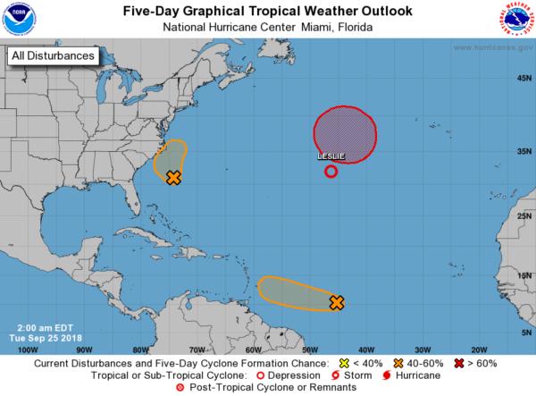
TROPICS: A wave, formerly Tropical Storm Kirk, could regenerate as it approaches the Windward Islands over the next day or so, but it will dissipate again over the Caribbean this weekend due to strong shear. A wave will skirt the Outer Banks of North Carolina tomorrow; this is the “ghost of Florence”. And, a system formerly known as Leslie will stay in the middle of the Atlantic, no threat to land. Nothing threatening the Gulf of Mexico anytime soon.
BEACH FORECAST: Click here to see the AlabamaWx Beach Forecast Center page.
WEATHER BRAINS: Don’t forget you can listen to our weekly 90 minute netcast anytime on the web, or on iTunes. This is the show all about weather featuring many familiar voices, including our meteorologists here at ABC 33/40.
CONNECT: You can find me on all of the major social networks…
Facebook
Twitter
Instagram
Pinterest
Snapchat: spannwx
I have a weather program today at Moundville Elementary School in Hale County… look for the next Weather Xtreme video here by 4:00 this afternoon. Enjoy the day!
Category: Alabama's Weather, ALL POSTS, Weather Xtreme Videos
About the Author (Author Profile)
James Spann is one of the most recognized and trusted television meteorologists in the industry. He holds the AMS CCM designation and television seals from the AMS and NWA. He is a past winner of the Broadcast Meteorologist of the Year from both professional organizations.Subscribe
If you enjoyed this article, subscribe to receive more just like it.


