Model Fans: A Review of Current Output on Michael
We don’t like to look at any one set of model output since the only thing we know is that all of it will end up being wrong. But the various scenarios can give us more clues as to what the hurricane is up to.
EUROPEAN
The 12z run of the European from this morning depicts a 957 mb hurricane with top winds around 100 mph coming inland near Destin Wednesday afternoon. This is faster than its previous runs and further west like the GFS has been. There is pretty good agreement between it and the GFS. The center turns sharply northeastward after making landfall.
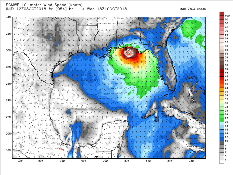
The model does ahould wind gusts as high as 138 knots though, which is believable. That would be 158 mph!!
Here are the members of the Euro ensemble showing various center positions:
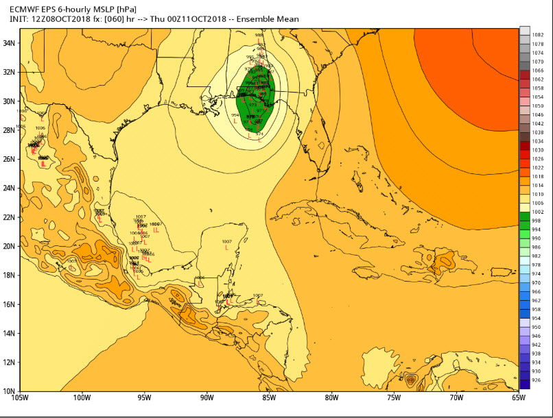
I do think a faster storm stays further west longer. A slower storm will turn further east.
GFS
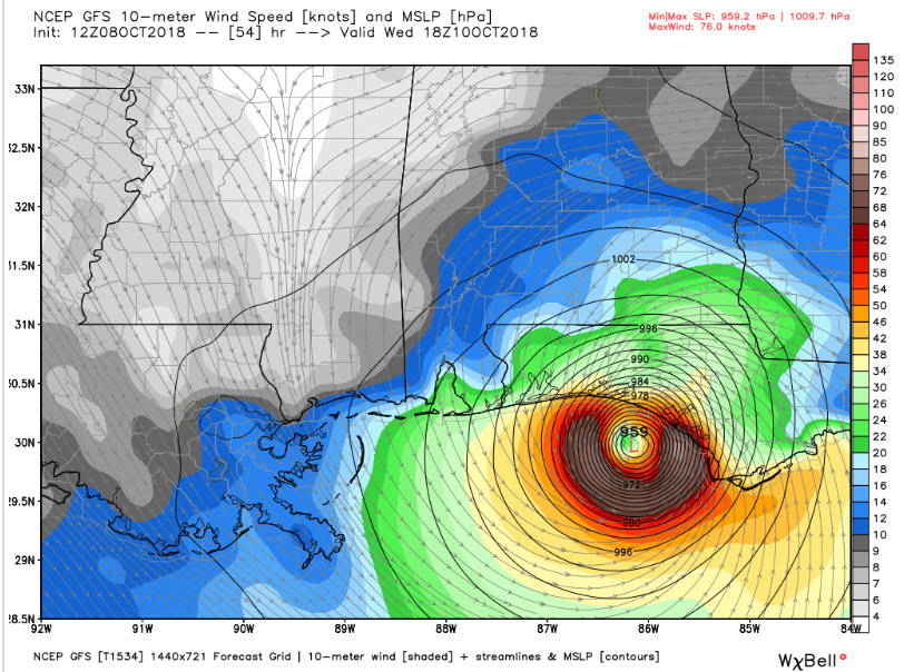
The GFS shows a 955 mb hurricane with top winds of 95 mph making landfall mid-afternoon Wednesday between Destin and Panama City.
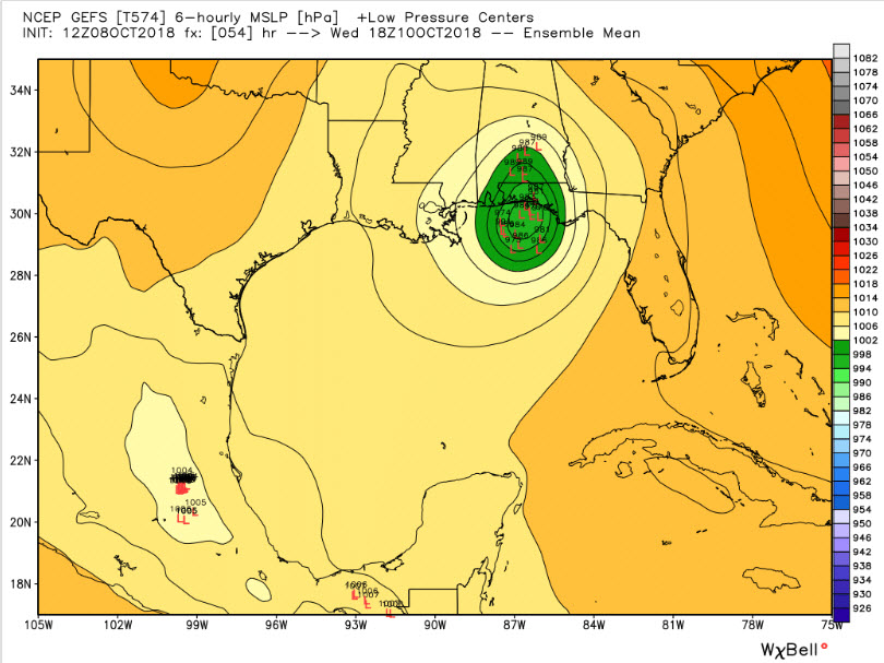
Here are the GFS Ensemble Members:
NEW EXPERIMENTAL GFS
This model has consistently predicted that the hurricane would come inland on the middle of the Florida Panhandle, perhaps near Destin, with a more northerly track into East Alabama. While this seems unlikely given the other model data, if it were right, there would be even more significant power outages further north and a greater impact on Alabama.
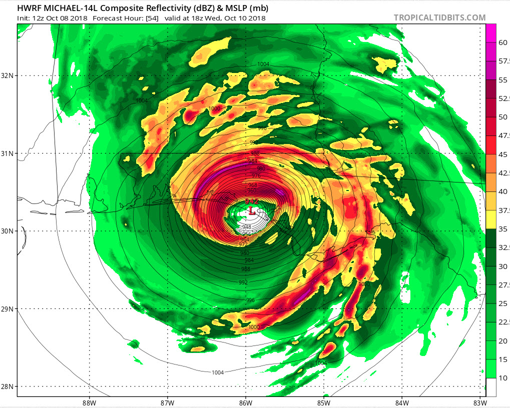
HWRF
The HWRF shows a 942 mb hurricane making landfall just west of Panama City around noon on Wednesday.
So, all in all, you can find a model solution that bring the center of Michael on almost every part of the coast with a wide range of intensities. They are all just potential solutions that we have yet to put all our stock in just yet.
The new advisory package is out and hurricane and storm surge warnings have been issued. Stand by for further updates.
About the Author (Author Profile)
Bill Murray is the President of The Weather Factory. He is the site's official weather historian and a weekend forecaster. He also anchors the site's severe weather coverage. Bill Murray is the proud holder of National Weather Association Digital Seal #0001 @wxhistorianSubscribe
If you enjoyed this article, subscribe to receive more just like it.


