Michael Continues To Be A Dangerous Hurricane While Losing Wind Strength
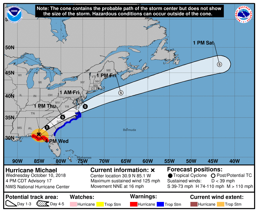
LOCATION…30.9N 85.1W
ABOUT 30 MILES W OF BAINBRIDGE, GEORGIA
ABOUT 70 MILES SW OF ALBANY, GEORGIA
MAXIMUM SUSTAINED WINDS: 125 MPH
PRESENT MOVEMENT: NNE AT 16 MPH
MINIMUM CENTRAL PRESSURE: 932 MB
Plenty of damage reports are coming in across the NWS Chat, ABC 33/40, and social media feeds from the Florida Panhandle, especially from Panama City and Mexico Beach.
These Tweets are from a friend of mine from Mississippi State, Alex Forbes, who is currently down in Marianna, Florida…
#Marianna #Michael pic.twitter.com/qbHXWBGehV
— Alex Forbes (@AForbesWx) October 10, 2018
#Marianna #Michael pic.twitter.com/80roMKrZb6
— Alex Forbes (@AForbesWx) October 10, 2018
#Marianna #Michael pic.twitter.com/UlJU7FN88t
— Alex Forbes (@AForbesWx) October 10, 2018
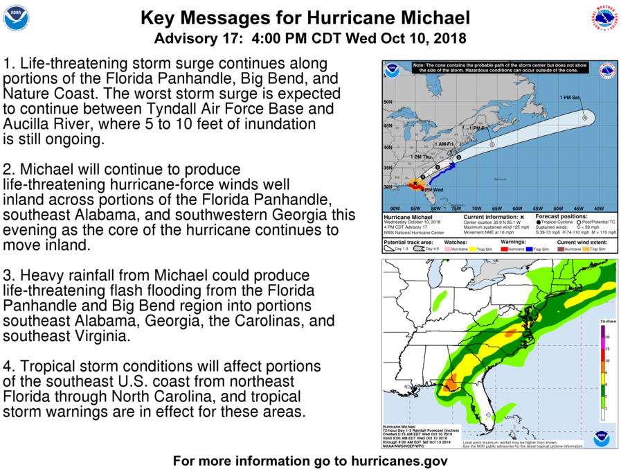
Key Messages From The NHC
1. Life-threatening storm surge continues along portions of the Florida Panhandle, Big Bend, and Nature Coast. The worst storm surge is expected to continue between Tyndall Air Force Base and Aucilla River, where 5 to 10 feet of inundation is still ongoing.
2. Michael will continue to produce life-threatening hurricane-force winds well inland across portions of the Florida Panhandle, southeast Alabama, and southwestern Georgia this evening as the core of the hurricane continues to move inland.
3. Heavy rainfall from Michael could produce life-threatening flash flooding from the Florida Panhandle and Big Bend region into portions southeast Alabama, Georgia, the Carolinas, and southeast Virginia.
4. Tropical storm conditions will affect portions of the southeast U.S. coast from northeast Florida through North Carolina, and tropical storm warnings are in effect for these areas.
About the Author (Author Profile)
Scott Martin is an operational meteorologist, professional graphic artist, musician, husband, and father. Not only is Scott a member of the National Weather Association, but he is also the Central Alabama Chapter of the NWA president. Scott is also the co-founder of Racecast Weather, which provides forecasts for many racing series across the USA. He also supplies forecasts for the BassMaster Elite Series events including the BassMaster Classic.Subscribe
If you enjoyed this article, subscribe to receive more just like it.


