Updated Look At This Morning’s Alabama Weather Situation
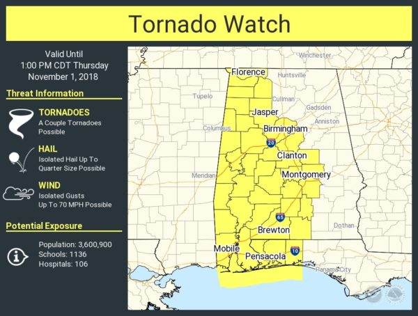
A line of storms will sweep through Alabama this morning. There is very little instability over the northern half of the state, and not much lightning associated with the line. But, there is a high amount of directional shear, and there is the risk of a few small, short lived “spin up” tornadoes. Accordingly, a tornado watch is in effect for the western half of the state through midday…
The main issue will come from gusty winds within the line as it passes through; winds will be in the 20-40 mph range for most places, under classic severe limits (winds must be 58 mph or higher for a storm to be considered severe).
TIMELINE: The heavier part of the line should be in the Tuscaloosa area by 8:30 a.m…. Birmingham by 9:30 a.m… and Anniston/Gadsden by 10:30-11:00 a.m. Then, it sweeps into Georgia this afternoon.
BOTTOM LINE: This is not a major severe weather threat, but a few tornadoes warnings could be issued if a good radar signature pops up. Understand these “spin ups” won’t last long, and are warning for them is a challenge. Just pay attention to any warnings that are issued this morning; should we have a tornado warning we will be live on ABC 33/40, and of course, the information will be posted here on the blog.
Category: Alabama's Weather, Severe Weather
About the Author (Author Profile)
James Spann is one of the most recognized and trusted television meteorologists in the industry. He holds the AMS CCM designation and television seals from the AMS and NWA. He is a past winner of the Broadcast Meteorologist of the Year from both professional organizations.Subscribe
If you enjoyed this article, subscribe to receive more just like it.


