12z Model Data Is In, Forecast For Severe Weather Still Projected
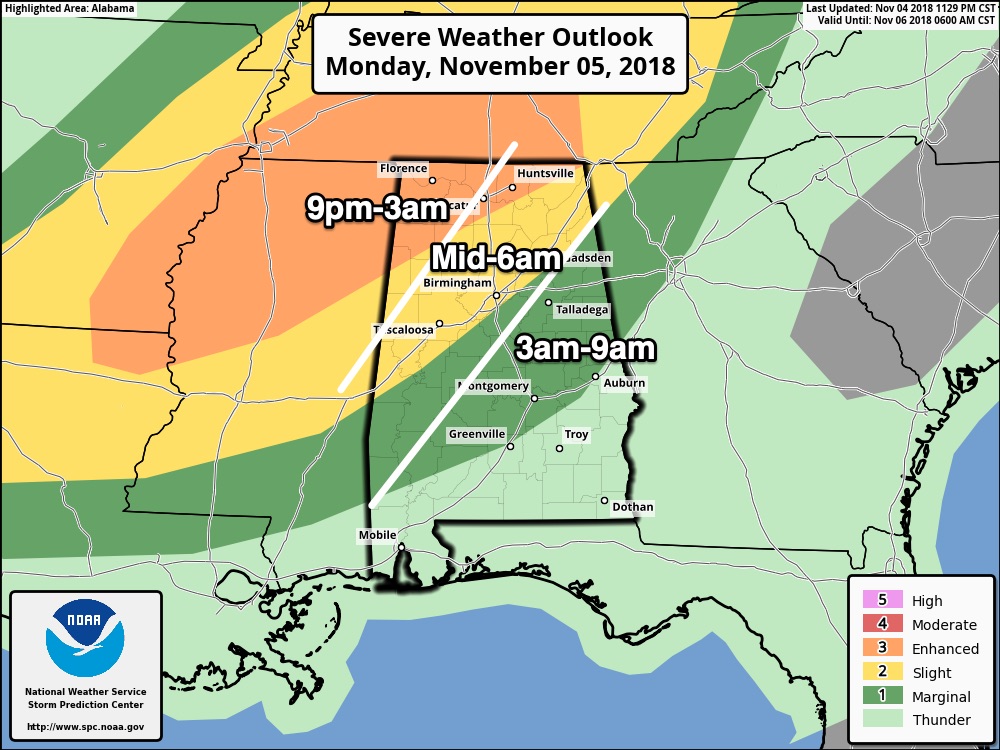
Looks like the timing for strong to severe storms continues to be in the 9:00 PM tonight through 9:00 AM Tuesday. The main squall line should enter the northwestern corner of the state roughly around midnight, but we need to watch for supercells that may form out ahead of the line. Here are the latest severe weather parameters from the 12z run of the high-resolution NAM…
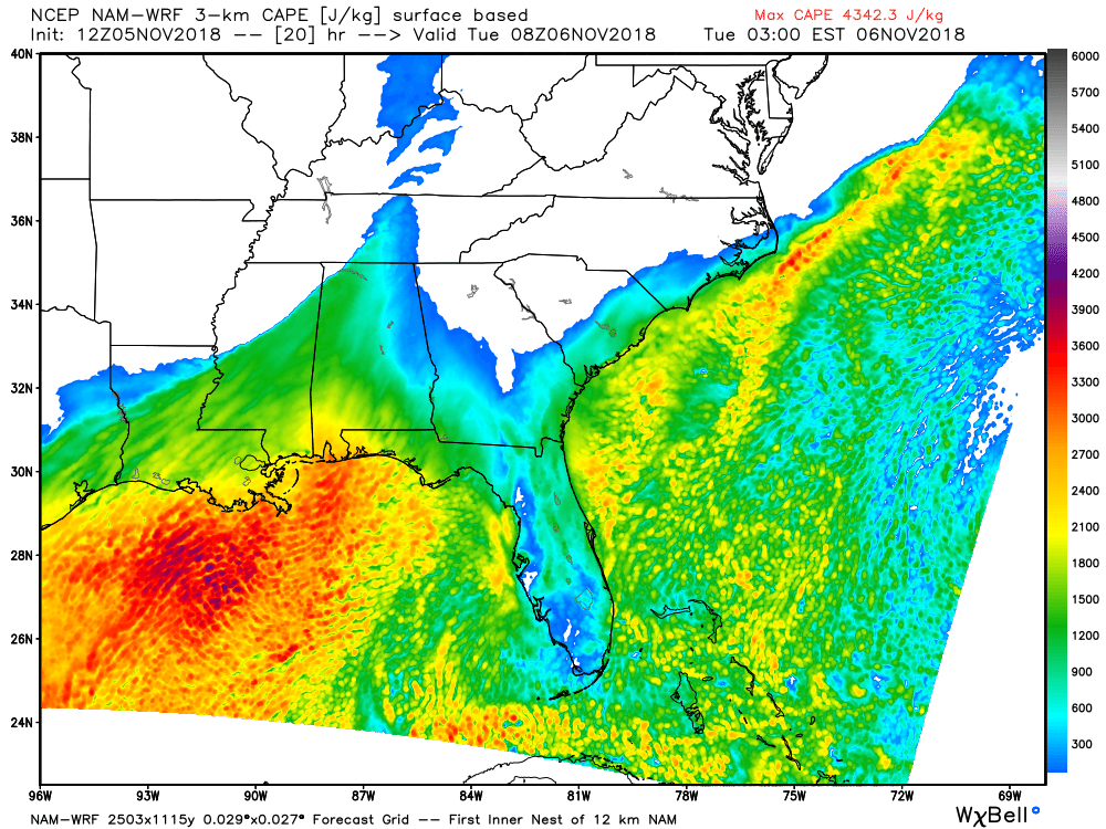
Surface-based instability values (CAPE) will be in the 1200-1800 J/kg range across the western portions of the area at roughly 2:00 AM Thursday. This appears to be when conditions for the state will be the most conducive for severe weather. All of the following model images are valid at 2:00 AM Thursday. The good news is that all of the severe parameters start to decrease after 2:00 AM.
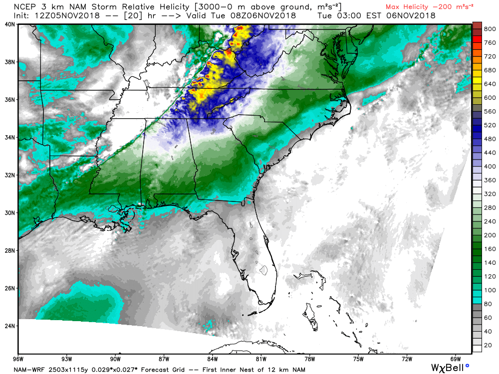
While the Storm Relative Helicity values will be highest up into Tennessee at this time, we still have more than ample shear across Alabama to support rotating updrafts.
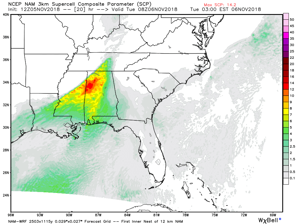
The Supercell Composite Parameter shows the likelihood of supercellular thunderstorms. As you can see, we’ll have values of 10 and above, which means supercells will be likely.
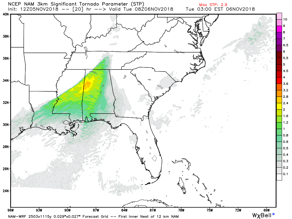
And finally we have the Significant Tornado Parameter (STP) showing values ranging from 1.0 to 3.2. This shows that we do have the possibility of a few tornadoes that may develop could be rather strong.
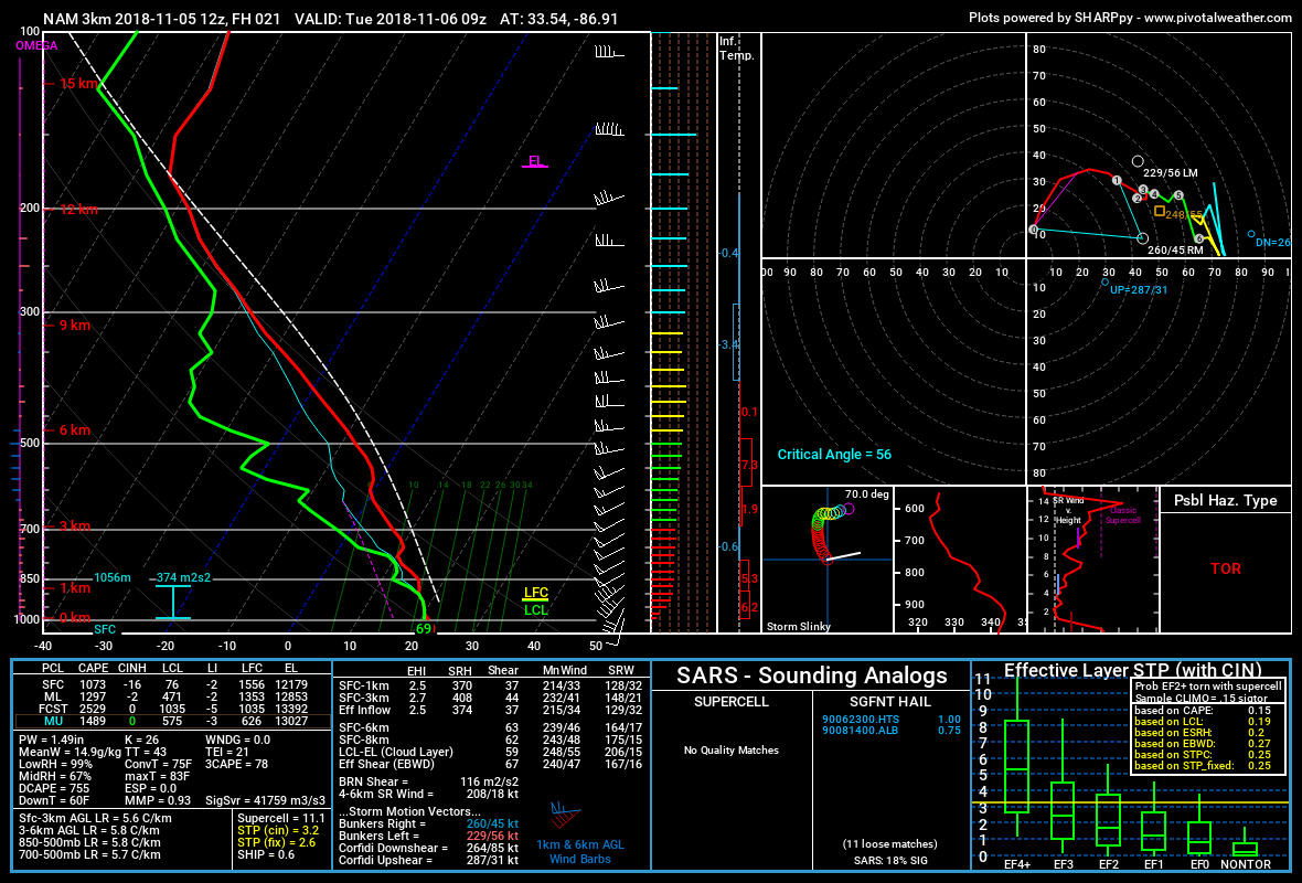
This is the projected sounding from the high-resolution NAM for the Birmingham Metropolitan Area valid at 3:00 AM Tuesday. This shows that the atmosphere will be conducive for severe storms with the possibility of a tornado. The STP on this sounding is up to 3.2 and instability values are over 1,000 J/kg. This also shows that there is still plenty of shear available, but the good news is that the surface winds are not backed out of the southeast at this time.
Remember, we don’t share this information to scare anyone, but to simply get you prepared. Have your severe weather safety plan ready to go and have your safety supplies in your place of safety. Go ahead and keep those smartphones charged up and download the ABC 33/40 app so you can watch live tornado coverage if you have to be in your safe room. Make sure you have fresh batteries in your NOAA WeatherRadio and in your flashlights. If you do not have a NOAA WeatherRadio, now is the perfect time to grab one.
We’ll have updates on the blog throughout the day.
Category: Alabama's Weather, ALL POSTS
About the Author (Author Profile)
Scott Martin is an operational meteorologist, professional graphic artist, musician, husband, and father. Not only is Scott a member of the National Weather Association, but he is also the Central Alabama Chapter of the NWA president. Scott is also the co-founder of Racecast Weather, which provides forecasts for many racing series across the USA. He also supplies forecasts for the BassMaster Elite Series events including the BassMaster Classic.Subscribe
If you enjoyed this article, subscribe to receive more just like it.


