Tornado Threat Increasing To Our West, Showers Forming Across Parts Of Central Alabama

TORNADO THREAT INCREASING TO OUR WEST:
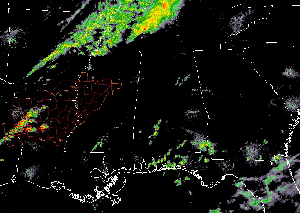
A Tornado Watch has been issued for parts of eastern Texas, parts of southeastern Arkansas, the northern half of Louisiana, and parts of eastern Mississippi until 11:00 pm CST tonight.
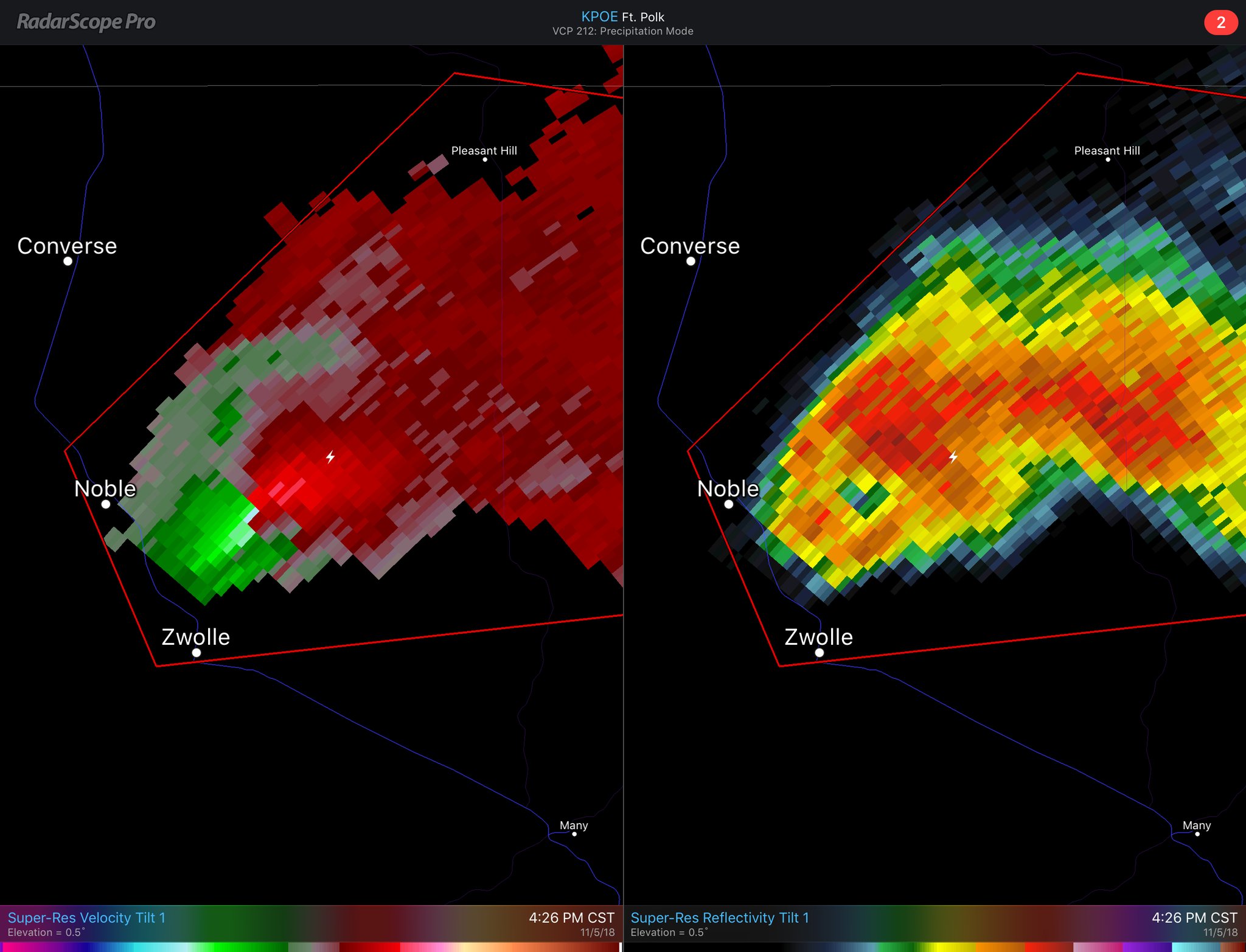
A few tornado warnings have already been issued in the eastern parts of Louisiana, one of which was located around Noble and Zwolle in Sabine Parrish around 4:25 pm. More supercellular thunderstorms are forming over parts of northwestern Louisiana and into eastern Texas.
This is the type of development that we could see later tonight as the system moves closer and more moist and unstable air is advected into North and Central Alabama from the south.
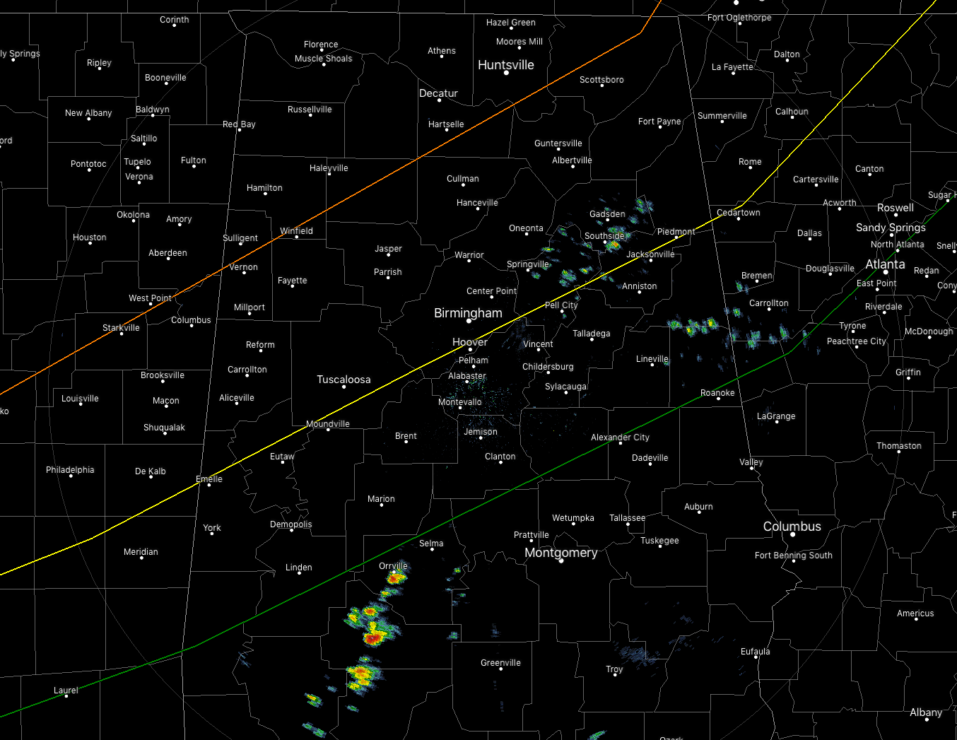
A few showers have developed in the southwestern parts of Central Alabama and are moving to the north-northeast at 25-30 MPH. A few other light showers have popped up over the eastern parts of the area. No severe threat across the state at the moment, but that will come later tonight.
The main window for severe storms across the area will be from 11:00 pm through 9:00 am Tuesday morning. Areas west of a line from Millport (Lamar Co.) to Eva (Morgan Co.) to Stevenson (Jackson Co.) will see the main threat from 11:00 pm to 3:00 am. Areas extended as far east as Cuba (Sumter Co.) to Pelham Shelby Co.) to Piedmont (Calhoun Co.) will see the main threat from 2:00 am to 6:00 am. Areas east of that will see the main threat from 5:00 am to 9:00 am.
We are nearly to the point where we just have to wait and see what happens as the next runs of the larger models won’t be out for a while yet. The HRRR updates every hour and it continues to show STP values as high as 2.0-3.0 over much of the area throughout the event. Instability and helicity values will continue to increase throughout the evening and into the overnight hours and will be at the highest along and just ahead of the line. Those values are well more than sufficient for damaging winds and rotating updrafts. Some hail is possible as well, but not as high of a threat as the damaging winds and tornadoes.
DELAYS/CLOSURES:
A few school systems and businesses have decided to delay the start of their day a few hours on Tuesday morning from the threat of severe storms…
Clastran – Tuscaloosa City Schools – Delayed 2 hours
Cullman City Schools – Delayed 2 hours
Cullman County Schools – Delayed 2 hours
Holy Spirit Catholic School – Delayed 2 hours
Jefferson County Schools – Delayed 2 hours
Pickens County Schools – Delayed 2 hours
Tuscaloosa Christian School – Delayed 2 hours
Tuscaloosa City Schools – Delayed 2 hours
Tuscaloosa County Schools – Delayed 2 hours
Tuscaloosa Public Library – Morning staff arrives at 10:00 am
Wallace State Community College – Opening at 9:30 am
Keep checking back on ABC 33/40s Closings page for the latest updates on school, business, and church closings due to the weather.
We’ll have updates through the evening and into the early morning hours on the blog.
Category: Alabama's Weather, ALL POSTS
About the Author (Author Profile)
Scott Martin is an operational meteorologist, professional graphic artist, musician, husband, and father. Not only is Scott a member of the National Weather Association, but he is also the Central Alabama Chapter of the NWA president. Scott is also the co-founder of Racecast Weather, which provides forecasts for many racing series across the USA. He also supplies forecasts for the BassMaster Elite Series events including the BassMaster Classic.Subscribe
If you enjoyed this article, subscribe to receive more just like it.


