A Few Showers For Central AL; New Tornado Watch Issued For TN & MS
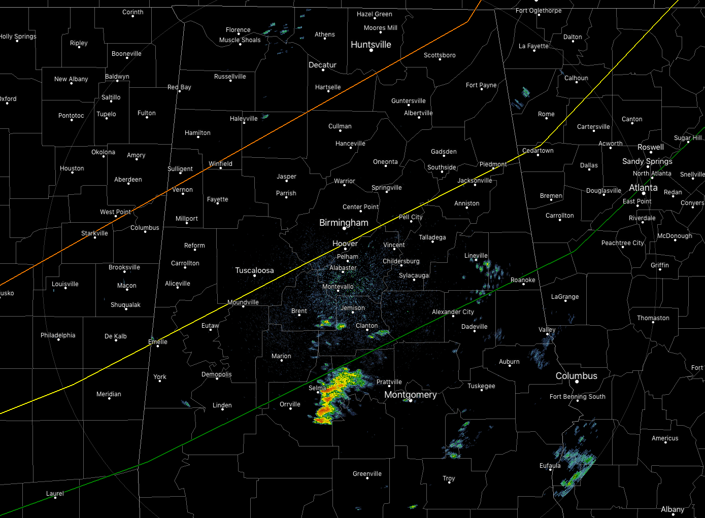
Much of North and Central Alabama is free from any rainfall as we make the approach to the 7:00 pm hour. We do have some shower activity in the south-central and the southeastern parts of the area, but none of these contain any lightning. No severe weather is expected across the area until after 10:00 pm tonight.
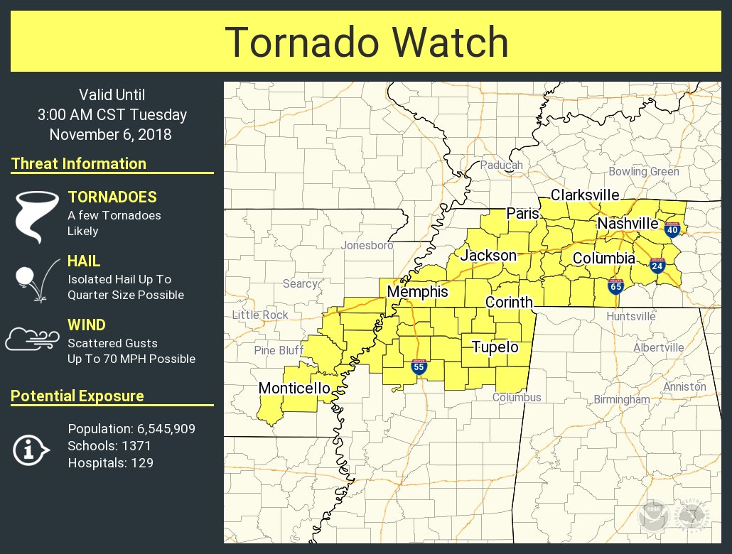
A new Tornado Watch was just issued for the extreme eastern Arkansas, extreme northern Mississippi, and much of the western half of Tennessee until 3:00 AM Tuesday morning.
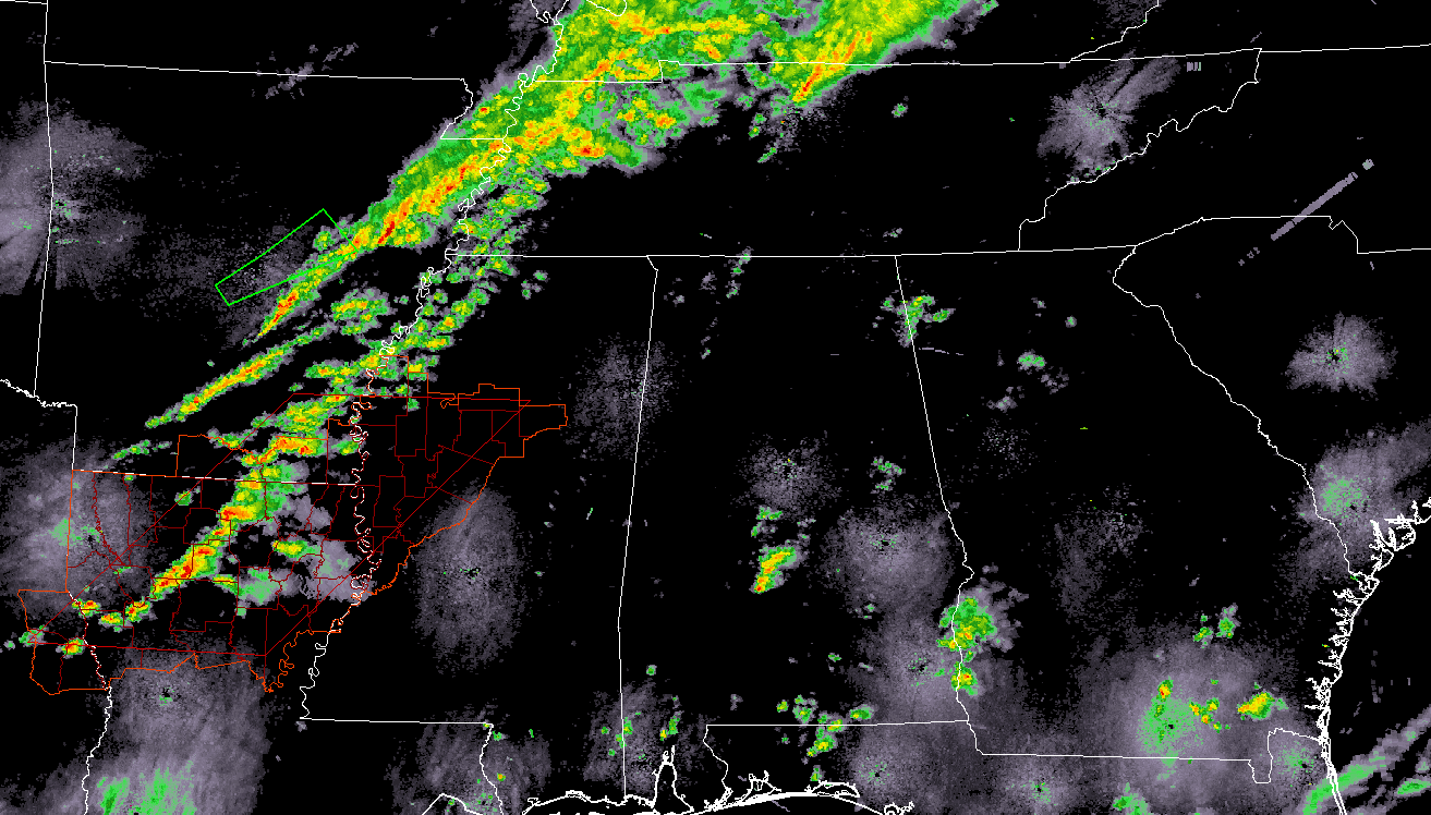
The line of storms is still well off to our west over the extreme northwestern parts of Mississippi and the north-central parts of Louisiana. At this point, no severe warnings are in effect, but a Tornado Watch continues for extreme southeastern Arkansas, northern Louisiana, west-central Mississippi, and extreme east-central Texas until 11:00 pm CST.
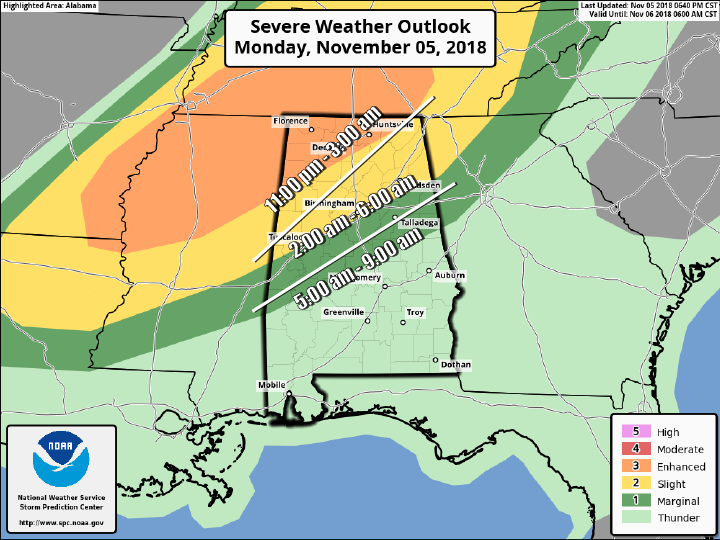
Timing for the strong to severe storms will be from 11:00 pm to 9:00 am. The main threats continue to be damaging winds up to 70 MPH, a few tornadoes, some of which could be strong, long-track in nature, and a much lesser threat of hail. The higher risk for tornadoes will be over the northwestern parts of the state, but a tornado or two can’t be ruled out as far south as I-20.
We’ll keep you updated through the remainder of the night and through the pre-dawn hours on the blog.
Category: Alabama's Weather, ALL POSTS
About the Author (Author Profile)
Scott Martin is an operational meteorologist, professional graphic artist, musician, husband, and father. Not only is Scott a member of the National Weather Association, but he is also the Central Alabama Chapter of the NWA president. Scott is also the co-founder of Racecast Weather, which provides forecasts for many racing series across the USA. He also supplies forecasts for the BassMaster Elite Series events including the BassMaster Classic.Subscribe
If you enjoyed this article, subscribe to receive more just like it.


