Severe Storm Threat Increasing In South Alabama, Just A Cold Rain For North/Central Alabama
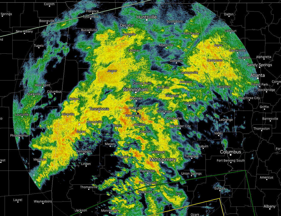
Moderate and a little heavier rainfall continues to fall over a good portion of North and Central Alabama as we make the run-up to the noon hour. The heaviest rainfall at this point is currently along and around the I-59/20 corridor in western parts of the area, and stretching south into portions of Bibb, Chilton, Autauga, and Lowndes counties. All of the activity continues to push off to the northeast at 45 to 50 MPH.
Already have images coming in of flooding occurring at 8th Street South and University Boulevard in Birmingham. Usual poor drainage areas will be the most likely points of localized ponding or flash flooding, but there is no widespread threat of flooding across Central Alabama.
WORD OF CAUTION: If you have to be out on the roadways while rain is falling, please be sure to slow down, do not use your cruise control, and stay well behind the car in front of you. Alabama State Troopers are working numerous crashed across Central Alabama due to the rainfall. One crash is still being worked on I-20 west at the I-459 interchange which resulted in one fatality and one injury. The crash scene is still under investigation. Remember, hydroplaning at any speed but you are at a higher risk the faster you go.
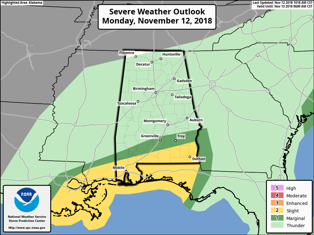
The threat of strong to severe thunderstorms persists across the extreme southern portions of the state as a warm front continues to work northward from the Gulf Coast into the state. Supercell thunderstorms have been developing throughout the morning out over the Gulf, some of which had tornado warnings issued on them for rotation. The threat for damaging winds and a few tornadoes will continue as the atmosphere continues to destabilize along and south of the warm front.
The Slight Risk (level 2 of 5) includes locations south of a line from Citronelle to Dozier to Blue Springs. The Marginal Risk (level 1 of 5) includes the area north of the slight risk stretching as far as Jackson (Greene Co.) to Pine Apple (Wilcox Co.) to Fort Deposit (Lowndes Co.) to just south of Hurtsboro (Russell Co.).
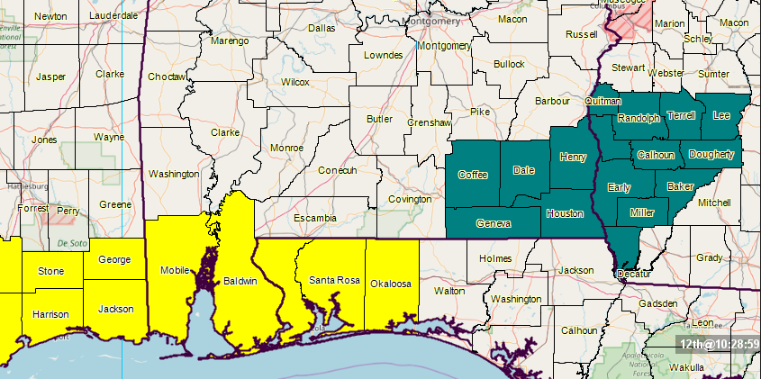
A Tornado Watch continues for Mobile and Baldwin counties until 12:00 pm CST. A Flash Flood Watch continues for Coffee, Dale, Henry, Houston, and Geneva counties until 6:00 pm CST Tuesday.
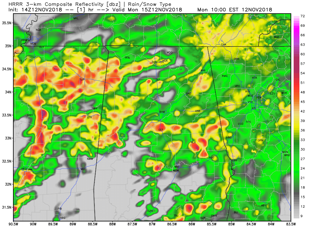
The latest HRRR model run continues to show the rainfall coming to an end in Tuscaloosa in the 4:00-5:00 pm window, coming to an end in the Birmingham area by 5:00-6:00 pm, and out of the Gadsden/Anniston area by 7:00-8:00 pm time frame. We’ll have a break from a little while during the late night before more rain moves in from the west during the overnight hours. We’re still looking at rainfall totals throughout the area around 1.50-2.50 inches.
Category: Alabama's Weather, ALL POSTS
About the Author (Author Profile)
Scott Martin is an operational meteorologist, professional graphic artist, musician, husband, and father. Not only is Scott a member of the National Weather Association, but he is also the Central Alabama Chapter of the NWA president. Scott is also the co-founder of Racecast Weather, which provides forecasts for many racing series across the USA. He also supplies forecasts for the BassMaster Elite Series events including the BassMaster Classic.Subscribe
If you enjoyed this article, subscribe to receive more just like it.


