New Tornado Watch Issued For South Alabama Until 7:00 PM CST
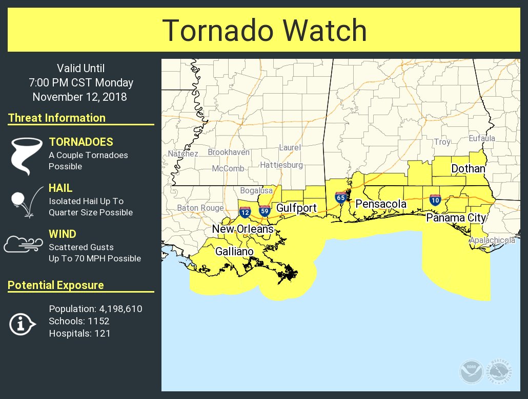
The Storm Prediction Center in coordination with NWS Mobile and NWS Tallahassee has issues a new tornado watch for Baldwin, Coffee, Covington, Dale, Escambia, Geneva, Henry, Houston, and Mobile counties until 7:00 pm CST this evening.
As I mentioned in an earlier post, conditions were continuing to destabilize along and south of a warm front. The main threat will be from damaging wind gusts, but the tornado risk is starting to increase in the extreme southern parts of the state.
Here is the text of the new watch from the SPC:
URGENT – IMMEDIATE BROADCAST REQUESTED
Tornado Watch Number 427
NWS Storm Prediction Center Norman OK
1245 PM EST Mon Nov 12 2018
The NWS Storm Prediction Center has issued a
* Tornado Watch for portions of
Southern Alabama
Western Florida Panhandle
Southeast Louisiana
Southern Mississippi
Coastal Waters
* Effective this Monday afternoon and evening from 1245 PM until
800 PM EST.
* Primary threats include…
A couple tornadoes possible
Scattered damaging wind gusts to 70 mph possible
SUMMARY…Thunderstorms will continue to affect the watch area
through the afternoon and early evening. The strongest cells will
be capable of locally damaging wind gusts and isolated tornadoes.
The tornado watch area is approximately along and 60 statute miles
north and south of a line from 10 miles south southeast of Marianna
FL to 35 miles south southwest of New Orleans LA. For a complete
depiction of the watch see the associated watch outline update
(WOUS64 KWNS WOU7).
PRECAUTIONARY/PREPAREDNESS ACTIONS…
REMEMBER…A Tornado Watch means conditions are favorable for
tornadoes and severe thunderstorms in and close to the watch
area. Persons in these areas should be on the lookout for
threatening weather conditions and listen for later statements
and possible warnings.
Category: Alabama's Weather, ALL POSTS
About the Author (Author Profile)
Scott Martin is an operational meteorologist, professional graphic artist, musician, husband, and father. Not only is Scott a member of the National Weather Association, but he is also the Central Alabama Chapter of the NWA president. Scott is also the co-founder of Racecast Weather, which provides forecasts for many racing series across the USA. He also supplies forecasts for the BassMaster Elite Series events including the BassMaster Classic.Subscribe
If you enjoyed this article, subscribe to receive more just like it.


