Potential For Strong/Severe Storms On Saturday
An active system that will be bringing a threat of tornadoes, damaging winds, and some hail to parts of the south-central and the western parts of the southeastern states throughout the day today will invade Central Alabama on Saturday.
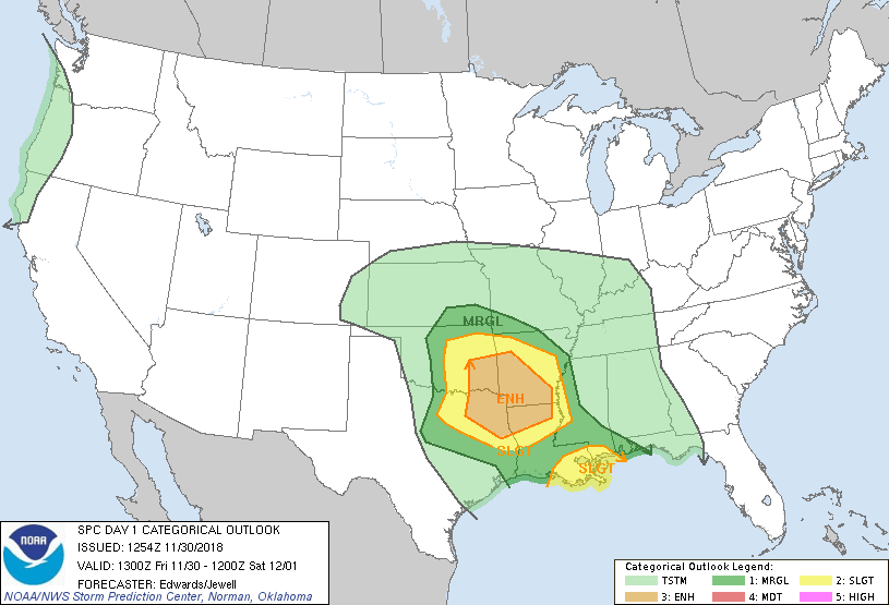
As you can see from the Day One Outlook from the Storm Prediction Center valid today through 6:00 am CST Saturday, there is an Enhanced Risk for severe storms located over the ArkLaTex area and into the southeastern corner of Oklahoma. A Slight Risk surrounds the Enhanced Risk area, with another Slight Risk area over the Lower Mississippi Delta.
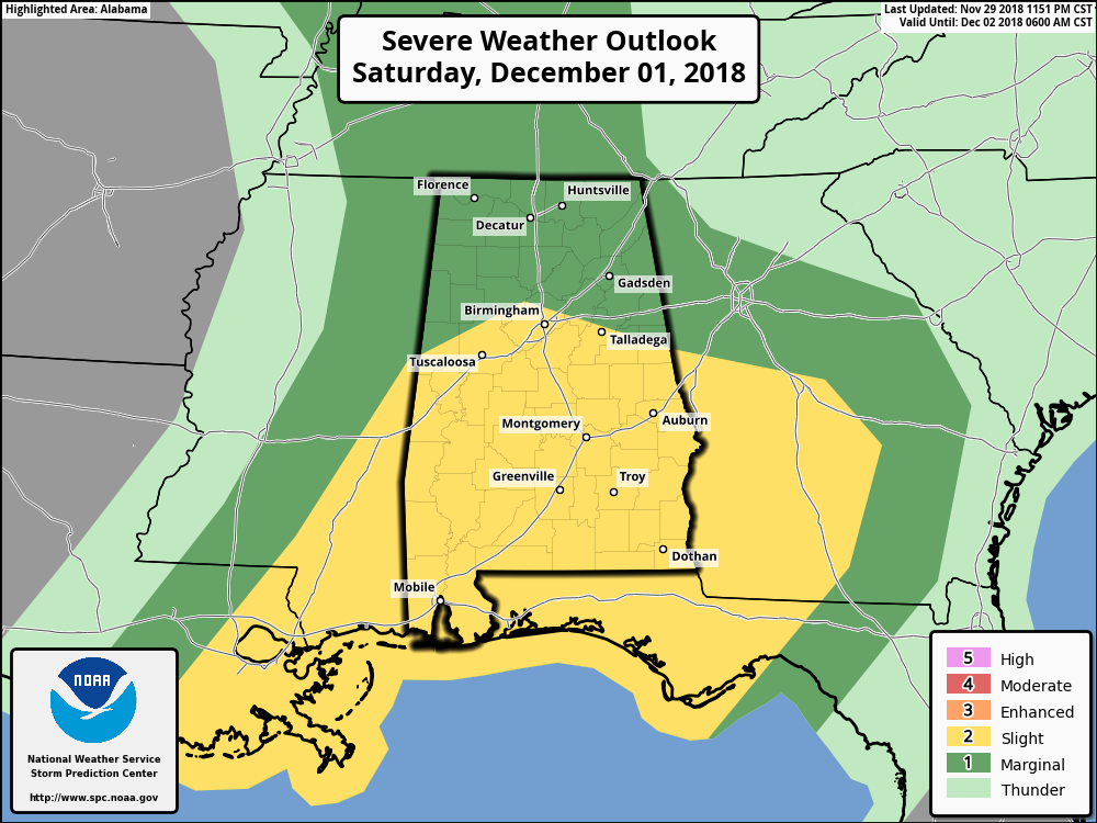
There has not been that much of a change of the outlook graphic for Saturday as the risk areas have pretty much remained the same. A Slight Risk for severe storms encapsulates much of the central and southern parts of Central Alabama, while a Marginal Risk includes the northern parts of the area.
Still the same story today as we have been posting over the past day or two, uncertainty still rules the forecast for Saturday. We are still expecting the possibility of a few strong to marginally severe storms with gusty winds being the main threat during the morning hours, but there will be convective activity along the Gulf Coast that could possibly cut the flow of instability off from reaching the area. Therefore, while there is a threat of severe storms from 6:00 am to 12:00 pm, the threat looks to be low at this point.
The big question is… Will the morning activity hamper the destabilization of the atmosphere for the afternoon and into the early evening hours?
After the noon hour, winds will continue to be backed out of the south-southeast, allowing the flow of moisture-rich air to be advected into the area from the gulf. We will have a good amount of shear available and surface based instability will begin to climb, especially south of the I-20 corridor. Significant Tornado Parameter values are not as impressive on this run (12z) as the 00z run, but we are still seeing 1.0-2.0 across the southern half of Central Alabama.
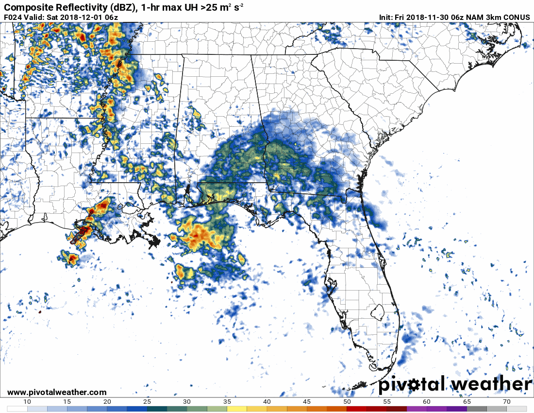
With all of that being said, the atmosphere will be ripe for the development of strong to severe storms with the threat of a couple isolated tornadoes, damaging winds, and some hail… BUT… The NAM continues to show no convective development at all throughout the afternoon and evening hours across Central Alabama, which means that it believes that the morning activity along with continued cloud cover will keep a cap in place.
BOTTOM LINE… We need to be prepared just in case storms do develop during the afternoon hours. Go ahead and have your severe weather action plan ready to go on Saturday just in case your location goes under a warning. If any storms do form, the potential is there for those to become strong to severe rather quickly.
Once again, the window of the morning storms will be from 6:00 am to 12:00 pm, but the main strong to severe thunderstorm threat will be from 12:00 pm to 6:00 pm.
Keep up-to-date with Saturday’s forecast and the threat of severe storms throughout the day on the AlabamaWx Weather Blog.
Category: Alabama's Weather, ALL POSTS
About the Author (Author Profile)
Scott Martin is an operational meteorologist, professional graphic artist, musician, husband, and father. Not only is Scott a member of the National Weather Association, but he is also the Central Alabama Chapter of the NWA president. Scott is also the co-founder of Racecast Weather, which provides forecasts for many racing series across the USA. He also supplies forecasts for the BassMaster Elite Series events including the BassMaster Classic.Subscribe
If you enjoyed this article, subscribe to receive more just like it.


