

Showers Continue Over The Northern Half Of Central Alabama Just After Midday
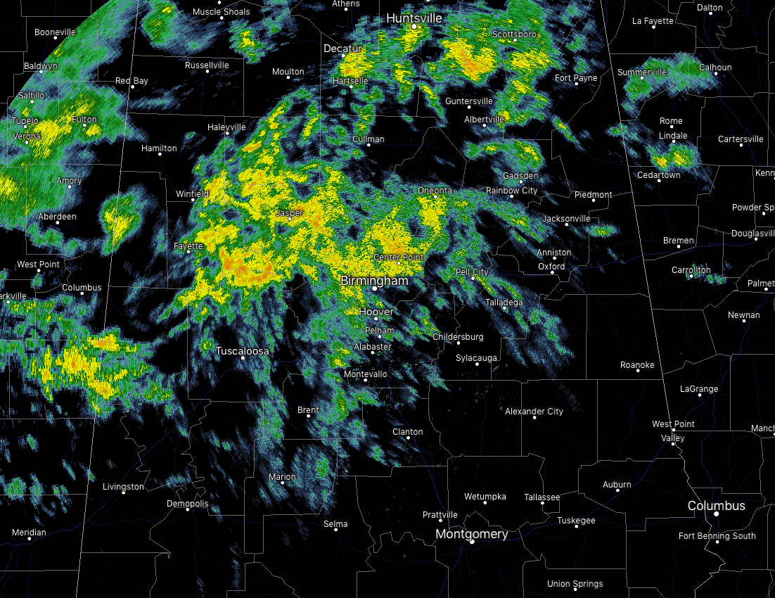
Well, I was trying to have my midday forecast out by 12:00 pm today, but it just wasn’t in the cards. After having to change a dead battery in my vehicle, I am finally able to do my now “Just After Midday” post. As of 1:50 pm, we have a good bit of light to moderate shower activity mainly north of the I-20 corridor while much of the southern portions of the area remain dry. What a big difference in temperatures as readings are in the lower 60s to the mid-70s across Central Alabama from north to south. The warm spot is Montgomery at 75 degrees while the cool spot was Cullman at 60 degrees. Birmingham was at 63 degrees.
We’ll continue to have mostly cloudy to completely overcast skies across the area for the rest of the afternoon and into the early evening hours, with rain likely north of the I-20 corridor and much lower chances south of that to the I-85 corridor. Afternoon highs will be in the mid-60s to the mid-70s. For tonight, Rain chances will greatly decrease across the area and most will remain dry for tonight’s high school football games. Isolated to scattered shower chances will be over the extreme northern parts of the area, while skies will be cloudy and dry for the rest. Kickoff temperatures will be in the upper 50s to the mid-60s and only dropping by a degree or two by the final whistle. Rain becomes likely after midnight across the area and lows will only drop into the lower 50s to the lower 60s.
QUICK UPDATE ON SATURDAY’S SEVERE THREAT: We are still waiting on the latest information to come out from the high-resolution models, but as of now, the story looks to remain mostly unchanged from the morning update. We still have the potential for strong to severe storms during the afternoon hours across parts of Central Alabama on the condition that the atmosphere doesn’t get worked over too much during the morning round of showers and storms. A few strong storms are possible during the 6:00 am to 12:00 pm time frame, but severe storms look to be unlikely.
The time frame for stronger to severe storms will be from 12:00 pm to 6:00 pm as more favorable conditions move into Central Alabama. Models continue to paint that all of the ingredients will be there for the potential of damaging winds and a couple tornadoes during the afternoon and evening, but there continues to be no convective development on the models during that time.
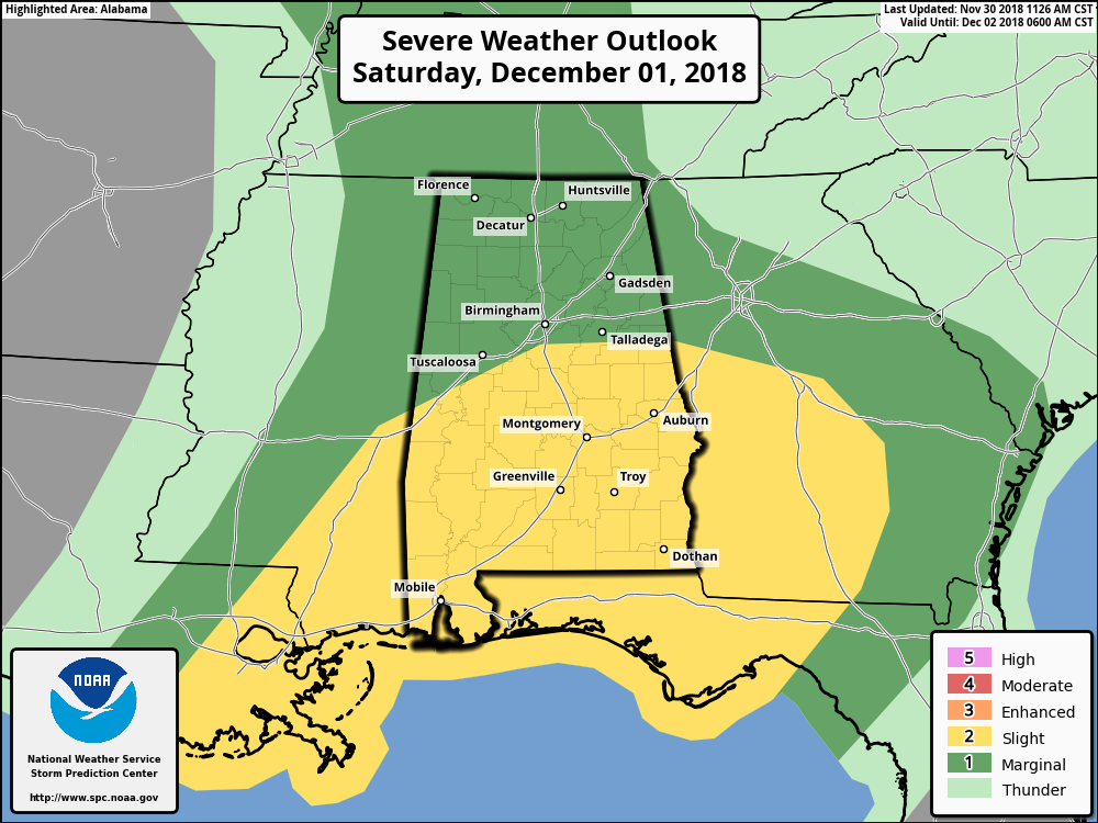
As of now, the severe threat is conditional due to the unknowns of the atmosphere at that time frame. We should have some better information by the time James Spann has his afternoon video released on the blog. We have noticed that the SPC has removed Birmingham and Tuscaloosa from the Slight Risk for severe storms on their Day Two Outlook graphic. Just be sure to have your severe weather action plan ready to go just in case your location goes under a warning.
Category: Alabama's Weather, ALL POSTS
About the Author (Author Profile)
Scott Martin is an operational meteorologist, professional graphic artist, musician, husband, and father. Not only is Scott a member of the National Weather Association, but he is also the Central Alabama Chapter of the NWA president. Scott is also the co-founder of Racecast Weather, which provides forecasts for many racing series across the USA. He also supplies forecasts for the BassMaster Elite Series events including the BassMaster Classic.Subscribe
If you enjoyed this article, subscribe to receive more just like it.


