No Thunder Currently Across Central Alabama, Conditional Severe Storm Threat Remains For This Afternoon
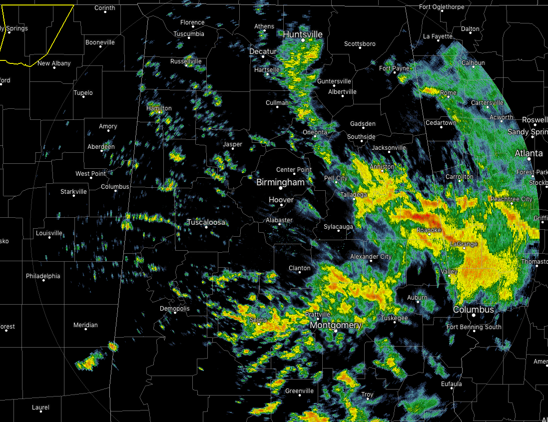
Radar at 9:10 AM shows the bulk of the rain activity over the east-central and the southeastern parts of Central Alabama, with spotty to scattered showers over the rest of the area. On this latest radar scan, I do not see any lightning at all, but a few of these showers are putting down some heavy rainfall. The heaviest cell is currently sitting over Wedowee and just north of Roanoke, and will soon be pushing off into Georgia. Much of the activity is moving to the northeast at 35-40 MPH.
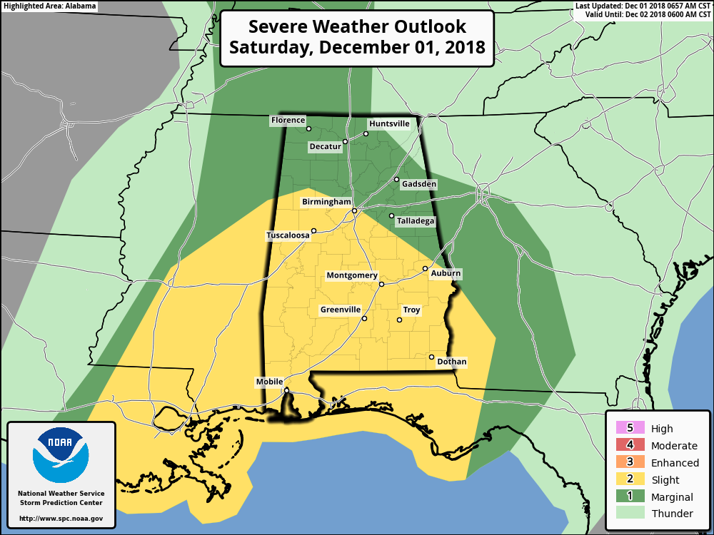
The latest updated Day One Severe Weather Outlook graphic from the Storm Prediction Center shows that the southern 2/3rds of Central Alabama is defined in a Slight Risk of severe storms throughout the day, while the northern 1/3rd of the area is in a Marginal Risk. We do note that the updated graphic now includes the cities of Tuscaloosa and Birmingham in the Slight Risk area.
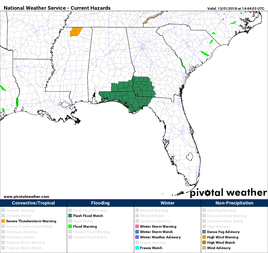
At this point, there are no severe weather watches in effect for anyone on the southeastern United States, but we do see that there is a Severe Thunderstorm warning in effect for several counties in North Mississippi until 9:30 am for the possibility of damaging wind gusts up to 60 MPH and quarter-size hail.
Models continue to show that conditions will be conducive for the potential of strong to severe thunderstorm development during the mid-afternoon and into the early evening hours. The latest full run of the HRRR continues to show robust values in the Significant Tornado Parameter, with numbers reaching as high as 5.3. Remember, any values over 1.0 means that supercells that form will have the potential of spawning significant tornadoes (EF2 and stronger). Values below 1.0 are usually associated with non-tornadic cells. The model run also shows higher instability values up to 2,500 J/kg and plenty of shear. So, the ingredients look to be likely for severe storm development.
BUT…
There will simply be no dynamic forcing to get the convection started over Central Alabama. The main dynamic support will have lifted well off to our northeast and the weakening and flattening cold front will not make it into the state until the late night and overnight hours. If we do have any storms that can break through the capping inversion, the potential is there for those cells to grow in intensity quickly.
This will be an afternoon where you will need your source of getting your severe weather information close by. Have your severe weather action plan ready to go and your NOAA WeatherRadio handy. This is a very tricky forecast due to the uncertainty that exists with the state of the atmosphere throughout the day. It is likely that we get no storm development at all this afternoon… but the threat is there for a few to develop.
We’ll continue to have updates throughout the day on the AlabamaWx Weather Blog.
Category: Alabama's Weather, ALL POSTS
About the Author (Author Profile)
Scott Martin is an operational meteorologist, professional graphic artist, musician, husband, and father. Not only is Scott a member of the National Weather Association, but he is also the Central Alabama Chapter of the NWA president. Scott is also the co-founder of Racecast Weather, which provides forecasts for many racing series across the USA. He also supplies forecasts for the BassMaster Elite Series events including the BassMaster Classic.Subscribe
If you enjoyed this article, subscribe to receive more just like it.


