Showers & Flurries Diminishing, Drier Air Moving In
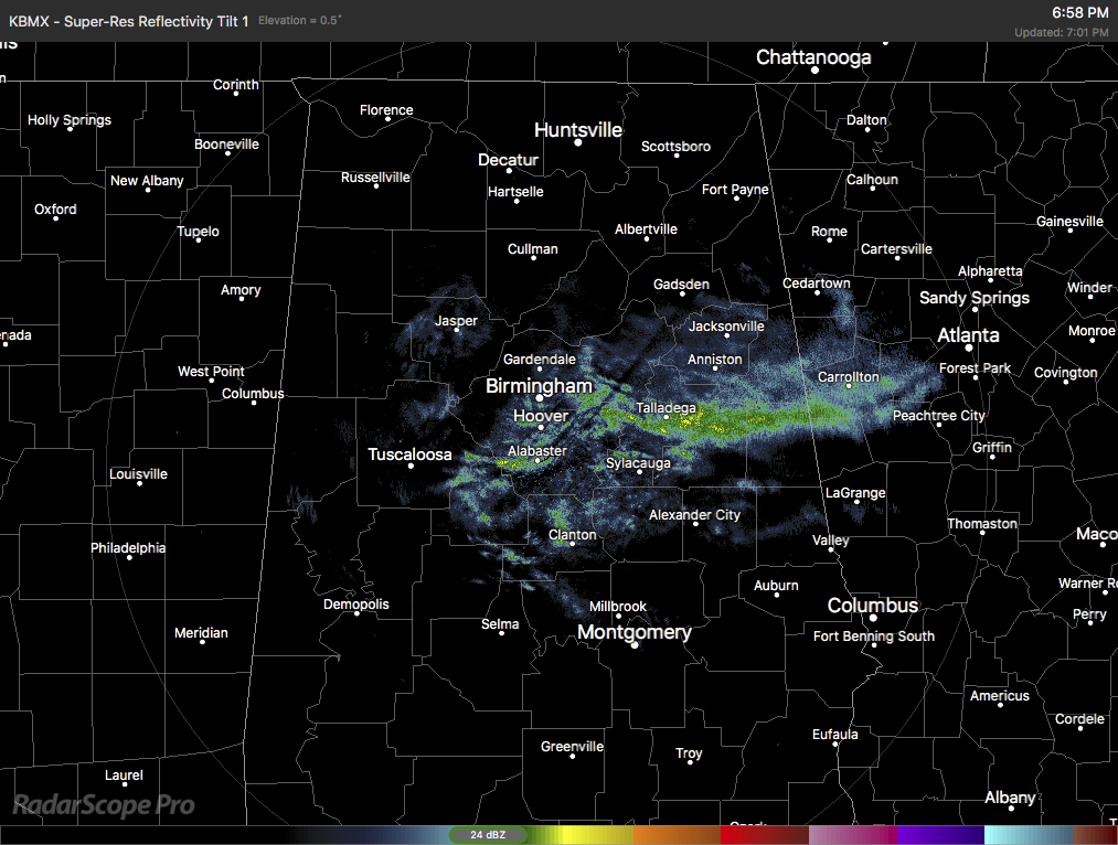
Light showers and a few flurries are now confined along and around the I-20 corridor east of I-65 as we approach the 7:00 pm hour in Central Alabama. Drier air is working into the area from the north and northwest and as that continues to happen, we’ll lose moisture from what is left of the precipitation and should dissipate and be out of the area by the next 2 hours or so.
Temperatures still look to stay above freezing through midnight until skies start clearing out. Once that starts, temperatures will drop into the lower 20s to the lower 30s across the area. With the drier air streaming into the area, we may have enough of a breeze from the pressure gradient that will help out in evaporating any leftover moisture from the roadways. No travel issues are expected tonight and through the overnight hours, there may be a few icy spots in areas where the wind is blocked or where water is slow to drain away.
The good news is that there will be plenty of sunshine to help melt whatever ice that may form rather quickly during the morning time, and temperatures will be above normal by the end of rush hour at 9:00 am. Afternoon highs on Tuesday will be in the upper 40s to the lower 50s.
Category: ALL POSTS
About the Author (Author Profile)
Scott Martin is an operational meteorologist, professional graphic artist, musician, husband, and father. Not only is Scott a member of the National Weather Association, but he is also the Central Alabama Chapter of the NWA president. Scott is also the co-founder of Racecast Weather, which provides forecasts for many racing series across the USA. He also supplies forecasts for the BassMaster Elite Series events including the BassMaster Classic.Subscribe
If you enjoyed this article, subscribe to receive more just like it.


