This Morning’s Freezing Fog Event
This was not a good morning for commuters in the Birmingham metro. Here is a look at the event, and some answers to questions I am hearing…
LAST NIGHT: Late last night, the sky was clearing, the air was drier, and moisture on most roads was evaporating. Still, the advice was to use caution early this morning while driving since poor drainage areas with standing water could become icy. But, widespread problems were not expected.
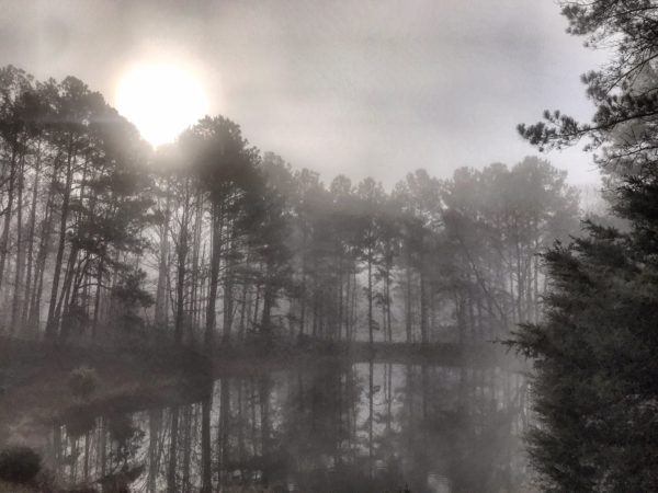
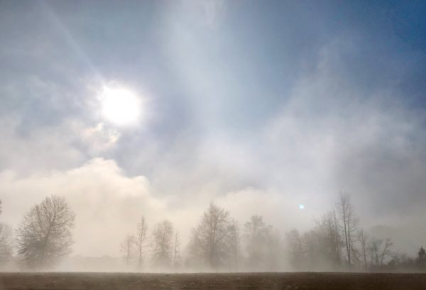
AFTER MIDNIGHT: Temperatures dropped quickly down to the dewpoint across Central Alabama, and with a clear sky, light wind, and very wet soil conditions, freezing fog started to form. And, it became very dense by 3:00-4:00 a.m. The freezing fog did us in; tiny, supercooled liquid water droplets in freezing fog can create a coating of thin ice instantly on exposed surfaces like bridges and overpasses. Without the fog, most would not have had any problems this morning.
WHAT IS FREEZING FOG? No, this is nothing new. Simple definition is fog that forms with surface temperatures below 32 degrees (F). Much like freezing rain is simply rain that falls in liquid form when the temperature is at or below freezing.
WHAT KIND OF ICE FORMS DURING FREEZING FOG? We had lots of great images of ice that formed on exposed objects this morning…
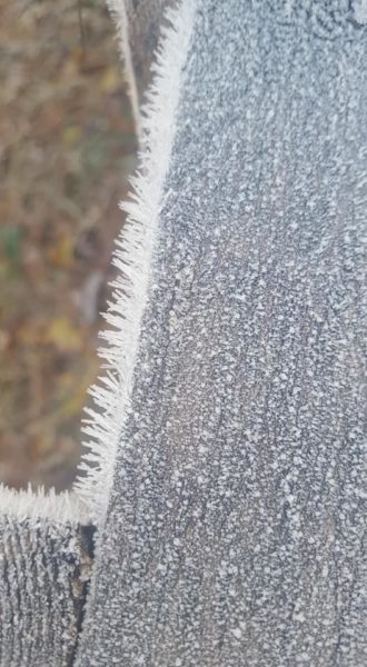
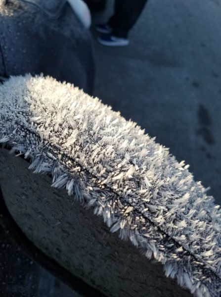
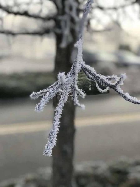
This is rime ice, which forms when supercooled water droplets freeze on contact and accumulate on the windward side of sub-freezing objects like a tree branch. This is not hoar frost, which tends to develop on clear calm nights in the absence of fog.
WAS IT SNOWING THIS MORNING? No. But, many noticed suspended and slowly sinking ice crystals because of the freezing fog, which looked like snow. Snow forms such higher, and by a difference process in the “dendritic growth zone”, which is usually around 15,000-20,000 feet off the ground.
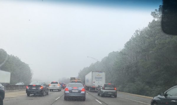
IMPACT: The freezing fog brought a huge impact to the Birmingham metro this morning, with dozens of crashes, some with injuries, across the Birmingham metro. The ice was mostly confined to bridges, but some black top roads accumulated ice across higher terrain.

WHO NO ROAD PREPARATION? A freezing fog advisory was issued by NWS Birmingham this morning at 3:00 a.m. for six counties in Northwest Alabama, and was expanded to include most of North/Central Alabama at 4:00 a.m. This simply didn’t get ALDOT or other government agencies time to get roads sanded in advance. Fog was much more widespread and dense than expected last night. Yes, we expected isolated issues, but nothing as widespread as what happened.
TAKEAWAY: Freezing fog can bring serious icing problems to bridges and overpasses on cold mornings in Alabama!
Category: Alabama's Weather
About the Author (Author Profile)
James Spann is one of the most recognized and trusted television meteorologists in the industry. He holds the AMS CCM designation and television seals from the AMS and NWA. He is a past winner of the Broadcast Meteorologist of the Year from both professional organizations.Subscribe
If you enjoyed this article, subscribe to receive more just like it.


