Wispy High Clouds Filtering The Sunshine At Midday
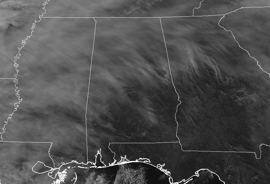
AT 11:30 AM: While some in the southern and eastern parts are seeing some of the sun’s rays reaching the surface at midday, these pesky high clouds are keeping the rest of Central Alabama from enjoying the brighter and a little warmer atmosphere. Temperatures across the area are coming in with mid-40s to 50 degrees north of I-20, with lower to mid-50s south of that. Birmingham and Tuscaloosa were both at 50 degrees while Gadsden was the cool spot at 45 degrees. Dannelly Field in Montgomery is the “balmy” spot at 55 degrees.
WEATHER FOR THE REST OF YOUR “HUMP DAY”: We will stay dry through the rest of the day across Central Alabama as our next rain-making system is in the process of forming out to our west. We’ll continue to have high clouds across the skies for the daylight hours and afternoon highs should reach the mid-50s to just at 60 degrees from north to south across the area. Clouds will increase throughout the evening and overnight hours, but rain continues to stay generally west of the Mississippi River. Overnight lows will fall into the mid-30s to the mid-40s.
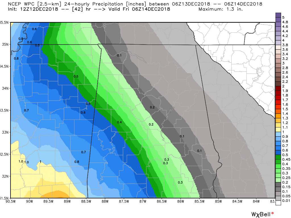
SHOWERS MOVE IN LATE ON THURSDAY: While it is possible that we may have a few stray showers move across the western parts of Central Alabama throughout the late morning and the afternoon hours, rain will be likely by sunset across the entire area. Don’t expect to see that much of the sun tomorrow as skies will be mainly cloudy throughout the day and highs should top out in the mid-50s to the lower 60s. Rainfall amounts (pictured above) throughout the day should end up in the 0.10 inches in the northeast to around 0.75 inches in the southwest.
BEACH FORECAST CENTER: Get the latest weather and rip current forecasts for the beaches from Fort Morgan to Panama City on our Beach Forecast Center page. There, you can select the forecast of the region that you are interested in.
WE’RE HAVING A RECORD-BREAKING YEAR… ADVERTISE WITH US TODAY!: Don’t miss out! We have enjoyed over 18.7 MILLION page views on AlabamaWx.com so far in 2018. We can customize a creative, flexible and affordable package that will suit your organization’s needs. Contact Bill Murray at (205) 687-0782.
E-FORECAST: Get the Alabama Wx Weather Blog’s Seven-Day Forecast delivered directly to your inbox by email twice daily. It is the most detailed weather forecast available in Central Alabama. Subscribe here… It’s free!
CONNECT ON SOCIAL MEDIA: You can find the AlabamaWx Weather Blog on the major social media networks:
Facebook
Twitter
WEATHERBRAINS: Don’t forget you can listen to our weekly 90 minute netcast anytime on the web at WeatherBrains.com or on iTunes, Stitcher, or Spotify. This is the show all about weather featuring many familiar voices, including the meteorologists at ABC 33/40.
ON THIS DAY IN WEATHER HISTORY: 1969 – The worst tornado of record for western Washington State tracked south of Seattle, traveling five miles, from Des Moines to Kent. The tornado, 50 to 200 yards in width, began as a waterspout over Puget Sound. One person was injured and the tornado caused half a million dollars damage.
Category: Alabama's Weather, ALL POSTS
About the Author (Author Profile)
Scott Martin is an operational meteorologist, professional graphic artist, musician, husband, and father. Not only is Scott a member of the National Weather Association, but he is also the Central Alabama Chapter of the NWA president. Scott is also the co-founder of Racecast Weather, which provides forecasts for many racing series across the USA. He also supplies forecasts for the BassMaster Elite Series events including the BassMaster Classic.Subscribe
If you enjoyed this article, subscribe to receive more just like it.


