A Gray And Dreary Midday Across Central Alabama
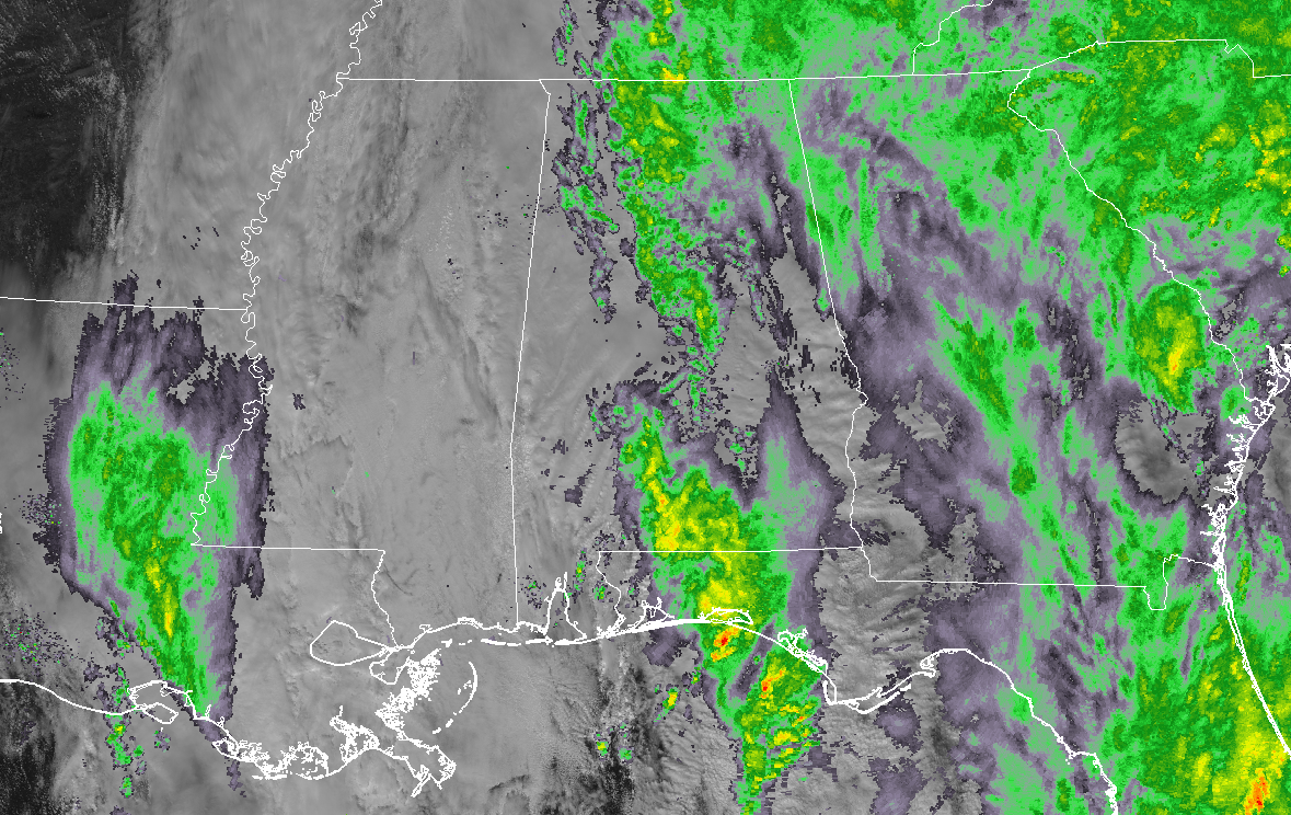
Conditions Across Central Alabama At 12:15 PM: Rain continues to stream in from the south across much of Central Alabama as we have reached the midday hour on this Thursday before Christmas. Much of the activity is light in nature, but we do notice a dry slot that is starting to work into the western parts of the area from Mississippi. Temperatures were in the upper 40s to the upper 50s across the area. Birmingham was at 54 degrees at this time.
Weather For The Rest Of Your Thursday: We’ll continue to have numerous showers across the area for the rest of the afternoon and into the early evening hours, but we could have a few dry periods in there as there are some drier areas working into the circulation around the low. When it’s not raining, skies will continue to stay cloudy. Afternoon highs will be in the lower 50s to the lower 60s across the area from north to south. Rain will continue to be likely and widespread in coverage tonight and through the overnight hours, and lows will be in the upper 30s to the upper 40s.
Rain Moves Out And We Dry Out By Friday Evening: As the low starts to move up the eastern seaboard, rain will start to drop in coverage from southwest to northeast across the area, with rain coming to an end during the afternoon and into the early evening hours. By sunset, much of Central Alabama will be dry, but a lingering shower may hang around the northeastern parts of the area for a little while longer. All should be dry by the late local news. The pressure gradient will be really tight on the backside of the low, so winds will be breezy at times, gusting as high as 25 MPH out of the north and northwest. Highs will be in the 40s for the most part, but a few locations in the extreme northern parts of Central Alabama may not be able to escape the upper 30s.
Beach Forecast Center: Get the latest weather and rip current forecasts for the beaches from Fort Morgan to Panama City on our Beach Forecast Center page. There, you can select the forecast of the region that you are interested in.
We’re Having A Record-Breaking Year On The AlabamaWx Weather Blog… Advertise With Us Today!: Don’t miss out! We have enjoyed over 19.2 MILLION page views on AlabamaWx.com so far in 2018. We can customize a creative, flexible and affordable package that will suit your organization’s needs. Contact Bill Murray at (205) 687-0782.
E-Forecast: Get the Alabama Wx Weather Blog’s Seven-Day Forecast delivered directly to your inbox by email twice daily. It is the most detailed weather forecast available in Central Alabama. Subscribe here… It’s free!
Connect With The AlabamaWx Weather Blog On Social Media: You can find the AlabamaWx Weather Blog on the major social media networks:
Facebook
Twitter
WeatherBrains: Don’t forget you can listen to our weekly 90 minute netcast anytime on the web at WeatherBrains.com or on iTunes, Stitcher, or Spotify. This is the show all about weather featuring many familiar voices, including the meteorologists at ABC 33/40.
On This Day In Weather History: 1836 – A famous cold wave occurred in central Illinois. A cold front with 70 mph winds swept through at Noon dropping the temperature from 40 degrees to near zero in a matter of minutes. Many settlers froze to death. Folklore told of chickens frozen in their tracks and men frozen to saddles. Ice in streams reportedly froze to six inches in a few hours.
Category: Alabama's Weather, ALL POSTS
About the Author (Author Profile)
Scott Martin is an operational meteorologist, professional graphic artist, musician, husband, and father. Not only is Scott a member of the National Weather Association, but he is also the Central Alabama Chapter of the NWA president. Scott is also the co-founder of Racecast Weather, which provides forecasts for many racing series across the USA. He also supplies forecasts for the BassMaster Elite Series events including the BassMaster Classic.Subscribe
If you enjoyed this article, subscribe to receive more just like it.


