Just A Few Scattered Showers For Now, Potential For Stronger To Severe Storms Just A Few Hours Away
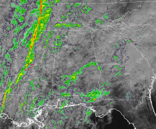
The squall line that we are expecting to move through the area later today is already beginning to take shape over the western parts of Mississippi, and we already have our first tornado warning issued in Madison and Yazoo counties in Mississippi until 12:00 pm. No word yet from the Storm Prediction Center on the possibility of a watch being issued.
As for North/Central Alabama, we have a few scattered showers over the northwestern parts of the area along with showers moving up from the south over the southern parts of the area. None of these have any lightning at this time, but instability is starting to creep up to the west, and lightning will become likely this afternoon. We do have some sun beginning to peek through the clouds and that can actually lead to more destabilization of the atmosphere. While seeing some sun would be nice, let’s hope we don’t see it that often today.
The wind is another big story. Sustained winds are up in the 15-25 MPH range and gusts throughout the remainder of the day could reach as high as 40 MPH due to the tightening pressure gradient. NWS Huntsville has a Wind Advisory in effect for all of their counties until 6:00 pm tonight.
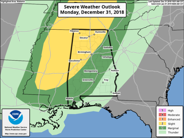
If you needed to brush up on the severe thunderstorm risk categories, this is the graphic from the Storm Prediction Center of the National Weather Service. We have a Slight Risk for much of the north and western parts of North/Central Alabama with a Marginal Risk for nearly all of the rest of the area. Damaging winds up to 60-70 MPH and a couple brief spin-up tornadoes are possible this afternoon and early evening across the area.
Surface-based instability values are starting to climb over the western parts of the state and well into Mississippi. Values are approaching 500 J/kg near the state line. We already have a good deal of helicity in place over much of the area, and with temperatures already in the upper 60s and the lower 70s with dewpoints well into the 60s, the ingredients are really starting to come together for the potential of some strong to severe storms.
Timing for the stronger to severe storms will be from the late morning hours through the early evening hours, with a peak in the action during the afternoon and early evening hours. The Slight Risk areas should see the stronger storms from 1:00 pm to 7:00 pm, while the Marginal Risk area should see those from 6:00 pm through 9:00 pm. By the time we reach 9:00 pm, the threat for stronger to severe storms should be over.
NWS Birmingham will be sending up an extra weather balloon at noon today for the threat of severe weather across the area.
Unfortunately, we have the potential of some flash flooding as we could see some thunderstorms dump heavy amounts of rainfall in a very short amount of time, in some cases, around 1.00 inches in less than one hour.
We’ll continue to keep you updated throughout the day.
Category: Alabama's Weather, ALL POSTS, Severe Weather


