

Heavy Rain Could Bring The Potential For Some Flooding To North Alabama
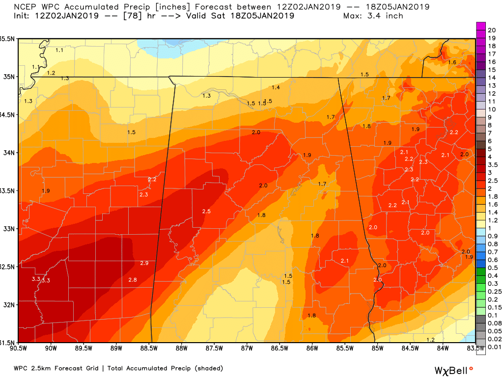
Latest WPC forecast rainfall totals through noon on Saturday.
NWS Huntsville issued a Hydrologic Outlook for its counties in North Alabama earlier this morning talking about the potential for some flash flooding throughout the end of the week. With the soil already being saturated, it wouldn’t take that much at all to have streams and rivers to rise to full bank or flood stage. A Flood Watch or Flash Flood Watch may be issued at some point during the day today. Here is the statement from NWS Huntsville…
Hydrologic Outlook
National Weather Service, Huntsville AL
6:25 AM CST – Wed. Jan. 2, 2019
…Flood Potential Outlook…
…Heavy Rainfall And Flooding Possible Late Thursday And Friday…
Another developing storm system forming over the northwest Gulf of Mexico will move eastward through tonight, then to the northeast late this week. This system will produce a couple of periods of rain forecast to impact the Tennessee Valley. The first episode of rain will affect the forecast area today and tonight. Through early Thursday morning, rainfall amounts should range from one half of an inch to one inch, with the heaviest amounts across portions of northeast Alabama.
A brief break in the rain is expected on Thursday. The system is forecast to approach the area Thursday night and on Friday. This will bring another round of rain (some locally heavy) across the Tennessee Valley. This additional rainfall will result in ponding of water on roads, as well as minor flooding in low lying portions of the region that normally experience poor drainage. An additional one to one and a half inches of rainfall is forecast to occur in the second round – leading to rainfall totals of one and a half to over two inches by late Friday night.
This rain falling on an already very wet to saturated soil, will run off and result in area stream and river level rises late this week and over the weekend. These higher river levels could reach bankfull and/or flood stage. Given antecedent wet conditions, a flood watch could be issued for the area later today or tonight.
Category: Alabama's Weather, ALL POSTS
About the Author (Author Profile)
Scott Martin is an operational meteorologist, professional graphic artist, musician, husband, and father. Not only is Scott a member of the National Weather Association, but he is also the Central Alabama Chapter of the NWA president. Scott is also the co-founder of Racecast Weather, which provides forecasts for many racing series across the USA. He also supplies forecasts for the BassMaster Elite Series events including the BassMaster Classic.Subscribe
If you enjoyed this article, subscribe to receive more just like it.


