We’re Dry With Some Clearing Across Central Alabama At Midday
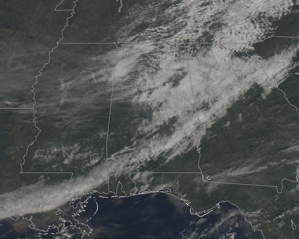
CONDITIONS ACROSS CENTRAL ALABAMA AT 11:05 AM
At this point on your Tuesday morning, radar is free from any rain falling over Central Alabama. Clouds are starting to decrease across the area as well as clearing is starting to work in over the southwestern parts of the area. There are breaks in the cloud cover over the rest of the area so it’s not an all gloomy day. Temperatures are well above seasonal norms in the lower 60s to near 70 degrees across the area. The warm spot is currently Tuscaloosa at 72 degrees but I believe that could be an erroneous reading with all of the surrounding sites in the lower to mid-60s. The cool spot is Sylacauga at 60 degrees.
WEATHER FOR THE REST OF YOUR TUESDAY
While we continue to have a very small risk of a stray light shower or a few sprinkles, it looks like those chances will diminish later this evening. Skies will begin to clear out slowly from the northwest to the southeast and afternoon highs will top out in the mid-60s to the lower 70s across the area. Clouds will continue to decrease through the evening and late night hours and temperatures will begin to quickly cool. Overnight lows will bottom out in the mid-30s to the mid-40s.
PLENTY OF SUN BUT MUCH COOLER ON WEDNESDAY
“Hump Day” will feature mainly clear and sunny skies throughout the day with the small possibility of a passing cloud or two. Unfortunately, the milder temperatures we have seen will be gone and much cooler weather has returned. Afternoon highs will be around 15 degrees cooler than today, only reaching the upper 40s to the mid-50s across the area. Skies will be clear for the late night and overnight hours, with lows in the upper 20s to the lower 30s.
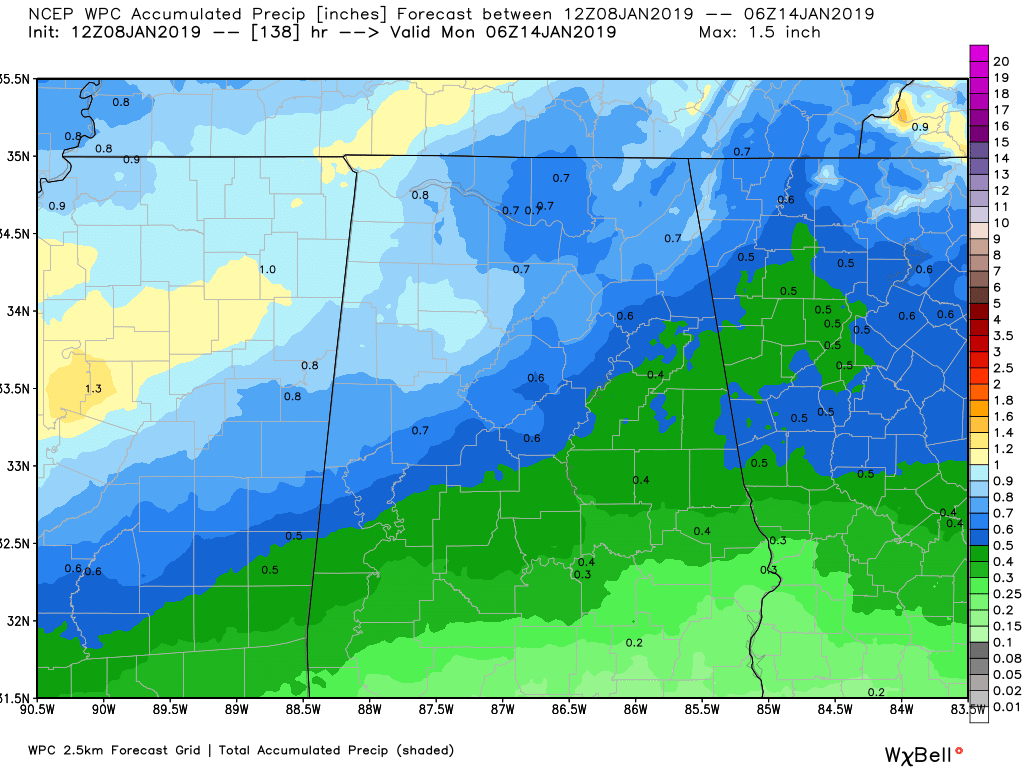
NEXT RAIN CHANCE WILL BE HERE FOR THE WEEKEND
We’ll have a system that will begin to affect our weather on late Friday through the morning hours on Sunday, bringing more rainfall to the area. Latest projections from the WPC suggests we could see totals from 0.25 inches in the southwestern parts of the area to nearly 1.00 inches in the northwest. Since this will be a lighter rainfall event than we have seen with the last couple of big rainmakers, flooding issues are not expected.
BEACH FORECAST CENTER
Get the latest weather and rip current forecasts for the beaches from Fort Morgan to Panama City on our Beach Forecast Center page. There, you can select the forecast of the region that you are interested in.
WE HAD A RECORD-BREAKING YEAR IN 2018! ADVERTISE WITH US TODAY ON THE ALABAMAWX WEATHER BLOG!
We have enjoyed over 19.9 MILLION page views on AlabamaWx.com for 2018… breaking our previous record by over 3 million page views. Don’t miss out! We can customize a creative, flexible and affordable package that will suit your organization’s needs. Contact Bill Murray at (205) 687-0782.
E-FORECAST
Get the Alabama Wx Weather Blog’s Seven-Day Forecast delivered directly to your inbox by email twice daily. It is the most detailed weather forecast available in Central Alabama. Subscribe here… It’s free!
CONNECT WITH THE ALABAMAWX WEATHER BLOG ON SOCIAL MEDIA
You can find the AlabamaWx Weather Blog on the major social media networks:
Facebook
Twitter
WEATHERBRAINS
Don’t forget you can listen to our weekly 90 minute netcast anytime on the web at WeatherBrains.com or on iTunes, Stitcher, or Spotify. This is the show all about weather featuring many familiar voices, including the meteorologists at ABC 33/40.
Category: Alabama's Weather, ALL POSTS
About the Author (Author Profile)
Scott Martin is an operational meteorologist, professional graphic artist, musician, husband, and father. Not only is Scott a member of the National Weather Association, but he is also the Central Alabama Chapter of the NWA president. Scott is also the co-founder of Racecast Weather, which provides forecasts for many racing series across the USA. He also supplies forecasts for the BassMaster Elite Series events including the BassMaster Classic.Subscribe
If you enjoyed this article, subscribe to receive more just like it.


