A Cloudy, Cool Day; Chill Continues until Mid-Week Warmup; Get Ready for Strong Cold Front Saturday
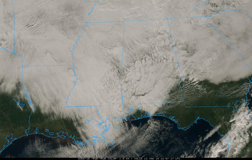
Clouds are pretty thick across Alabama early on this mid-January day. Temperatures are edging up to and just beyond 50 degrees, but a chilly west wind is making it feel even colder at times. Afternoon highs will range from 46-52F when all is said and done.
Don’t expect much in the way of clearing for the next 36 hours or so as moisture levels remain high in the cloud formation regions.
It will be cool again tonight, with lows across the area in the 30s. Highs on Monday will remain in the 40s all day.
Sunshine returns on Tuesday after a cool start, but highs will still be restricted to the 40s. The warm-up should start on Wednesday, with highs returning to the 50s. We will see 60s on Thursday, but rain will return late in the day. Expect around one-tenth to one-quarter of an inch of rain before it ends early Friday. Friday should be dry, but expect another soaking rain Saturday morning. There could even be some thunder ahead of a very strong cold front.
Winds will be strong and gusty on Saturday, especially behind the front, and temperatures will tumble from highs in the middle 60s into the 30s by dark. Lows by morning will be among the coldest of the year, in the upper teens and lower 20s in many spots. And Sunday highs won’t get out above freezing for most folks.
Category: Alabama's Weather, ALL POSTS
About the Author (Author Profile)
Bill Murray is the President of The Weather Factory. He is the site's official weather historian and a weekend forecaster. He also anchors the site's severe weather coverage. Bill Murray is the proud holder of National Weather Association Digital Seal #0001 @wxhistorianSubscribe
If you enjoyed this article, subscribe to receive more just like it.


