Potential For Strong To Severe Storms On Saturday
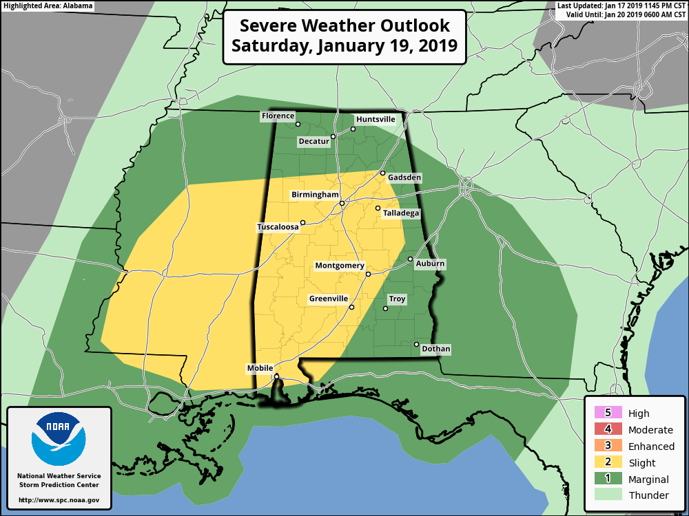
The Storm Prediction Center has defined much of Central Alabama in the standard Slight Risk for severe storms (level 2 of 5) throughout the day on Saturday while the rest of the area is defined in a Marginal Risk (level 1 of 5).
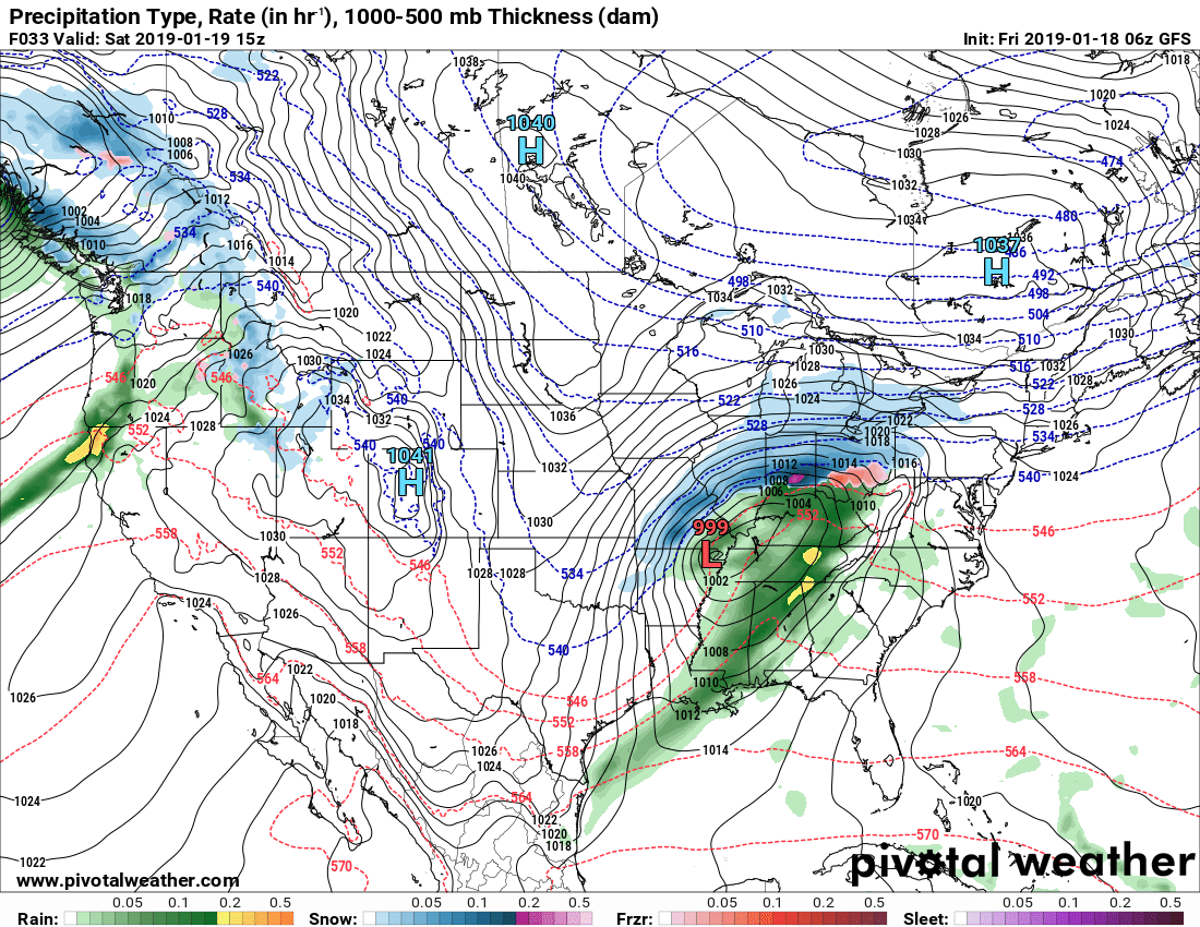
We’ll have strong dynamic support as the center of low pressure will be just off to our northwest in northeastern Arkansas to start the day and will move into the eastern parts of Kentucky by the evening. A strong cold front will drag through the area during the day bringing with it rain and thunderstorms.
As it looks now, we’ll have strong low-level and deep-layer shear in place across the area but the ingredient that we’ll need to fire off severe storms will be instability. Models indicate that there should be just enough surface-based instability for stronger to severe storms to form.
The main threat from Saturday’s system will be from damaging thunderstorm wind gusts up to 60 MPH, but there is the potential for a few brief spin-up tornadoes.
Nearly all the action will come in the form of a QLCS (squall line) that looks to enter the western parts of the area around 9:00 am and should slowly strengthen as it moves into a more moisture-rich environment and with the heating of the day. We do have the possibility of a few cells developing out ahead of the QLCS that may need watching, especially in the late morning through the afternoon.
Timing for the threat of strong to severe storms will be 9:00 am to 1:00 pm for locations along and west of a line from Demopolis to Tuscaloosa to Cullman, 11:00 am to 3:00 pm for locations in the central parts of the area, including Birmingham, Oneonta, Gadsden, Talladega, Clanton, Selma, and Fort Deposit. The threat can be expected from 1:00 pm to 6:00 pm for locations along and east of a line from Montgomery to Ashland to Piedmont.
At this point, the severe threat will be conditional on the basis if there will be enough instability to form during the morning hours to support severe storm development. If the instability doesn’t form, we could see just a line of showers with some gusty winds. If the instability does climb, severe storms could become an issue. Be sure that you stay up-to-date with any warnings that are issued and have your severe weather safety plan ready to go, just in case.
In either case, rainfall amounts throughout the event will be in the 1.00-2.00 inch range. There may be some localized ponding or a quick flash flooding issue with heavier storms, but major flooding issues are not expected.
Storms will be out of the area by Saturday night and much colder air will be moving in behind the passage of the front. We may have a few flurries on the backside of the front, but no accumulations or impacts are expected.
Category: Alabama's Weather, ALL POSTS
About the Author (Author Profile)
Scott Martin is an operational meteorologist, professional graphic artist, musician, husband, and father. Not only is Scott a member of the National Weather Association, but he is also the Central Alabama Chapter of the NWA president. Scott is also the co-founder of Racecast Weather, which provides forecasts for many racing series across the USA. He also supplies forecasts for the BassMaster Elite Series events including the BassMaster Classic.Subscribe
If you enjoyed this article, subscribe to receive more just like it.


