Even With Clouds, It’s Not Too Bad At Midday Across Central Alabama
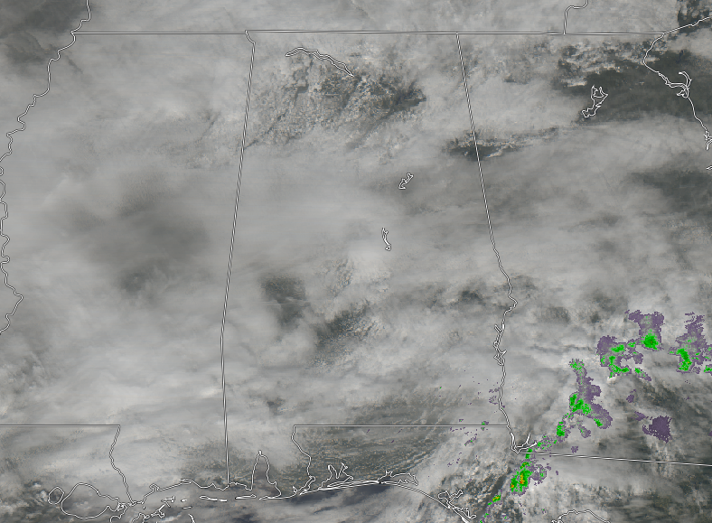
CONDITIONS ACROSS THE AREA AT 11:40 AM
Well, even though we are getting a nice treat with above average temperatures on this decent Friday, we are very limited with sunshine as skies are mostly cloudy across Central Alabama. No rain in the area at this point and it should stay that way throughout the rest of the day. Temperatures are in the lower 50s to the lower 60s across the area, with Birmingham checking in at 55 degrees. The cool spot is Gadsden at 50 degrees while the warm spot is Troy at 61 degrees.
WEATHER FOR THE REST OF YOUR FRIDAY
We’ll continue to have mostly cloudy skies throughout the rest of the afternoon and into the early evening hours across Central Alabama. There may be a few isolated showers over the extreme southeastern parts of the area, but the chance for showers over those locations will be less than 20%. Afternoon highs will top out in the upper 50s to the mid-60s across the area from north to south. We’ll stay cloudy and dry throughout the rest of the evening and late night hours, but showers and a few storms could move in as early as 3:00 am. Overnight lows will be in the upper 40s to the mid-50s.
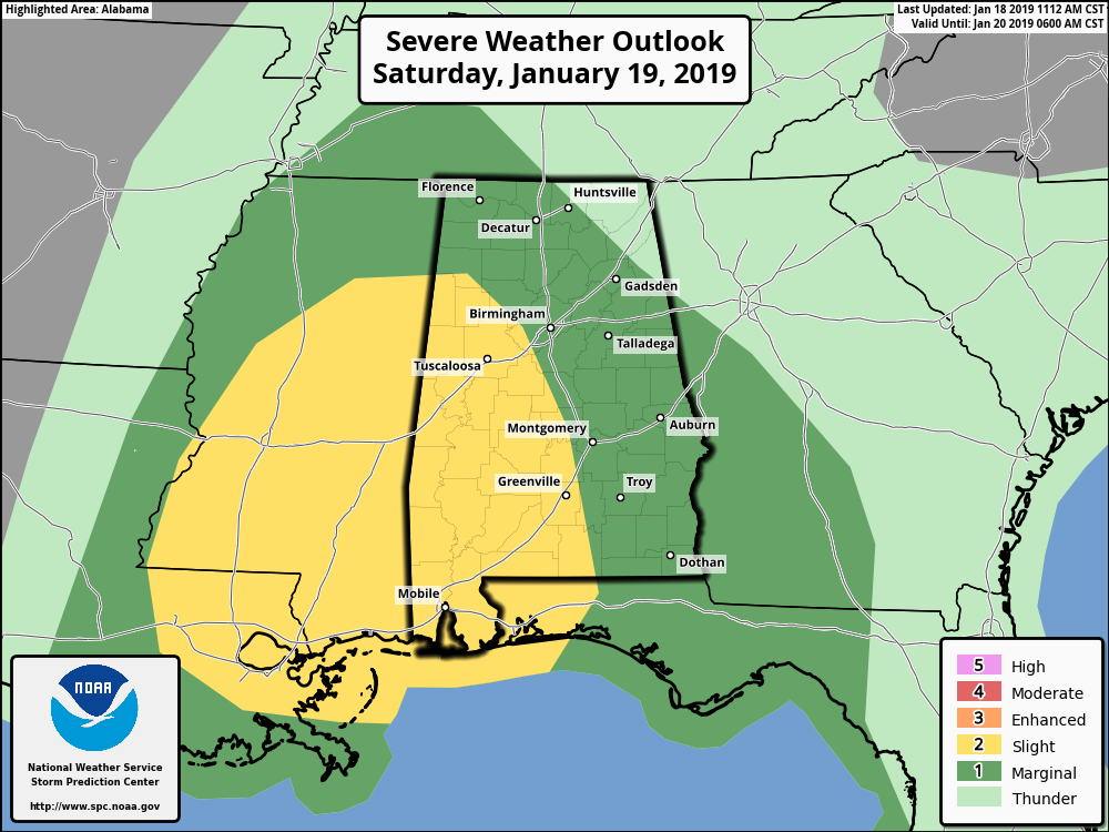
A STORMY SATURDAY WITH MUCH COLDER AIR AFTER
Saturday will be a very breezy day before and after a line of potential strong to severe storms move through, as winds could gust as high as 30-35 MPH at times. The western half of Central Alabama has been defined in a Slight Risk for severe storms throughout the day on Saturday, with the main window being from 9:00 am to 6:00 pm throughout the area. The main threat will be from damaging thunderstorm wind gusts up to 60 MPH, but there is the potential for one or two brief spin-up tornadoes.
The forecast is still on track from what I posted earlier this morning. The threat is conditional on the fact if we can get enough instability to build so that storms can form. We’ll have the moisture and shear in place that would support strong to severe storms if the instability forms. If instability doesn’t show, we’ll just have rain with a few claps of thunder and very breezy conditions. Afternoon highs will be in the lower 60s to the lower 70s.
Storms should be out of the area by Saturday night and much colder air will begin to quickly filter in behind the cold front. Wind will continue to be breezy and we may have a few snow flurries on the back edge of the system. No accumulations or travel issues are expected. Overnight lows will be in the upper 20s to the mid-30s.
BEACH FORECAST CENTER
Get the latest weather and rip current forecasts for the beaches from Fort Morgan to Panama City on our Beach Forecast Center page. There, you can select the forecast of the region that you are interested in.
WE HAD A RECORD-BREAKING YEAR IN 2018! ADVERTISE WITH THE BLOG!
We have enjoyed over 19.9 MILLION page views on AlabamaWx.com for 2018… breaking our previous record by over 3 million page views. Don’t miss out! We can customize a creative, flexible and affordable package that will suit your organization’s needs. Contact Bill Murray at (205) 687-0782.
E-FORECAST
Get the Alabama Wx Weather Blog’s Seven-Day Forecast delivered directly to your inbox by email twice daily. It is the most detailed weather forecast available in Central Alabama. Subscribe here… It’s free!
CONNECT WITH THE BLOG ON SOCIAL MEDIA
You can find the AlabamaWx Weather Blog on the major social media networks:
Facebook
Twitter
WEATHERBRAINS
Don’t forget you can listen to our weekly 90 minute netcast anytime on the web at WeatherBrains.com or on iTunes, Stitcher, or Spotify. This is the show all about weather featuring many familiar voices, including the meteorologists at ABC 33/40.
Category: Alabama's Weather, ALL POSTS
About the Author (Author Profile)
Scott Martin is an operational meteorologist, professional graphic artist, musician, husband, and father. Not only is Scott a member of the National Weather Association, but he is also the Central Alabama Chapter of the NWA president. Scott is also the co-founder of Racecast Weather, which provides forecasts for many racing series across the USA. He also supplies forecasts for the BassMaster Elite Series events including the BassMaster Classic.Subscribe
If you enjoyed this article, subscribe to receive more just like it.


