Tornado Watch Issued For Parts Of Central Alabama Until 5:00 PM This Evening
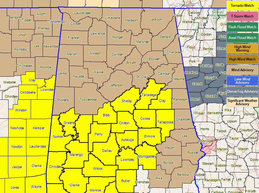
Tornado Watch just issued for Autauga, Bibb, Chilton, Clay, Coosa, Dallas, Elmore, Greene, Hale, Lowndes, Marengo, Montgomery, Perry, Shelby, Sumter, Talladega, and Tallapoosa counties until 5:00 PM CST.
The NWS Storm Prediction Center has issued a
* Tornado Watch for portions of
Central and southwestern Alabama
The western Florida Panhandle
The eastern part of the Mississippi Sound
Coastal Waters
* Effective this Saturday morning and afternoon from 940 AM until
500 PM CST.
* Primary threats include…
A few tornadoes possible
Scattered damaging wind gusts to 70 mph possible
SUMMARY…A broken band of storms will spread eastward from
Mississippi to Alabama through the afternoon. Embedded supercells
and bowing segments will be capable of producing a few tornadoes and
damaging gusts.
The tornado watch area is approximately along and 70 statute miles
east and west of a line from 60 miles north of Selma AL to 10 miles
south southwest of Mobile AL. For a complete depiction of the watch
see the associated watch outline update (WOUS64 KWNS WOU2).
PRECAUTIONARY/PREPAREDNESS ACTIONS…
REMEMBER…A Tornado Watch means conditions are favorable for
tornadoes and severe thunderstorms in and close to the watch
area. Persons in these areas should be on the lookout for
threatening weather conditions and listen for later statements
and possible warnings.
Category: Alabama's Weather, ALL POSTS
About the Author (Author Profile)
Scott Martin is an operational meteorologist, professional graphic artist, musician, husband, and father. Not only is Scott a member of the National Weather Association, but he is also the Central Alabama Chapter of the NWA president. Scott is also the co-founder of Racecast Weather, which provides forecasts for many racing series across the USA. He also supplies forecasts for the BassMaster Elite Series events including the BassMaster Classic.Subscribe
If you enjoyed this article, subscribe to receive more just like it.


