Squall Line Approaching The Birmingham Metropolitan Area
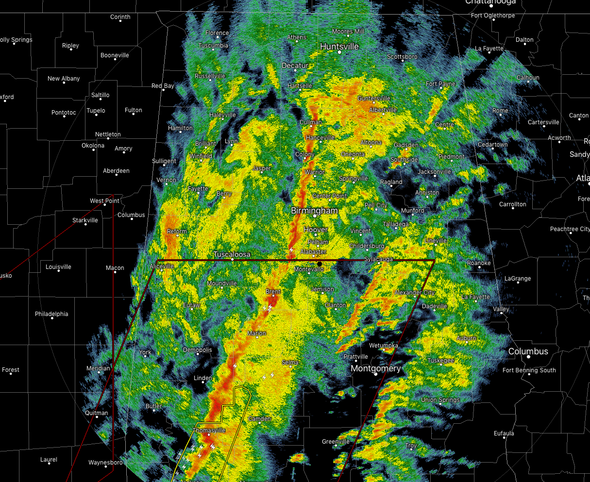
The strongest part of the line of storms is moving into the central parts of the area, now stretching from Cullman to Warrior to Bessemer to Brent and to Uniontown. None of the storms are severe at the moment, but you can expect very heavy rainfall and some gusty winds as it moves through your location.
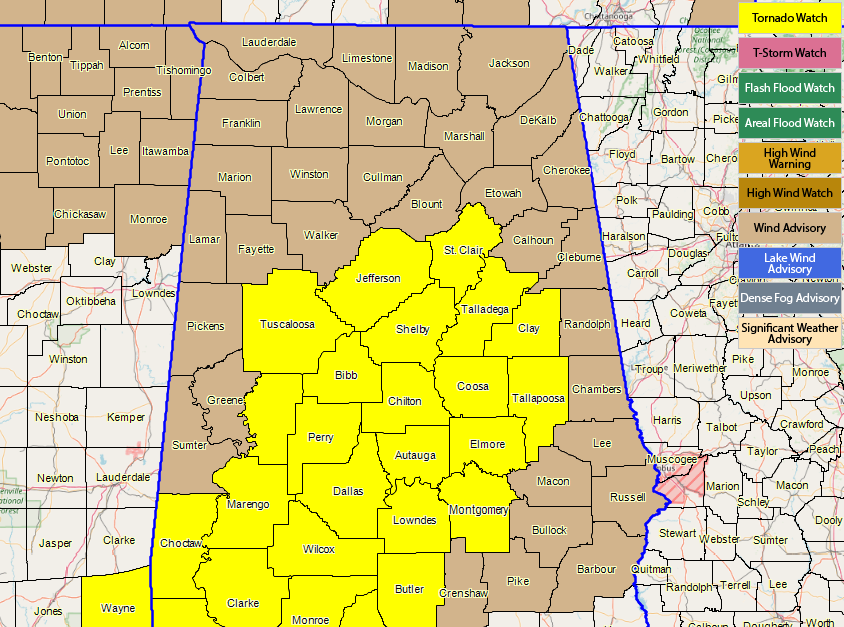
A Tornado Watch continues for much of Central Alabama until 5:00 pm this evening, but NWS Birmingham has already started removing counties from the western edge of the watch. Greene and Sumter counties were just removed.
We’ll have updates throughout the day on the blog… keep checking back with us.
Category: Alabama's Weather, ALL POSTS
About the Author (Author Profile)
Scott Martin is an operational meteorologist, professional graphic artist, musician, husband, and father. Not only is Scott a member of the National Weather Association, but he is also the Central Alabama Chapter of the NWA president. Scott is also the co-founder of Racecast Weather, which provides forecasts for many racing series across the USA. He also supplies forecasts for the BassMaster Elite Series events including the BassMaster Classic.Subscribe
If you enjoyed this article, subscribe to receive more just like it.


