Strong/Severe Storms Continue, Damage Reported In Autauga County From Possible Tornado
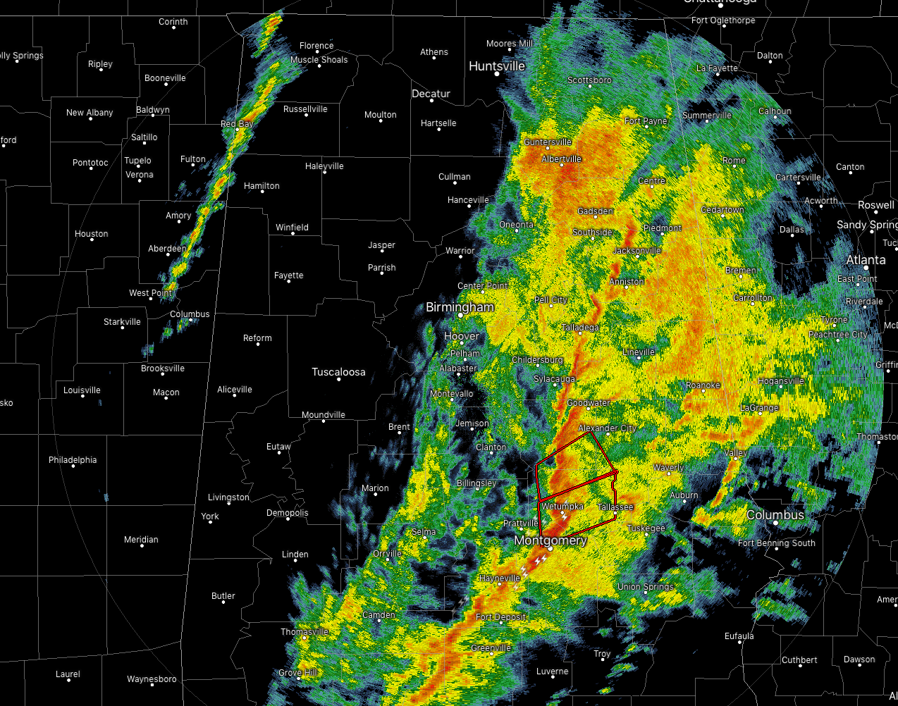
We currently have two separate Tornado Warnings in effect for parts of Elmore and Montgomery counties until 3:30 pm and the other for parts of Elmore, Tallapoosa and Coosa counties until 3:15 pm.
The northern cell has a history of producing damage back in Autauga County. Roof damage was being reported very near to Booth, along with trees blocking the roadway.
A tornado has been confirmed on the radar with the southern polygon, please take shelter immediately if your location is in the warning polygon. Damage has already been reported in Wetumpka,
The higher risk of strong to severe storms continues to be in the eastern and southeastern parts of Central Alabama through the rest of the afternoon and into the early evening hours. Storms should be out of the area by 7-8 pm and colder air will be moving in quickly behind the cold front. We’ll still have a very small chance of some flurries during the late night and into the first couple of hours on Sunday, but accumulations will not happen as winds and temperatures will be too high to allow any snow to stick.
Category: Alabama's Weather, ALL POSTS
About the Author (Author Profile)
Scott Martin is an operational meteorologist, professional graphic artist, musician, husband, and father. Not only is Scott a member of the National Weather Association, but he is also the Central Alabama Chapter of the NWA president. Scott is also the co-founder of Racecast Weather, which provides forecasts for many racing series across the USA. He also supplies forecasts for the BassMaster Elite Series events including the BassMaster Classic.Subscribe
If you enjoyed this article, subscribe to receive more just like it.


